TopoQuest Logo
Do you find TopoQuest useful?
Help keep TopoQuest running and adding new maps/features by donating!
Bitcoin:  19c7KJd3qBynnjoSw5npx9KScwjBe4ifkT
Litecoin:  LXs6TkuXGGXo1vDsWCkWVdjQX94eUKd6ui
Home View Maps Find Maps Find Places Resources & Links


White Rock, North Carolina Topographic Map

USGS Map Title: White Rock, NC
USGS Map MRC: 35082H6
DRG (GeoTIFF) Download: o35082h6.tif


Neighboring USGS Topographic Map Quads:


  Davy Crockett Lake, TN  
36082A7
 

  Greystone, TN  
36082A6
 

  Flag Pond, TN  
36082A5
 

  Hot Springs, NC  
35082H7
 

  White Rock, NC  
35082H6
 

  Sams Gap, NC  
35082H5
 

  Spring Creek, NC  
35082G7
 

  Marshall, NC  
35082G6
 

  Mars Hill, NC  
35082G5


Map MRC Location:

N36°
W83°
N36°
W82°
H8 H7 H6 H5 H4 H3 H2 H1
G8 G7 G6 G5 G4 G3 G2 G1
F8 F7 F6 F5 F4 F3 F2 F1
E8 E7 E6 E5 E4 E3 E2 E1
D8 D7 D6 D5 D4 D3 D2 D1
C8 C7 C6 C5 C4 C3 C2 C1
B8 B7 B6 B5 B4 B3 B2 B1
A8 A7 A6 A5 A4 A3 A2 A1
N35°
W83°
N35°
W82°

White Rock, NC USGS 1:24K Topographic Map Preview:
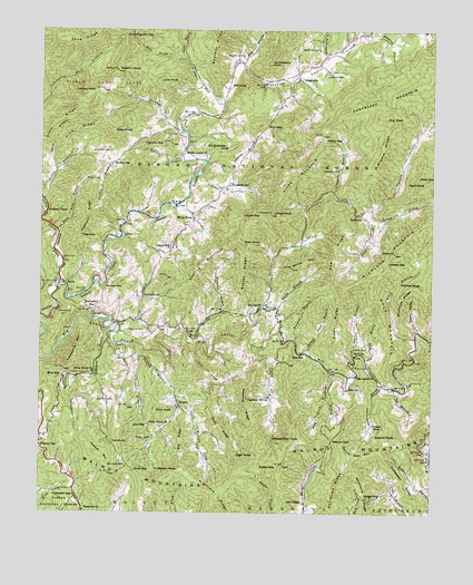
White Rock, NC USGS Topographic Map
Click on map above to begin viewing in our Map Viewer.

This topographic map contains these locations and features:
Feature Name Type Latitude Longitude GNIS ID View Map
AlleghenyPopulated PlaceN35.9884°W82.6674°1018792View Map
Allen RidgeRidgeN35.9759°W82.7454°1008687View Map
Alum KnobSummitN35.9734°W82.7271°1018810View Map
Alum RidgeRidgeN35.9745°W82.7382°1008703View Map
Amos CreekStreamN35.9532°W82.6454°1008713View Map
Andy CovePopulated PlaceN35.8948°W82.7129°1018824View Map
Andy GapGapN35.8859°W82.7190°1008735View Map
Angelico KnobSummitN35.9895°W82.7263°1008740View Map
Appletree RidgeRidgeN35.8823°W82.6549°1018837View Map
Baker CreekStreamN35.9532°W82.6451°1018907View Map
Barnes BranchStreamN35.9198°W82.7046°1008930View Map
Bearpen BranchStreamN35.9198°W82.6688°1009018View Map
BelvaPopulated PlaceN35.9343°W82.7429°1009169View Map
Belva CemeteryCemeteryN35.9884°W82.6587°1009170View Map
Big KnobSummitN35.9771°W82.6401°1019146View Map
Big LaurelPopulated PlaceN35.9279°W82.6760°1019150View Map
Big Laurel ChurchChurchN35.9115°W82.6496°1009334View Map
Big RidgeRidgeN35.8943°W82.7038°1009364View Map
Billy GapGapN35.9109°W82.7424°1009405View Map
Billy King BranchStreamN35.9479°W82.7446°1009406View Map
Brigman ChapelChurchN35.9537°W82.7485°1009609View Map
Brigman HollowValleyN35.9529°W82.7487°1009610View Map
Buck KnobSummitN35.9009°W82.7135°1019368View Map
Buckner BranchStreamN35.9118°W82.6568°1009784View Map
Bullman CemeteryCemeteryN35.8870°W82.7218°1009807View Map
Burton CoveValleyN35.9026°W82.7051°1009856View Map
Calvin CreekStreamN35.9537°W82.6443°1019480View Map
Capps HollowValleyN35.9222°W82.6296°1010032View Map
Cargle GapGapN35.8796°W82.6460°1010039View Map
Chapel HillPopulated PlaceN35.9429°W82.7088°1019601View Map
Chestnut Hill ChurchChurchN35.9054°W82.6768°1010252View Map
Cook CemeteryCemeteryN35.9268°W82.7337°1010449View Map
Crane BranchStreamN35.9157°W82.7185°1010564View Map
Cutshall BranchStreamN35.9629°W82.6988°1010632View Map
CutshalltownPopulated PlaceN35.9607°W82.6896°1019890View Map
Deading RidgeRidgeN35.9032°W82.6824°1010713View Map
Devils Den MountainSummitN35.8915°W82.6518°1019958View Map
Duckmill CreekStreamN35.9743°W82.7049°1020040View Map
East Prong Hickey ForkStreamN35.9923°W82.7038°1011001View Map
Franklin CemeteryCemeteryN35.9223°W82.7162°1018081View Map
Franklin CemeteryCemeteryN35.9932°W82.6862°1011377View Map
Franklin MountainSummitN35.9701°W82.7190°1020356View Map
Gosnell CemeteryCemeteryN35.9045°W82.7268°1011571View Map
Gosnell KnobSummitN35.8954°W82.6354°1020481View Map
Grassy RidgeRidgeN35.9376°W82.6849°1011656View Map
Graveyard GapGapN35.9276°W82.7338°1011668View Map
Gunter BranchStreamN35.9240°W82.7246°1011776View Map
GuntertownPopulated PlaceN35.9309°W82.7163°1020581View Map
Hack KnobSummitN35.9607°W82.6268°1020584View Map
Hensley BranchStreamN35.9990°W82.6451°1011974View Map
Hickey ForkStreamN35.9809°W82.6915°1020698View Map
Hickorylog BranchStreamN35.9929°W82.6593°1012017View Map
Hicks MountainSummitN35.9640°W82.6690°1020724View Map
High KnobSummitN35.8901°W82.6807°1020741View Map
HighrockSummitN35.9473°W82.7365°1020771View Map
Highrock RidgeRidgeN35.9520°W82.7346°1012066View Map
Highshoal BranchStreamN35.9257°W82.7321°1012067View Map
Hog CoveValleyN35.9052°W82.6585°1012095View Map
Hopewell ChurchChurchN35.8759°W82.7349°1012173View Map
Hopewell GapGapN35.8790°W82.7376°1012174View Map
Huckleberry KnobSummitN35.9915°W82.6768°1020855View Map
Jarrett CovePopulated PlaceN35.8984°W82.6435°1020936View Map
Job ChapelChurchN35.8779°W82.6651°1012483View Map
Johnson BranchStreamN35.9657°W82.6971°1012522View Map
Laurel Elementary SchoolSchoolN35.9287°W82.6779°1023403View Map
Laurel Volunteer Fire DepartmentBuildingN35.9651°W82.7011°2638320View Map
Lewis BranchStreamN35.9154°W82.6490°1012832View Map
Lewis CemeteryCemeteryN35.9187°W82.6474°1012833View Map
Licklog KnobSummitN35.9848°W82.7332°1021143View Map
Lisenbee BranchStreamN35.9584°W82.6568°1021159View Map
Little Laurel CreekStreamN35.9351°W82.7438°1012987View Map
Locust GapGapN35.9520°W82.6807°1013062View Map
Locust KnobSummitN35.9526°W82.6760°1021259View Map
Lone KnobSummitN35.9868°W82.7129°1021271View Map
Lonesome MountainSummitN35.9134°W82.7385°1021273View Map
Lovada GapGapN35.9401°W82.6387°1013207View Map
Low GapGapN35.8973°W82.7149°1013228View Map
LumptownPopulated PlaceN35.8926°W82.7254°1021309View Map
Middle Laurel ChurchChurchN35.9679°W82.7040°1013507View Map
Middle RidgeRidgeN35.9696°W82.6410°1013517View Map
Mile GapGapN35.9751°W82.6776°1021446View Map
Mill KnobSummitN35.9854°W82.6846°1021455View Map
Mitchell KnobSummitN35.9348°W82.6287°1021499View Map
Mollie MountainSummitN35.9387°W82.6699°1013650View Map
No Business KnobSummitN35.9690°W82.6910°1021651View Map
Odell RidgeRidgeN35.9246°W82.6562°1014076View Map
Palmer Camp BranchStreamN35.9162°W82.6640°1021785View Map
Pilot RidgeRidgeN35.8979°W82.6910°1014403View Map
Pine BranchStreamN35.9073°W82.6368°1014409View Map
Piney Grove ChurchChurchN35.9118°W82.7326°1021948View Map
Potato GapGapN35.8876°W82.6735°1014610View Map
Potato GapGapN35.9721°W82.6593°1014611View Map
Pounding Mill GapGapN35.9979°W82.7232°1014627View Map
Pounding Mill TrailTrailN35.9984°W82.7246°1014628View Map
Redoak MountainSummitN35.9340°W82.7229°1022209View Map
ReverePopulated PlaceN35.9026°W82.7032°1022227View Map
Rice CoveValleyN35.9139°W82.6768°1014843View Map
Rice MillPopulated PlaceN35.9162°W82.6665°1022243View Map
Rice SchoolSchoolN35.9073°W82.6510°1014846View Map
Richland MountainSummitN35.9432°W82.6371°1022277View Map
Rock BranchStreamN35.9909°W82.6860°1014985View Map
Rock KnobSummitN35.9457°W82.6854°1022327View Map
Rod RidgeRidgeN35.9421°W82.6565°1015061View Map
Roddy BranchStreamN35.9493°W82.7246°1015062View Map
Roddy CemeteryCemeteryN35.9620°W82.7315°1015063View Map
Roddy MountainSummitN35.9662°W82.7218°1022382View Map
Sapling MountainSummitN35.9390°W82.6982°1022500View Map
Shade BranchStreamN35.9637°W82.7449°1015367View Map
Shady Grove ChurchChurchN35.8982°W82.7140°1015375View Map
Sheepstamp KnobSummitN35.8946°W82.6662°1022582View Map
Shelton BranchStreamN35.9559°W82.7490°1022589View Map
Shelton CemeteryCemeteryN35.9648°W82.6549°1015412View Map
Shelton CemeteryCemeteryN35.9684°W82.7335°1015413View Map
Shelton CemeteryCemeteryN35.9945°W82.6621°1015414View Map
Shinbone RidgeRidgeN35.9312°W82.6343°994722View Map
Sodom BranchStreamN35.9187°W82.7193°1022698View Map
Sodom MountainSummitN35.8907°W82.7313°1022699View Map
SpillcornPopulated PlaceN35.9546°W82.6501°1022737View Map
Spillcorn CreekStreamN35.9207°W82.6857°1015729View Map
Tarlton BranchStreamN35.9673°W82.7043°1016033View Map
Tett CoveValleyN35.9169°W82.7006°1016078View Map
Township 11, Revere-Rice CoveCivilN35.9036°W82.6996°2406935View Map
Township 2-LaurelCivilN35.9809°W82.6862°1026913View Map
Turkeypen KnobSummitN35.8857°W82.7051°1023012View Map
Turkeypen RidgeRidgeN35.8818°W82.6321°1016285View Map
Wallin BranchStreamN35.9284°W82.6788°1016413View Map
Walnut GapGapN35.8937°W82.6565°1016428View Map
Watermelon BranchStreamN35.9084°W82.6410°1016464View Map
West Prong Hickey ForkStreamN35.9923°W82.7040°1023177View Map
White RockPopulated PlaceN35.9526°W82.7015°1023208View Map
Wild BranchStreamN35.9151°W82.6462°1016659View Map
Wolf BranchStreamN35.9207°W82.6307°1016769View Map
Wolf MountainSummitN35.9248°W82.6393°1023302View Map

Note: Coordinates in the location and feature list above are referenced to NAD83 datum.


Copyright (C) 2008-2024 Ryan Niemi / Sunset Dynamics ... All Rights Reserved