TopoQuest Logo
Do you find TopoQuest useful?
Help keep TopoQuest running and adding new maps/features by donating!
Bitcoin:  19c7KJd3qBynnjoSw5npx9KScwjBe4ifkT
Litecoin:  LXs6TkuXGGXo1vDsWCkWVdjQX94eUKd6ui
Home View Maps Find Maps Find Places Resources & Links


Whiskey Dick Mountain, Washington Topographic Map

USGS Map Title: Whiskey Dick Mountain, WA
USGS Map MRC: 47120A2
DRG (GeoTIFF) Download: o47120a2.tif


Neighboring USGS Topographic Map Quads:


  Colockum Pass, WA  
47120B3
 

  Stray Gulch, WA  
47120B2
 

  West Bar, WA  
47120B1
 

  Colockum Pass SE, WA  
47120A3
 

  Whiskey Dick Mountain, WA  
47120A2
 

  Cape Horn SE, WA  
47120A1
 

  East Kittitas, WA  
46120H3
 

  Boylston, WA  
46120H2
 

  Ginkgo, WA  
46120H1


Map MRC Location:

N48°
W121°
N48°
W120°
H8 H7 H6 H5 H4 H3 H2 H1
G8 G7 G6 G5 G4 G3 G2 G1
F8 F7 F6 F5 F4 F3 F2 F1
E8 E7 E6 E5 E4 E3 E2 E1
D8 D7 D6 D5 D4 D3 D2 D1
C8 C7 C6 C5 C4 C3 C2 C1
B8 B7 B6 B5 B4 B3 B2 B1
A8 A7 A6 A5 A4 A3 A2 A1
N47°
W121°
N47°
W120°

Whiskey Dick Mountain, WA USGS 1:24K Topographic Map Preview:
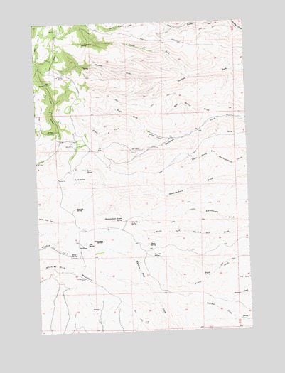
Whiskey Dick Mountain, WA USGS Topographic Map
Click on map above to begin viewing in our Map Viewer.

This topographic map contains these locations and features:
Feature Name Type Latitude Longitude GNIS ID View Map
Basalt SpringSpringN47.0621°W120.2289°1516173View Map
Bryant SpringSpringN47.0224°W120.1498°1517017View Map
Dorse SpringSpringN47.0312°W120.2320°1518878View Map
Government SpringsSpringN47.0368°W120.2123°1520175View Map
Hunt CreekStreamN47.0776°W120.1712°1521076View Map
North Fork Hunt CreekStreamN47.0801°W120.1828°1523794View Map
North Fork Perkins ForkStreamN47.1029°W120.1567°1523819View Map
Pine SpringSpringN47.0351°W120.2217°1524452View Map
Quilomene Wildlife Recreation AreaParkN47.0985°W120.1512°1530441View Map
Reynolds SpringSpringN47.0304°W120.1831°1525019View Map
Seabrock SpringSpringN47.0501°W120.2287°1525538View Map
Skookumchuck Heights SpringSpringN47.0457°W120.2003°1525882View Map
South Fork Hunt CreekStreamN47.0801°W120.1828°1526149View Map
Spike SpringSpringN47.0662°W120.2206°1526366View Map
The PinesLocaleN47.0351°W120.2253°1527059View Map
Thorn SpringSpringN47.0351°W120.1851°1527119View Map
Whiskey Dick MountainSummitN47.0251°W120.2320°1528028View Map
Wide Hollow CreekStreamN47.0857°W120.1423°1528118View Map
Wild Horse SpringSpringN47.0437°W120.1964°1528125View Map

Note: Coordinates in the location and feature list above are referenced to NAD83 datum.


Copyright (C) 2008-2024 Ryan Niemi / Sunset Dynamics ... All Rights Reserved