TopoQuest Logo
Do you find TopoQuest useful?
Help keep TopoQuest running and adding new maps/features by donating!
Bitcoin:  19c7KJd3qBynnjoSw5npx9KScwjBe4ifkT
Litecoin:  LXs6TkuXGGXo1vDsWCkWVdjQX94eUKd6ui
Home View Maps Find Maps Find Places Resources & Links


Waterman Mountain, California Topographic Map

USGS Map Title: Waterman Mountain, CA
USGS Map MRC: 34117C8
DRG (GeoTIFF) Download: o34117c8.tif


Neighboring USGS Topographic Map Quads:


  Pacifico Mountain, CA  
34118D1
 

  Juniper Hills, CA  
34117D8
 

  Valyermo, CA  
34117D7
 

  Chilao Flat, CA  
34118C1
 

  Waterman Mountain, CA  
34117C8
 

  Crystal Lake, CA  
34117C7
 

  Mount Wilson, CA  
34118B1
 

  Azusa, CA  
34117B8
 

  Glendora, CA  
34117B7


Map MRC Location:

N35°
W118°
N35°
W117°
H8 H7 H6 H5 H4 H3 H2 H1
G8 G7 G6 G5 G4 G3 G2 G1
F8 F7 F6 F5 F4 F3 F2 F1
E8 E7 E6 E5 E4 E3 E2 E1
D8 D7 D6 D5 D4 D3 D2 D1
C8 C7 C6 C5 C4 C3 C2 C1
B8 B7 B6 B5 B4 B3 B2 B1
A8 A7 A6 A5 A4 A3 A2 A1
N34°
W118°
N34°
W117°

Waterman Mountain, CA USGS 1:24K Topographic Map Preview:
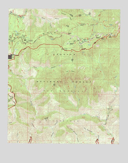
Waterman Mountain, CA USGS Topographic Map
Click on map above to begin viewing in our Map Viewer.

This topographic map contains these locations and features:
Feature Name Type Latitude Longitude GNIS ID View Map
Buckhorn FlatFlatN34.3450°W117.9156°239771View Map
Buckhorn Guard StationLocaleN34.3456°W117.9203°239772View Map
Buckhorn SpringSpringN34.3419°W117.9081°239775View Map
Camp ChristianLocaleN34.3486°W117.9995°240077View Map
Camp Cumorah CrestLocaleN34.3486°W117.9845°240082View Map
Camp GlenwoodLocaleN34.3528°W117.9578°240093View Map
Camp PajaritoLocaleN34.3503°W117.9423°240104View Map
Camp Singing PinesLocaleN34.3514°W117.9923°240111View Map
Camp ValcrestLocaleN34.3456°W117.9787°240120View Map
Cedar SpringSpringN34.3508°W117.8856°1669836View Map
Cedar SpringsPopulated PlaceN34.3506°W117.8851°1660454View Map
Cloudburst CanyonValleyN34.3633°W117.9551°240710View Map
Cloudburst SummitGapN34.3514°W117.9345°240711View Map
Conservation Camp ThirtysevenLocaleN34.3542°W117.8790°240863View Map
Cooper CanyonValleyN34.3619°W117.9012°240891View Map
Cooper Canyon Trail CampLocaleN34.3603°W117.9209°277246View Map
Eagles Roost Picnic GroundLocaleN34.3539°W117.8773°277258View Map
Kratka RidgeRidgeN34.3494°W117.8890°244368View Map
Kratka Ridge Ski AreaLocaleN34.3511°W117.8981°277257View Map
Louies CabinLocaleN34.3306°W117.9959°245232View Map
Lower Bear CampgroundLocaleN34.2544°W117.8834°277255View Map
Mount Waterman Ski AreaLocaleN34.3461°W117.9337°277256View Map
Pasadena CampLocaleN34.3528°W117.9920°247285View Map
Rattlesnake SpringSpringN34.3597°W117.8873°248006View Map
Rattlesnake TrailTrailN34.3586°W117.8884°248011View Map
Ridge Crest Picnic GroundParkN34.3533°W117.8881°248180View Map
San Gabriel WildernessReserveN34.2935°W117.9326°1802874View Map
Sulpher Springs CampgroundLocaleN34.3664°W117.9873°1655320View Map
Sulphur SpringSpringN34.3667°W117.9865°250046View Map
Three PointsPopulated PlaceN34.3433°W117.9823°252996View Map
Twin PeaksSummitN34.3158°W117.9267°252235View Map
Upper Bear Trail CampLocaleN34.2831°W117.8859°277254View Map
Vista Picnic GroundParkN34.3494°W117.8920°251106View Map
Waterman MountainSummitN34.3361°W117.9365°255859View Map
West Fork Bear CreekStreamN34.2711°W117.8906°251338View Map
Winston PeakSummitN34.3583°W117.9353°251730View Map
Winston SpringSpringN34.3472°W117.9501°251731View Map

Note: Coordinates in the location and feature list above are referenced to NAD83 datum.


Copyright (C) 2008-2024 Ryan Niemi / Sunset Dynamics ... All Rights Reserved