TopoQuest Logo
Do you find TopoQuest useful?
Help keep TopoQuest running and adding new maps/features by donating!
Bitcoin:  19c7KJd3qBynnjoSw5npx9KScwjBe4ifkT
Litecoin:  LXs6TkuXGGXo1vDsWCkWVdjQX94eUKd6ui
Home View Maps Find Maps Find Places Resources & Links


Utica, Minnesota Topographic Map

USGS Map Title: Utica, MN
USGS Map MRC: 43091H8
DRG (GeoTIFF) Download: o43091h8.tif


Neighboring USGS Topographic Map Quads:


  Elba, MN  
44092A1
 

  Altura, MN  
44091A8
 

  Rollingstone, MN  
44091A7
 

  Saint Charles, MN  
43092H1
 

  Utica, MN  
43091H8
 

  Lewiston, MN  
43091H7
 

  Pilot Mound, MN  
43092G1
 

  Arendahl, MN  
43091G8
 

  Rushford West, MN  
43091G7


Map MRC Location:

N44°
W92°
N44°
W91°
H8 H7 H6 H5 H4 H3 H2 H1
G8 G7 G6 G5 G4 G3 G2 G1
F8 F7 F6 F5 F4 F3 F2 F1
E8 E7 E6 E5 E4 E3 E2 E1
D8 D7 D6 D5 D4 D3 D2 D1
C8 C7 C6 C5 C4 C3 C2 C1
B8 B7 B6 B5 B4 B3 B2 B1
A8 A7 A6 A5 A4 A3 A2 A1
N43°
W92°
N43°
W91°

Utica, MN USGS 1:24K Topographic Map Preview:
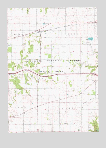
Utica, MN USGS Topographic Map
Click on map above to begin viewing in our Map Viewer.

This topographic map contains these locations and features:
Feature Name Type Latitude Longitude GNIS ID View Map
City of UticaCivilN43.9772°W91.9495°2397104View Map
ClydePopulated PlaceN43.8947°W91.9793°654647View Map
Clyde Post Office (historical)Post OfficeN43.8947°W91.9793°2051983View Map
FremontPopulated PlaceN43.9139°W91.8990°643929View Map
Fremont Post Office (historical)Post OfficeN43.9139°W91.8990°2051972View Map
Heartland Community ChurchChurchN43.9736°W91.9549°2052169View Map
Interchange 242CrossingN43.9319°W91.8785°2052198View Map
Mount Auburn CemeteryCemeteryN43.9607°W91.9194°648160View Map
Saint John CemeteryCemeteryN43.9846°W91.8856°650634View Map
Scottish CemeteryCemeteryN43.8836°W91.9188°2052186View Map
Scottish ChurchChurchN43.8836°W91.9193°651807View Map
Shelton HillRidgeN43.9339°W91.9596°651950View Map
Township of FremontCivilN43.8903°W91.8994°664229View Map
Township of UticaCivilN43.9768°W91.8987°665846View Map
UticaPopulated PlaceN43.9755°W91.9549°653580View Map
UticaLocaleN43.9755°W91.9579°2052171View Map
Utica Post OfficePost OfficeN43.9759°W91.9554°2052170View Map
Worth CemeteryCemeteryN43.9247°W91.9749°654390View Map

Note: Coordinates in the location and feature list above are referenced to NAD83 datum.


Copyright (C) 2008-2024 Ryan Niemi / Sunset Dynamics ... All Rights Reserved