TopoQuest Logo
Do you find TopoQuest useful?
Help keep TopoQuest running and adding new maps/features by donating!
Bitcoin:  19c7KJd3qBynnjoSw5npx9KScwjBe4ifkT
Litecoin:  LXs6TkuXGGXo1vDsWCkWVdjQX94eUKd6ui
Home View Maps Find Maps Find Places Resources & Links


Upper Soda, Oregon Topographic Map

USGS Map Title: Upper Soda, OR
USGS Map MRC: 44122D3
DRG (GeoTIFF) Download: o44122d3.tif


Neighboring USGS Topographic Map Quads:


  Yellowstone Mountain, OR  
44122E4
 

  Quartzville, OR  
44122E3
 

  Chimney Peak, OR  
44122E2
 

  Cascadia, OR  
44122D4
 

  Upper Soda, OR  
44122D3
 

  Harter Mountain, OR  
44122D2
 

  Swamp Mountain, OR  
44122C4
 

  Tidbits Mountain, OR  
44122C3
 

  Carpenter Mountain, OR  
44122C2


Map MRC Location:

N45°
W123°
N45°
W122°
H8 H7 H6 H5 H4 H3 H2 H1
G8 G7 G6 G5 G4 G3 G2 G1
F8 F7 F6 F5 F4 F3 F2 F1
E8 E7 E6 E5 E4 E3 E2 E1
D8 D7 D6 D5 D4 D3 D2 D1
C8 C7 C6 C5 C4 C3 C2 C1
B8 B7 B6 B5 B4 B3 B2 B1
A8 A7 A6 A5 A4 A3 A2 A1
N44°
W123°
N44°
W122°

Upper Soda, OR USGS 1:24K Topographic Map Preview:
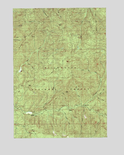
Upper Soda, OR USGS Topographic Map
Click on map above to begin viewing in our Map Viewer.

This topographic map contains these locations and features:
Feature Name Type Latitude Longitude GNIS ID View Map
Bloody PointCapeN44.4254°W122.3587°1138272View Map
Boulder CreekStreamN44.4037°W122.3040°1138475View Map
Channel CreekStreamN44.4026°W122.3679°1153401View Map
Cougar RockPillarN44.4840°W122.3115°1140244View Map
East Linn DivisionCivilN44.4463°W122.2727°1938006View Map
Elk CreekStreamN44.3968°W122.2617°1141761View Map
Fernview Recreation SiteLocaleN44.4023°W122.2998°1142072View Map
Garrison Post Office (historical)Post OfficeN44.4062°W122.2831°1164374View Map
Harter CreekStreamN44.4173°W122.2645°1143337View Map
Husky CreekStreamN44.4471°W122.3617°1143967View Map
Keith CreekStreamN44.4054°W122.2862°1144512View Map
Little Boulder CreekStreamN44.4026°W122.3145°1145105View Map
Menagerie WildernessReserveN44.4173°W122.3146°1987623View Map
Moose LakeLakeN44.4394°W122.3679°1146438View Map
Moose MountainSummitN44.4482°W122.3020°1146439View Map
Rooster CreekStreamN44.4054°W122.3054°1153402View Map
Rooster RockPillarN44.4178°W122.3038°1148719View Map
Soda ForkStreamN44.4046°W122.2823°1149849View Map
Stewart CreekStreamN44.4051°W122.2851°1150419View Map
Taylor CreekStreamN44.4137°W122.2676°1150918View Map
Trout CreekStreamN44.3973°W122.3484°1151435View Map
Trout Creek Recreation SiteLocaleN44.3968°W122.3534°1151450View Map
Upper SodaPopulated PlaceN44.4062°W122.2829°1151705View Map
Yukwah Recreation SiteLocaleN44.3996°W122.3381°1926281View Map

Note: Coordinates in the location and feature list above are referenced to NAD83 datum.


Copyright (C) 2008-2024 Ryan Niemi / Sunset Dynamics ... All Rights Reserved