TopoQuest Logo
Do you find TopoQuest useful?
Help keep TopoQuest running and adding new maps/features by donating!
Bitcoin:  19c7KJd3qBynnjoSw5npx9KScwjBe4ifkT
Litecoin:  LXs6TkuXGGXo1vDsWCkWVdjQX94eUKd6ui
Home View Maps Find Maps Find Places Resources & Links


Twin Springs, Idaho Topographic Map

USGS Map Title: Twin Springs, ID
USGS Map MRC: 43115F6
DRG (GeoTIFF) Download: o43115f6.tif


Neighboring USGS Topographic Map Quads:


  Idaho City, ID  
43115G7
 

  Rabbit Creek Summit, ID  
43115G6
 

  Barber Flat, ID  
43115G5
 

  Arrowrock Reservoir NE, ID  
43115F7
 

  Twin Springs, ID  
43115F6
 

  Sheep Creek, ID  
43115F5
 

  Grape Mountain, ID  
43115E7
 

  Long Gulch, ID  
43115E6
 

  Prairie, ID  
43115E5


Map MRC Location:

N44°
W116°
N44°
W115°
H8 H7 H6 H5 H4 H3 H2 H1
G8 G7 G6 G5 G4 G3 G2 G1
F8 F7 F6 F5 F4 F3 F2 F1
E8 E7 E6 E5 E4 E3 E2 E1
D8 D7 D6 D5 D4 D3 D2 D1
C8 C7 C6 C5 C4 C3 C2 C1
B8 B7 B6 B5 B4 B3 B2 B1
A8 A7 A6 A5 A4 A3 A2 A1
N43°
W116°
N43°
W115°

Twin Springs, ID USGS 1:24K Topographic Map Preview:
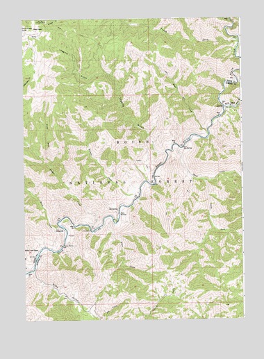
Twin Springs, ID USGS Topographic Map
Click on map above to begin viewing in our Map Viewer.

This topographic map contains these locations and features:
Feature Name Type Latitude Longitude GNIS ID View Map
Alder CreekStreamN43.6663°W115.6998°376503View Map
Badger CreekStreamN43.6646°W115.7198°376828View Map
Badger Creek Recreation SiteLocaleN43.6621°W115.7118°394127View Map
Bald Mountain CampgroundLocaleN43.7491°W115.7445°376890View Map
Birch CreekStreamN43.6543°W115.7423°377663View Map
Birch Creek CampgroundLocaleN43.6627°W115.7340°377667View Map
Browns CreekStreamN43.6774°W115.6876°378285View Map
French CreekStreamN43.7405°W115.6268°382059View Map
Haga CreekStreamN43.7027°W115.6459°382793View Map
Hot SpringsSpringN43.6704°W115.7015°383447View Map
Logging GulchValleyN43.6943°W115.6726°385978View Map
Middle Fork Boise RiverStreamN43.7132°W115.6357°386799View Map
North Fork Badger CreekStreamN43.6893°W115.7415°387644View Map
North Fork Boise RiverStreamN43.7135°W115.6357°387658View Map
Rough CreekStreamN43.7132°W115.6276°389638View Map
Sheep CreekStreamN43.6968°W115.6637°390199View Map
South Fork Sheep CreekStreamN43.6832°W115.6493°391022View Map
Troutdale CampgroundLocaleN43.7163°W115.6251°392431View Map
Troutdale Guard StationLocaleN43.7132°W115.6357°392432View Map
Twin SpringsPopulated PlaceN43.6693°W115.7012°398282View Map
Twinsprings Post Office (historical)Post OfficeN43.6693°W115.7012°2027013View Map

Note: Coordinates in the location and feature list above are referenced to NAD83 datum.


Copyright (C) 2008-2024 Ryan Niemi / Sunset Dynamics ... All Rights Reserved