TopoQuest Logo
Do you find TopoQuest useful?
Help keep TopoQuest running and adding new maps/features by donating!
Bitcoin:  19c7KJd3qBynnjoSw5npx9KScwjBe4ifkT
Litecoin:  LXs6TkuXGGXo1vDsWCkWVdjQX94eUKd6ui
Home View Maps Find Maps Find Places Resources & Links


Tule Springs Lake, Nevada Topographic Map

USGS Map Title: Tule Springs Lake, NV
USGS Map MRC: 36115C3
DRG (GeoTIFF) Download: o36115c3.tif


Neighboring USGS Topographic Map Quads:


  Corn Creek Springs NW, NV  
36115D4
 

  Corn Creek Springs, NV  
36115D3
 

  Gass Peak, NV  
36115D2
 

  Grapevine Spring, NV  
36115C4
 

  Tule Springs Lake, NV  
36115C3
 

  Gass Peak SW, NV  
36115C2
 

  La Madre Mountain, NV  
36115B4
 

  Blue Diamond NE, NV  
36115B3
 

  Las Vegas NW, NV  
36115B2


Map MRC Location:

N37°
W116°
N37°
W115°
H8 H7 H6 H5 H4 H3 H2 H1
G8 G7 G6 G5 G4 G3 G2 G1
F8 F7 F6 F5 F4 F3 F2 F1
E8 E7 E6 E5 E4 E3 E2 E1
D8 D7 D6 D5 D4 D3 D2 D1
C8 C7 C6 C5 C4 C3 C2 C1
B8 B7 B6 B5 B4 B3 B2 B1
A8 A7 A6 A5 A4 A3 A2 A1
N36°
W116°
N36°
W115°

Tule Springs Lake, NV USGS 1:24K Topographic Map Preview:
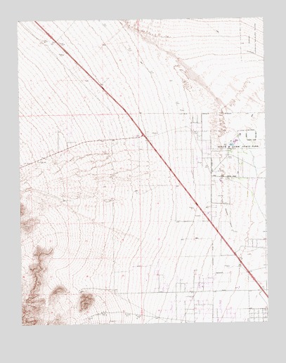
Tule Springs Lake, NV USGS Topographic Map
Click on map above to begin viewing in our Map Viewer.

This topographic map contains these locations and features:
Feature Name Type Latitude Longitude GNIS ID View Map
Arbor View High SchoolSchoolN36.3025°W115.2575°2085650View Map
Betsy Rhodes Elementary SchoolSchoolN36.2943°W115.2619°2084964View Map
Bright Angel Church of ChristChurchN36.2727°W115.2842°2472836View Map
Centennial AcademySchoolN36.2669°W115.2944°2087951View Map
Centennial Centre Shopping CenterLocaleN36.2742°W115.2706°2473530View Map
Centennial High SchoolSchoolN36.2789°W115.3195°2085655View Map
Centennial Hills Hospital Medical CenterHospitalN36.2871°W115.2860°2642847View Map
Cimarron Rose ParkParkN36.2625°W115.2703°2473277View Map
Cottonwood LakeLakeN36.3242°W115.2670°855488View Map
Dean Lamar Allen Elementary SchoolSchoolN36.2600°W115.2834°2083964View Map
Desert Willow LakeLakeN36.3235°W115.2665°855489View Map
Floyd R Lamb State ParkParkN36.3222°W115.2661°845332View Map
James Bilbray Elementary SchoolSchoolN36.3186°W115.3004°2083971View Map
KRBO-FM (Las Vegas)TowerN36.3333°W115.3622°865089View Map
KRBO-FM (Las Vegas)TowerN36.3294°W115.3645°865090View Map
Las Vegas Fire and Rescue Station 41BuildingN36.2869°W115.2610°2473003View Map
Las Vegas Gun ClubLocaleN36.3244°W115.2683°855722View Map
Las Vegas Indian ColonyCivilN36.3500°W115.3404°853945View Map
Marshall C Darnell Elementary SchoolSchoolN36.2708°W115.3030°2083985View Map
Mountain View Baptist ChurchChurchN36.2633°W115.2702°2473587View Map
Mulberry LakeLakeN36.3246°W115.2656°855491View Map
Peterson Behaviour Junior / Senior High SchoolSchoolN36.2781°W115.3219°2086501View Map
Ralph Cadwaller Middle SchoolSchoolN36.2897°W115.2637°2085518View Map
Stillwell SpringSpringN36.3197°W115.2681°846692View Map
Tule SpringSpringN36.3202°W115.2683°851438View Map
Tule SpringsLocaleN36.3172°W115.2811°851480View Map
Tule Springs LakeLakeN36.3230°W115.2680°855490View Map
Tule Springs RanchLocaleN36.3197°W115.2681°846691View Map
William and Mary Scherkenbach Elementary SchoolSchoolN36.3204°W115.3003°2084971View Map

Note: Coordinates in the location and feature list above are referenced to NAD83 datum.


Copyright (C) 2008-2024 Ryan Niemi / Sunset Dynamics ... All Rights Reserved