TopoQuest Logo
Do you find TopoQuest useful?
Help keep TopoQuest running and adding new maps/features by donating!
Bitcoin:  19c7KJd3qBynnjoSw5npx9KScwjBe4ifkT
Litecoin:  LXs6TkuXGGXo1vDsWCkWVdjQX94eUKd6ui
Home View Maps Find Maps Find Places Resources & Links


Troutman, North Carolina Topographic Map

USGS Map Title: Troutman, NC
USGS Map MRC: 35080F8
DRG (GeoTIFF) Download: o35080f8.tif


Neighboring USGS Topographic Map Quads:


  Stony Point, NC  
35081G1
 

  Statesville West, NC  
35080G8
 

  Statesville East, NC  
35080G7
 

  Catawba, NC  
35081F1
 

  Troutman, NC  
35080F8
 

  Shepherds, NC  
35080F7
 

  Denver, NC  
35081E1
 

  Lake Norman North, NC  
35080E8
 

  Mooresville, NC  
35080E7


Map MRC Location:

N36°
W81°
N36°
W80°
H8 H7 H6 H5 H4 H3 H2 H1
G8 G7 G6 G5 G4 G3 G2 G1
F8 F7 F6 F5 F4 F3 F2 F1
E8 E7 E6 E5 E4 E3 E2 E1
D8 D7 D6 D5 D4 D3 D2 D1
C8 C7 C6 C5 C4 C3 C2 C1
B8 B7 B6 B5 B4 B3 B2 B1
A8 A7 A6 A5 A4 A3 A2 A1
N35°
W81°
N35°
W80°

Troutman, NC USGS 1:24K Topographic Map Preview:
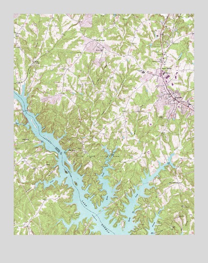
Troutman, NC USGS Topographic Map
Click on map above to begin viewing in our Map Viewer.

This topographic map contains these locations and features:
Feature Name Type Latitude Longitude GNIS ID View Map
Balls CreekStreamN35.6887°W80.9895°980501View Map
Barium Spring Orphanage DamDamN35.7335°W80.9031°999321View Map
Barium SpringsPopulated PlaceN35.7190°W80.8981°1018963View Map
Barium Springs Post OfficePost OfficeN35.7216°W80.8967°1955472View Map
Bass CreekStreamN35.7087°W80.9445°980603View Map
Bells CrossroadsPopulated PlaceN35.6543°W80.8859°1006127View Map
Bethel ChurchChurchN35.6740°W80.9523°981177View Map
Concord ChurchChurchN35.6743°W80.9990°983441View Map
Concord United Methodist Church CemeteryCemeteryN35.6732°W80.9995°983427View Map
Duke Powder State ParkParkN35.6685°W80.9409°984402View Map
Duke Power Park DamDamN35.6701°W80.9331°999225View Map
Duke Power Park LakeReservoirN35.6701°W80.9331°999226View Map
East MonboPopulated PlaceN35.6715°W80.9584°984517View Map
EufolaPopulated PlaceN35.7224°W80.9859°1020173View Map
Fern Hill ChurchChurchN35.6421°W80.9067°985053View Map
Hicks CreekStreamN35.6404°W80.9398°986726View Map
Iredell County Schools Special ServicesSchoolN35.7004°W80.8851°1001722View Map
Iredell Memorial ParkCemeteryN35.7404°W80.8990°986591View Map
Kyles CrossroadsPopulated PlaceN35.7351°W80.9442°1027417View Map
Little Joes ChurchChurchN35.7271°W80.8959°988681View Map
Long IslandPopulated PlaceN35.6779°W80.9934°1021277View Map
Long Island Access AreaAreaN35.6782°W80.9815°1005905View Map
Long Island AirportAirportN35.6623°W80.9705°997956View Map
Long Island MarinaLocaleN35.6776°W80.9812°1007470View Map
MonboPopulated PlaceN35.6643°W80.9784°1021510View Map
Mountain Road ChurchChurchN35.7296°W80.9387°990706View Map
NonameReservoirN35.7285°W80.8831°999311View Map
Norwood CreekStreamN35.6674°W80.9337°991318View Map
Olivet ChurchChurchN35.6668°W80.9920°991654View Map
Perth ChurchChurchN35.6821°W80.8981°992075View Map
Pine Grove CemeteryCemeteryN35.7187°W80.9640°992238View Map
Powder Spring BranchStreamN35.6868°W80.9448°992764View Map
Presbyterian Orphanage DamDamN35.7285°W80.8831°999312View Map
Reeder CreekStreamN35.7040°W80.9937°993163View Map
Rocky CreekStreamN35.6271°W80.9223°993577View Map
Rocky Mount ChurchChurchN35.6354°W80.8856°993606View Map
Saint James ChurchChurchN35.6410°W80.8820°993921View Map
Saint Johns ChurchChurchN35.6715°W80.9492°993974View Map
Saint Martins CemeteryCemeteryN35.7335°W80.9187°994024View Map
Saint Pauls ChurchChurchN35.6290°W80.8906°994104View Map
Skippers LandingLocaleN35.6660°W80.8945°1018742View Map
South Iredell High SchoolSchoolN35.7176°W80.9101°995168View Map
Stumpy Creek Access AreaAreaN35.6260°W80.9026°1005906View Map
Terrapin CreekStreamN35.6579°W80.9662°995933View Map
Town of TroutmanCivilN35.6887°W80.8852°2406757View Map
Township of FallstownCivilN35.6851°W80.9308°1026820View Map
Trinity ChurchChurchN35.7282°W80.9531°996256View Map
TroutmanPopulated PlaceN35.7007°W80.8881°996270View Map
Troutman CemeteryCemeteryN35.7143°W80.9340°996271View Map
Troutman Elementary SchoolSchoolN35.6971°W80.8851°1001750View Map
Troutman Fire and RescueBuildingN35.7024°W80.8897°2638214View Map
Troutman Police DepartmentBuildingN35.7072°W80.8924°2769746View Map
Troutman Post OfficePost OfficeN35.6997°W80.8882°2774051View Map

Note: Coordinates in the location and feature list above are referenced to NAD83 datum.


Copyright (C) 2008-2024 Ryan Niemi / Sunset Dynamics ... All Rights Reserved