TopoQuest Logo
Do you find TopoQuest useful?
Help keep TopoQuest running and adding new maps/features by donating!
Bitcoin:  19c7KJd3qBynnjoSw5npx9KScwjBe4ifkT
Litecoin:  LXs6TkuXGGXo1vDsWCkWVdjQX94eUKd6ui
Home View Maps Find Maps Find Places Resources & Links


Trapper, Colorado Topographic Map

USGS Map Title: Trapper, CO
USGS Map MRC: 40106A8
DRG (GeoTIFF) Download: o40106a8.tif


Neighboring USGS Topographic Map Quads:


  Sand Point, CO  
40107B1
 

  Yampa, CO  
40106B8
 

  Green Ridge, CO  
40106B7
 

  Orno Peak, CO  
40107A1
 

  Trapper, CO  
40106A8
 

  Toponas, CO  
40106A7
 

  Dome Peak, CO  
39107H1
 

  Burns North, CO  
39106H8
 

  Blue Hill, CO  
39106H7


Map MRC Location:

N41°
W107°
N41°
W106°
H8 H7 H6 H5 H4 H3 H2 H1
G8 G7 G6 G5 G4 G3 G2 G1
F8 F7 F6 F5 F4 F3 F2 F1
E8 E7 E6 E5 E4 E3 E2 E1
D8 D7 D6 D5 D4 D3 D2 D1
C8 C7 C6 C5 C4 C3 C2 C1
B8 B7 B6 B5 B4 B3 B2 B1
A8 A7 A6 A5 A4 A3 A2 A1
N40°
W107°
N40°
W106°

Trapper, CO USGS 1:24K Topographic Map Preview:
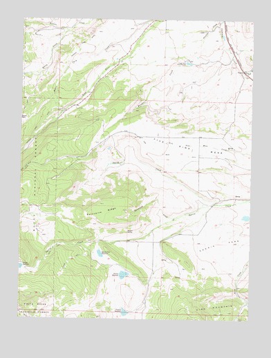
Trapper, CO USGS Topographic Map
Click on map above to begin viewing in our Map Viewer.

This topographic map contains these locations and features:
Feature Name Type Latitude Longitude GNIS ID View Map
Bear RiverStreamN40.0894°W106.9717°173065View Map
Beaver CreekStreamN40.1005°W106.8750°173072View Map
Brinker CreekStreamN40.1158°W106.8903°173090View Map
Chimney CreekStreamN40.1244°W106.8925°173091View Map
Crossan ReservoirReservoirN40.0027°W106.9431°173084View Map
Egeria Creek ReservoirReservoirN40.0271°W106.9569°173086View Map
Egeria DamDamN40.0283°W106.9573°200722View Map
Finger Rock Fish HatcheryLocaleN40.1072°W106.9117°173089View Map
Five Pine MesaSummitN40.0761°W106.9373°202134View Map
Five Pine Mesa DitchCanalN40.0769°W106.9298°202161View Map
Harper and Sons DamDamN40.0217°W106.9989°199856View Map
Harper ReservoirReservoirN40.0214°W106.9999°202163View Map
Harper SpringSpringN40.0367°W106.9423°173087View Map
Moody CreekStreamN40.1200°W106.9759°173562View Map
Moore Park CreekStreamN40.1200°W106.9339°173563View Map
Newton Gulch DamDamN40.0700°W106.8773°200736View Map
Newton Gulch ReservoirReservoirN40.0700°W106.8773°200737View Map
Porcupine CreekStreamN40.0422°W106.9167°173092View Map
Porcupine RidgeRidgeN40.0436°W106.9625°173088View Map
Roaring Fork DitchCanalN40.0833°W106.9881°202160View Map
Roberta DamDamN40.0433°W106.8773°200740View Map
Roberta ReservoirReservoirN40.0428°W106.8780°200741View Map
Smith CreekStreamN40.0480°W106.8934°173093View Map
Sterner DamDamN40.0197°W106.9434°199882View Map
Sterner ReservoirReservoirN40.0184°W106.9440°173085View Map
Todd CreekStreamN40.1044°W106.8817°173071View Map
TrapperPopulated PlaceN40.1039°W106.8798°173082View Map

Note: Coordinates in the location and feature list above are referenced to NAD83 datum.


Copyright (C) 2008-2024 Ryan Niemi / Sunset Dynamics ... All Rights Reserved