TopoQuest Logo
Do you find TopoQuest useful?
Help keep TopoQuest running and adding new maps/features by donating!
Bitcoin:  19c7KJd3qBynnjoSw5npx9KScwjBe4ifkT
Litecoin:  LXs6TkuXGGXo1vDsWCkWVdjQX94eUKd6ui
Home View Maps Find Maps Find Places Resources & Links


Tonkin Summit, Nevada Topographic Map

USGS Map Title: Tonkin Summit, NV
USGS Map MRC: 39116H4
DRG (GeoTIFF) Download: o39116h4.tif


Neighboring USGS Topographic Map Quads:


  Dugout Spring, NV  
40116A5
 

  Rocky Hills, NV  
40116A4
 

  Pete Hanson Creek, NV  
40116A3
 

  Walti Hot Springs, NV  
39116H5
 

  Tonkin Summit, NV  
39116H4
 

  Cooper Peak, NV  
39116H3
 

  Fagin Mountain, NV  
39116G5
 

  Three Bar Ranch, NV  
39116G4
 

  Roberts Creek Mountain, NV  
39116G3


Map MRC Location:

N40°
W117°
N40°
W116°
H8 H7 H6 H5 H4 H3 H2 H1
G8 G7 G6 G5 G4 G3 G2 G1
F8 F7 F6 F5 F4 F3 F2 F1
E8 E7 E6 E5 E4 E3 E2 E1
D8 D7 D6 D5 D4 D3 D2 D1
C8 C7 C6 C5 C4 C3 C2 C1
B8 B7 B6 B5 B4 B3 B2 B1
A8 A7 A6 A5 A4 A3 A2 A1
N39°
W117°
N39°
W116°

Tonkin Summit, NV USGS 1:24K Topographic Map Preview:
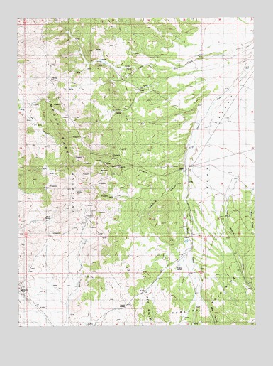
Tonkin Summit, NV USGS Topographic Map
Click on map above to begin viewing in our Map Viewer.

This topographic map contains these locations and features:
Feature Name Type Latitude Longitude GNIS ID View Map
Black SpringSpringN39.9183°W116.4842°838891View Map
Damele RanchLocaleN39.9374°W116.4142°846846View Map
Indian RanchLocaleN39.9705°W116.4354°841266View Map
Indian SpringSpringN39.9621°W116.4459°841277View Map
Lower Tonkin Creek SpringSpringN39.9224°W116.3884°846813View Map
McClusky PassGapN39.8905°W116.4992°841991View Map
Niel CreekStreamN39.9299°W116.3756°842473View Map
Pat Canyon Number OneSpringN39.9783°W116.4698°846808View Map
Pat Canyon Number TwoSpringN39.9563°W116.4834°846806View Map
Pat Canyon SpringSpringN39.9757°W116.4800°846809View Map
Pete Hanson CanyonValleyN39.9249°W116.3906°852290View Map
Red CanyonValleyN39.8944°W116.4048°843135View Map
Rooster CanyonValleyN39.9385°W116.4104°843350View Map
Telephone CanyonValleyN39.9385°W116.4106°844198View Map
TonkinPopulated PlaceN39.9391°W116.4115°846815View Map
Tonkin Post Office (historical)Post OfficeN39.9383°W116.4123°864934View Map
Tonkin RanchLocaleN39.9385°W116.4106°844359View Map
Tonkin Reservoir DamDamN39.9116°W116.4142°863550View Map
Tonkin SpringSpringN39.8984°W116.4175°844360View Map
Tonkin SummitGapN39.8833°W116.4429°845712View Map
Upper Tonkin Creek SpringSpringN39.9230°W116.3773°846812View Map

Note: Coordinates in the location and feature list above are referenced to NAD83 datum.


Copyright (C) 2008-2024 Ryan Niemi / Sunset Dynamics ... All Rights Reserved