TopoQuest Logo
Do you find TopoQuest useful?
Help keep TopoQuest running and adding new maps/features by donating!
Bitcoin:  19c7KJd3qBynnjoSw5npx9KScwjBe4ifkT
Litecoin:  LXs6TkuXGGXo1vDsWCkWVdjQX94eUKd6ui
Home View Maps Find Maps Find Places Resources & Links


Tome, New Mexico Topographic Map

USGS Map Title: Tome, NM
USGS Map MRC: 34106F6
DRG (GeoTIFF) Download: o34106f6.tif


Neighboring USGS Topographic Map Quads:


  Dalies, NM  
34106G7
 

  Los Lunas, NM  
34106G6
 

  Los Lunas SE, NM  
34106G5
 

  Belen, NM  
34106F7
 

  Tome, NM  
34106F6
 

  Tome NE, NM  
34106F5
 

  Veguita, NM  
34106E7
 

  Casa Colorada, NM  
34106E6
 

  Tome SE, NM  
34106E5


Map MRC Location:

N35°
W107°
N35°
W106°
H8 H7 H6 H5 H4 H3 H2 H1
G8 G7 G6 G5 G4 G3 G2 G1
F8 F7 F6 F5 F4 F3 F2 F1
E8 E7 E6 E5 E4 E3 E2 E1
D8 D7 D6 D5 D4 D3 D2 D1
C8 C7 C6 C5 C4 C3 C2 C1
B8 B7 B6 B5 B4 B3 B2 B1
A8 A7 A6 A5 A4 A3 A2 A1
N34°
W107°
N34°
W106°

Tome, NM USGS 1:24K Topographic Map Preview:
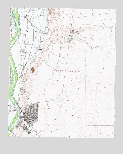
Tome, NM USGS Topographic Map
Click on map above to begin viewing in our Map Viewer.

This topographic map contains these locations and features:
Feature Name Type Latitude Longitude GNIS ID View Map
10006 Water WellWellN34.6923°W106.7397°927108View Map
10007 Water WellWellN34.6528°W106.6659°927106View Map
10012 Water WellWellN34.7453°W106.7320°926003View Map
10014 Water WellWellN34.7167°W106.7292°926000View Map
AdelinoPopulated PlaceN34.7159°W106.7311°923551View Map
Adelino Census Designated PlaceCensusN34.7066°W106.7305°2584044View Map
Adelino Post Office (historical)Post OfficeN34.7159°W106.7311°937517View Map
Adelino SchoolSchoolN34.7131°W106.7303°885561View Map
Catholic Church of TomeChurchN34.7409°W106.7284°914733View Map
Cerro DrainCanalN34.7428°W106.7097°887395View Map
City of Rio CommunitiesCivilN34.6457°W106.7163°2771703View Map
El CerroPopulated PlaceN34.7270°W106.7109°899621View Map
El Grande TankReservoirN34.7126°W106.6481°888809View Map
El Norte TankReservoirN34.7402°W106.6392°888815View Map
Immaculate Conception Parish MuseumBuildingN34.7409°W106.7284°929478View Map
Jaral Lateral Number 1CanalN34.6495°W106.7486°897942View Map
La Canada de la Loma de ArenaStreamN34.7289°W106.7061°890776View Map
La ConstanciaPopulated PlaceN34.6784°W106.7350°890791View Map
La Constancia DitchCanalN34.7170°W106.7175°890792View Map
La Constancia LateralCanalN34.7423°W106.7064°890793View Map
La LaderaPopulated PlaceN34.7092°W106.7150°899704View Map
La Lechusa TankReservoirN34.6829°W106.6671°890817View Map
La Loma AltaSummitN34.6567°W106.6886°899705View Map
Las MaravillasPopulated PlaceN34.7381°W106.6685°2413646View Map
Las Maravillas Census Designated PlaceCensusN34.7339°W106.6690°2584133View Map
Los Chavez DitchCanalN34.7442°W106.7475°891349View Map
Los Chavez LateralCanalN34.7433°W106.7475°891351View Map
Lower Belen Riverside DrainCanalN34.6834°W106.7453°891418View Map
Lower Peralta Riverside DrainCanalN34.7345°W106.7381°891444View Map
Miguel E Baca House Historic SiteBuildingN34.7409°W106.7284°933501View Map
New Jaral DitchCanalN34.6384°W106.7456°892440View Map
Pasitos del CieloPopulated PlaceN34.7217°W106.6884°2413658View Map
Rio CommunitiesPopulated PlaceN34.6496°W106.7340°2413664View Map
Rio Communities Census Designated PlaceCensusN34.6414°W106.7165°2409171View Map
Rio Communities North Census Designated PlaceCensusN34.7327°W106.6879°2409172View Map
Rio del OroPopulated PlaceN34.7337°W106.6888°2413665View Map
Rio Grande EstatesPopulated PlaceN34.6559°W106.7125°925165View Map
Rio Grande Estates Fire and Rescue Main StationBuildingN34.6507°W106.7355°2657810View Map
Senator Willie M Chavez State ParkParkN34.6514°W106.7436°934276View Map
TomePopulated PlaceN34.7409°W106.7284°899958View Map
Tome - Adelino Volunteer Fire Department Valley StationBuildingN34.7146°W106.7309°2657587View Map
Tome Adelino Fire Department Mesa StationBuildingN34.7227°W106.6779°2657949View Map
Tome CemeteryCemeteryN34.7245°W106.7078°895743View Map
Tome Census Designated PlaceCensusN34.7397°W106.7230°2633186View Map
Tome DitchCanalN34.7378°W106.7347°895744View Map
Tome Jail Historic SiteBuildingN34.7409°W106.7284°934457View Map
Tome Post OfficePost OfficeN34.7462°W106.7264°937541View Map
Tome-Adelino Census Designated Place (historical)CensusN34.7339°W106.7234°2409331View Map
University of New Mexico Valencia BranchSchoolN34.7289°W106.7053°901528View Map
UNM Valencia BranchSchoolN34.7289°W106.7336°2375379View Map

Note: Coordinates in the location and feature list above are referenced to NAD83 datum.


Copyright (C) 2008-2024 Ryan Niemi / Sunset Dynamics ... All Rights Reserved