TopoQuest Logo
Do you find TopoQuest useful?
Help keep TopoQuest running and adding new maps/features by donating!
Bitcoin:  19c7KJd3qBynnjoSw5npx9KScwjBe4ifkT
Litecoin:  LXs6TkuXGGXo1vDsWCkWVdjQX94eUKd6ui
Home View Maps Find Maps Find Places Resources & Links


Tioga, Illinois Topographic Map

USGS Map Title: Tioga, IL
USGS Map MRC: 40091B3
DRG (GeoTIFF) Download: o40091b3.tif


Neighboring USGS Topographic Map Quads:


  Warsaw, IL  
40091C4
 

  Sutter, IL  
40091C3
 

  West Point, IL  
40091C2
 

  Lima, IL  
40091B4
 

  Tioga, IL  
40091B3
 

  Loraine, IL  
40091B2
 

  Long Island, IL  
40091A4
 

  Mendon, IL  
40091A3
 

  Coatsburg, IL  
40091A2


Map MRC Location:

N41°
W92°
N41°
W91°
H8 H7 H6 H5 H4 H3 H2 H1
G8 G7 G6 G5 G4 G3 G2 G1
F8 F7 F6 F5 F4 F3 F2 F1
E8 E7 E6 E5 E4 E3 E2 E1
D8 D7 D6 D5 D4 D3 D2 D1
C8 C7 C6 C5 C4 C3 C2 C1
B8 B7 B6 B5 B4 B3 B2 B1
A8 A7 A6 A5 A4 A3 A2 A1
N40°
W92°
N40°
W91°

Tioga, IL USGS 1:24K Topographic Map Preview:
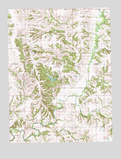
Tioga, IL USGS Topographic Map
Click on map above to begin viewing in our Map Viewer.

This topographic map contains these locations and features:
Feature Name Type Latitude Longitude GNIS ID View Map
Bethany CemeteryCemeteryN40.2095°W91.3440°1720585View Map
BreckenridgePopulated PlaceN40.2437°W91.2865°422498View Map
Buckeye CemeteryCemeteryN40.2492°W91.2949°1720587View Map
Buckeye School (historical)SchoolN40.2492°W91.2951°405119View Map
Camp SaukenaukLocaleN40.1878°W91.3226°1720506View Map
Camp Saukenauk LakeReservoirN40.1847°W91.3222°1691054View Map
Camp Saukenauk Lake DamDamN40.1834°W91.3235°1691053View Map
Crescent School (historical)SchoolN40.2142°W91.3646°406772View Map
Eshom School (historical)SchoolN40.1525°W91.3660°408058View Map
Green Hill School (historical)SchoolN40.2181°W91.2879°409385View Map
Grindstone CreekStreamN40.1431°W91.3218°409516View Map
Hagemeister Landing Strip (historical)AirportN40.1859°W91.3140°1720530View Map
Haynes School (historical)SchoolN40.1812°W91.3374°409965View Map
Higgins CemeteryCemeteryN40.1556°W91.3749°410205View Map
Karnes CemeteryCemeteryN40.1961°W91.3174°411315View Map
Lick BranchStreamN40.1625°W91.3126°412042View Map
Little CreekStreamN40.1812°W91.2807°412313View Map
Mount Hebron Church (historical)ChurchN40.1453°W91.2993°413971View Map
Mount Hebron School (historical)SchoolN40.1470°W91.2985°413972View Map
Mud CreekStreamN40.1867°W91.2729°414173View Map
Oak Forest School (historical)SchoolN40.1839°W91.3029°414761View Map
Panther CreekStreamN40.2087°W91.2707°415358View Map
Prairie School (historical)SchoolN40.1270°W91.2604°416162View Map
Pryor School (historical)SchoolN40.1684°W91.2585°416273View Map
South Fork Bear CreekStreamN40.1692°W91.2951°418752View Map
TiogaPopulated PlaceN40.2112°W91.3471°419740View Map
Tioga Post Office (historical)Post OfficeN40.2112°W91.3479°1812512View Map
Township of WalkerCivilN40.2424°W91.3170°429883View Map
Victory School (historical)SchoolN40.1598°W91.3318°420305View Map
West Tioga CemeteryCemeteryN40.2100°W91.3493°1720638View Map

Note: Coordinates in the location and feature list above are referenced to NAD83 datum.


Copyright (C) 2008-2024 Ryan Niemi / Sunset Dynamics ... All Rights Reserved