TopoQuest Logo
Do you find TopoQuest useful?
Help keep TopoQuest running and adding new maps/features by donating!
Bitcoin:  19c7KJd3qBynnjoSw5npx9KScwjBe4ifkT
Litecoin:  LXs6TkuXGGXo1vDsWCkWVdjQX94eUKd6ui
Home View Maps Find Maps Find Places Resources & Links


Tetonia, Idaho Topographic Map

USGS Map Title: Tetonia, ID
USGS Map MRC: 43111G2
DRG (GeoTIFF) Download: o43111g2.tif


Neighboring USGS Topographic Map Quads:


  Drummond, ID  
43111H3
 

  Lamont, ID  
43111H2
 

  McRenolds Reservoir, ID  
43111H1
 

  Packsaddle Lake, ID  
43111G3
 

  Tetonia, ID  
43111G2
 

  Clawson, ID  
43111G1
 

  Garns Mountain, ID  
43111F3
 

  Bates, ID  
43111F2
 

  Driggs, ID  
43111F1


Map MRC Location:

N44°
W112°
N44°
W111°
H8 H7 H6 H5 H4 H3 H2 H1
G8 G7 G6 G5 G4 G3 G2 G1
F8 F7 F6 F5 F4 F3 F2 F1
E8 E7 E6 E5 E4 E3 E2 E1
D8 D7 D6 D5 D4 D3 D2 D1
C8 C7 C6 C5 C4 C3 C2 C1
B8 B7 B6 B5 B4 B3 B2 B1
A8 A7 A6 A5 A4 A3 A2 A1
N43°
W112°
N43°
W111°

Tetonia, ID USGS 1:24K Topographic Map Preview:
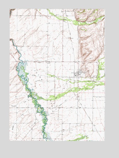
Tetonia, ID USGS Topographic Map
Click on map above to begin viewing in our Map Viewer.

This topographic map contains these locations and features:
Feature Name Type Latitude Longitude GNIS ID View Map
CachePopulated PlaceN43.7880°W111.1630°397513View Map
Cache Clawson CemeteryCemeteryN43.8111°W111.1420°371846View Map
City of TetoniaCivilN43.8147°W111.1588°2412053View Map
Dry HollowValleyN43.7810°W111.2330°380883View Map
FeltPopulated PlaceN43.8730°W111.1847°397700View Map
Felt CemeteryCemeteryN43.8612°W111.1995°372676View Map
Haden (historical)Populated PlaceN43.8249°W111.1797°399077View Map
Haden CemeteryCemeteryN43.8244°W111.1990°372955View Map
Horseshoe CreekStreamN43.7802°W111.2136°383417View Map
Middle Leigh CreekStreamN43.8094°W111.1349°386861View Map
North Leigh CreekStreamN43.8181°W111.1333°387826View Map
Packsaddle CreekStreamN43.7896°W111.2205°388107View Map
Rainer Access AreaLocaleN43.7532°W111.2063°401141View Map
South Leigh CreekStreamN43.7983°W111.2220°391069View Map
Spring CreekStreamN43.8274°W111.2405°391185View Map
Teton CountyCivilN43.7594°W111.2076°399297View Map
Teton County Fire Protection District Station 3BuildingN43.8137°W111.1643°2619209View Map
TetoniaPopulated PlaceN43.8145°W111.1602°398229View Map
Tetonia DivisionCivilN43.8694°W111.2014°1936817View Map
Tetonia Elementary SchoolSchoolN43.8130°W111.1586°399248View Map
Tetonia Post OfficePost OfficeN43.8138°W111.1599°2781799View Map

Note: Coordinates in the location and feature list above are referenced to NAD83 datum.


Copyright (C) 2008-2024 Ryan Niemi / Sunset Dynamics ... All Rights Reserved