TopoQuest Logo
Do you find TopoQuest useful?
Help keep TopoQuest running and adding new maps/features by donating!
Bitcoin:  19c7KJd3qBynnjoSw5npx9KScwjBe4ifkT
Litecoin:  LXs6TkuXGGXo1vDsWCkWVdjQX94eUKd6ui
Home View Maps Find Maps Find Places Resources & Links


Sylvanite, Montana Topographic Map

USGS Map Title: Sylvanite, MT
USGS Map MRC: 48115F7
DRG (GeoTIFF) Download: o48115f7.tif


Neighboring USGS Topographic Map Quads:


  Mount Baldy, MT  
48115G8
 

  Clark Mountain, MT  
48115G7
 

  Yaak, MT  
48115G6
 

  Newton Mountain, MT  
48115F8
 

  Sylvanite, MT  
48115F7
 

  Flatiron Mountain, MT  
48115F6
 

  Kilbrennan Lake, MT  
48115E8
 

  Pulpit Mountain, MT  
48115E7
 

  Turner Mountain, MT  
48115E6


Map MRC Location:

N49°
W116°
N49°
W115°
H8 H7 H6 H5 H4 H3 H2 H1
G8 G7 G6 G5 G4 G3 G2 G1
F8 F7 F6 F5 F4 F3 F2 F1
E8 E7 E6 E5 E4 E3 E2 E1
D8 D7 D6 D5 D4 D3 D2 D1
C8 C7 C6 C5 C4 C3 C2 C1
B8 B7 B6 B5 B4 B3 B2 B1
A8 A7 A6 A5 A4 A3 A2 A1
N48°
W116°
N48°
W115°

Sylvanite, MT USGS 1:24K Topographic Map Preview:
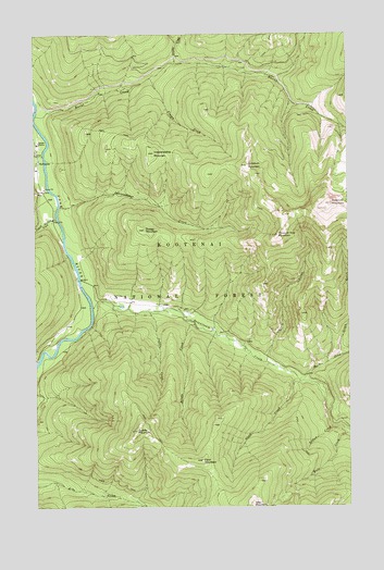
Sylvanite, MT USGS Topographic Map
Click on map above to begin viewing in our Map Viewer.

This topographic map contains these locations and features:
Feature Name Type Latitude Longitude GNIS ID View Map
Arbo MountainSummitN48.6255°W115.7893°779111View Map
Bridle CreekStreamN48.6733°W115.8121°780410View Map
Burnt CreekStreamN48.7286°W115.8746°780635View Map
Conn CreekStreamN48.6586°W115.7716°781576View Map
Conn MountainSummitN48.6377°W115.8093°781578View Map
Crawford CreekStreamN48.7177°W115.8727°793914View Map
Crum GulchValleyN48.6633°W115.7835°781944View Map
Dooley MountainSummitN48.6986°W115.8318°782479View Map
Fourth of July CreekStreamN48.7016°W115.8663°783658View Map
Grizzly CreekStreamN48.7422°W115.8185°784354View Map
Grush GulchValleyN48.6641°W115.7566°784401View Map
Independence CreekStreamN48.7047°W115.8652°785232View Map
Independence MountainSummitN48.7186°W115.8274°785237View Map
North Fork Seventeenmile CreekStreamN48.6588°W115.7691°788243View Map
Pelham CreekStreamN48.6463°W115.7580°788746View Map
Pleasant View MountainSummitN48.6969°W115.7788°788998View Map
Roderick MountainSummitN48.7052°W115.7577°789740View Map
Saddle CreekStreamN48.6769°W115.8293°789889View Map
Saddle MountainSummitN48.6455°W115.8352°789895View Map
Seventeenmile CreekStreamN48.6780°W115.8532°790251View Map
Skookum MountainSummitN48.7152°W115.7907°790606View Map
SylvanitePopulated PlaceN48.7163°W115.8744°791836View Map
Sylvanite Census Designated PlaceCensusN48.7063°W115.8740°2583857View Map
Sylvanite Elementary SchoolSchoolN48.7166°W115.8744°1782235View Map
Sylvanite Post Office (historical)Post OfficeN48.7163°W115.8744°1782325View Map
Sylvanite Ranger StationLocaleN48.7211°W115.8746°794384View Map
Troy DivisionCivilN48.6690°W115.8192°1940731View Map
Vivian CreekStreamN48.7386°W115.8288°792728View Map

Note: Coordinates in the location and feature list above are referenced to NAD83 datum.


Copyright (C) 2008-2024 Ryan Niemi / Sunset Dynamics ... All Rights Reserved