TopoQuest Logo
Do you find TopoQuest useful?
Help keep TopoQuest running and adding new maps/features by donating!
Bitcoin:  19c7KJd3qBynnjoSw5npx9KScwjBe4ifkT
Litecoin:  LXs6TkuXGGXo1vDsWCkWVdjQX94eUKd6ui
Home View Maps Find Maps Find Places Resources & Links


Sunset Village, Georgia Topographic Map

USGS Map Title: Sunset Village, GA
USGS Map MRC: 32084H4
DRG (GeoTIFF) Download: o32084h4.tif


Neighboring USGS Topographic Map Quads:


  Gay, GA  
33084A5
 

  Concord, GA  
33084A4
 

  Zebulon, GA  
33084A3
 

  Woodbury, GA  
32084H5
 

  Sunset Village, GA  
32084H4
 

  Thomaston, GA  
32084H3
 

  Manchester, GA  
32084G5
 

  Roland, GA  
32084G4
 

  Lincoln Park, GA  
32084G3


Map MRC Location:

N33°
W85°
N33°
W84°
H8 H7 H6 H5 H4 H3 H2 H1
G8 G7 G6 G5 G4 G3 G2 G1
F8 F7 F6 F5 F4 F3 F2 F1
E8 E7 E6 E5 E4 E3 E2 E1
D8 D7 D6 D5 D4 D3 D2 D1
C8 C7 C6 C5 C4 C3 C2 C1
B8 B7 B6 B5 B4 B3 B2 B1
A8 A7 A6 A5 A4 A3 A2 A1
N32°
W85°
N32°
W84°

Sunset Village, GA USGS 1:24K Topographic Map Preview:
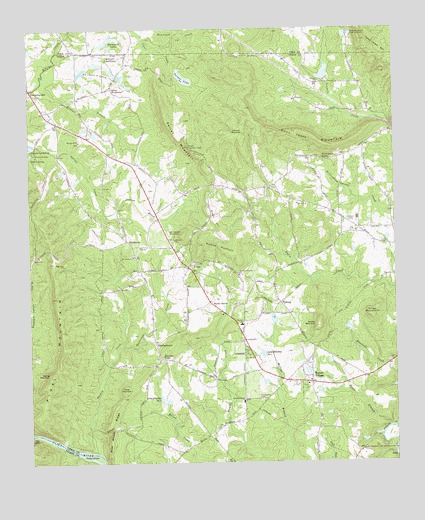
Sunset Village, GA USGS Topographic Map
Click on map above to begin viewing in our Map Viewer.

This topographic map contains these locations and features:
Feature Name Type Latitude Longitude GNIS ID View Map
Adams LakeReservoirN32.8768°W84.3783°338400View Map
Adams Lake DamDamN32.8768°W84.3783°338399View Map
Andrews BranchStreamN32.9465°W84.4733°310538View Map
Barker SpringPopulated PlaceN32.9215°W84.4383°331090View Map
Brooks MountainSummitN32.9140°W84.4010°331247View Map
Bull Trail MountainSummitN32.9707°W84.4152°331280View Map
Burkett School (historical)SchoolN32.9412°W84.3852°346689View Map
Camp ThunderLocaleN32.9646°W84.4977°312262View Map
CrestPopulated PlaceN32.9321°W84.4446°331476View Map
Crest ChurchChurchN32.9374°W84.4624°355375View Map
Crest Lookout TowerTowerN32.9668°W84.4444°344220View Map
Crest School (historical)SchoolN32.9368°W84.4513°346695View Map
Daniel DamDamN32.8835°W84.4499°340172View Map
Daniel LakeReservoirN32.8851°W84.4499°340173View Map
Dorster MountainSummitN32.9707°W84.4280°331574View Map
Elkins Creek ChurchChurchN32.9807°W84.4966°346700View Map
EllerbeetownPopulated PlaceN32.9101°W84.4569°326263View Map
Faithful Christian ChurchChurchN32.9293°W84.4283°314069View Map
Fellowship Baptist Church (historical)ChurchN32.8932°W84.4219°346703View Map
Fellowship CemeteryCemeteryN32.8932°W84.4207°314095View Map
Fellowship School (historical)SchoolN32.8935°W84.4271°346704View Map
Franklin LakeReservoirN32.9546°W84.4016°338388View Map
Franklin Lake DamDamN32.9535°W84.4016°338387View Map
Friendship CemeteryCemeteryN32.9107°W84.4280°346712View Map
Friendship ChurchChurchN32.9101°W84.4271°355937View Map
Gilbert CemeteryCemeteryN32.9448°W84.3905°314589View Map
GlencliffPopulated PlaceN32.9076°W84.4249°331814View Map
Green HillSummitN32.9451°W84.4363°356096View Map
Hebron ChurchChurchN32.9307°W84.4616°356248View Map
HendricksPopulated PlaceN32.9393°W84.4666°331954View Map
Hendricks CemeteryCemeteryN32.9348°W84.4649°346717View Map
Hendricks ChurchChurchN32.9349°W84.4646°356258View Map
Hewett SpringSpringN32.9629°W84.4996°315353View Map
Hickman ForksPopulated PlaceN32.9051°W84.4538°331960View Map
Hoyle BranchStreamN32.8851°W84.3777°315772View Map
Hurricane CreekStreamN32.9090°W84.4696°315846View Map
Jacks Ferry (historical)CrossingN32.8779°W84.4808°350819View Map
Jobe ChapelChurchN32.9379°W84.3771°316117View Map
Jones SettlementPopulated PlaceN32.9837°W84.4710°332117View Map
King Mountain Fish HatcheryLocaleN32.9990°W84.3894°344267View Map
Kings MountainSummitN32.9185°W84.3841°332150View Map
Lake Ellerbee Number 1ReservoirN32.9065°W84.4205°344233View Map
Lake Ellerbee Number 2ReservoirN32.8935°W84.4553°344234View Map
Lawrences MillPopulated PlaceN32.9835°W84.4996°332190View Map
Marymack LakesLakeN32.9959°W84.4740°317765View Map
McCrary Minnow FarmLocaleN32.9885°W84.4744°344285View Map
McCrary SettlementPopulated PlaceN32.9924°W84.4727°332344View Map
McGraw MountainSummitN32.9382°W84.4399°332350View Map
Midway ChurchChurchN32.9393°W84.4505°318123View Map
Mose MountainSummitN32.8960°W84.4683°332424View Map
Mount View ChurchChurchN32.9499°W84.4080°318916View Map
New Fellowship ChurchChurchN32.8932°W84.4266°319315View Map
New LakeReservoirN32.9138°W84.3909°338417View Map
New Lake DamDamN32.9135°W84.3916°338416View Map
Pasley ShoalsBarN32.8779°W84.4783°320254View Map
PickardPopulated PlaceN32.9212°W84.4138°332655View Map
Pine MountainSummitN32.9235°W84.4910°320637View Map
Pine Woods RidgeRidgeN32.8851°W84.4727°320656View Map
Potato Creek Watershed Dam Number SixDamN32.9851°W84.3983°338385View Map
Potato Creek Watershed Lake Number SixReservoirN32.9871°W84.3986°338386View Map
Salter MountainSummitN32.9660°W84.4446°332963View Map
Smith Academy (historical)SchoolN32.8832°W84.4635°346749View Map
Smyrna School (historical)SchoolN32.9840°W84.4008°346750View Map
Spring MountainSummitN32.9007°W84.4933°323449View Map
Springfield ChurchChurchN32.9679°W84.4824°323464View Map
Sunset VillagePopulated PlaceN32.8979°W84.4038°323779View Map
Sunset Village Census Designated PlaceCensusN32.8947°W84.4057°2402903View Map
Sunset Village DivisionCivilN32.9036°W84.4384°1936587View Map
Tally GapGapN32.8832°W84.4991°323897View Map
The TopSummitN32.9329°W84.4916°324059View Map
Thunder School (historical)SchoolN32.9737°W84.4902°346756View Map
Thundering SpringSpringN32.9654°W84.4991°324146View Map
Thurston SchoolSchoolN32.9149°W84.4274°324151View Map
Thurston Volunteer Fire and RescueBuildingN32.9148°W84.4289°2604935View Map
Turkey CreekStreamN32.8782°W84.4771°324368View Map
Turner LakeReservoirN32.9859°W84.4465°324414View Map
Turner Lake DamDamN32.9860°W84.4463°338410View Map
Van Houten MountainSummitN32.9410°W84.4474°333317View Map
Westwood SchoolSchoolN32.9024°W84.3896°346769View Map
Willingham SpringSpringN32.9626°W84.3991°325388View Map
Woodall BranchStreamN32.9843°W84.4963°325522View Map

Note: Coordinates in the location and feature list above are referenced to NAD83 datum.


Copyright (C) 2008-2024 Ryan Niemi / Sunset Dynamics ... All Rights Reserved