TopoQuest Logo
Do you find TopoQuest useful?
Help keep TopoQuest running and adding new maps/features by donating!
Bitcoin:  19c7KJd3qBynnjoSw5npx9KScwjBe4ifkT
Litecoin:  LXs6TkuXGGXo1vDsWCkWVdjQX94eUKd6ui
Home View Maps Find Maps Find Places Resources & Links


Sunman, Indiana Topographic Map

USGS Map Title: Sunman, IN
USGS Map MRC: 39085B1
DRG (GeoTIFF) Download: o39085b1.tif


Neighboring USGS Topographic Map Quads:


  Batesville, IN  
39085C2
 

  Spades, IN  
39085C1
 

  Cedar Grove, IN  
39084C8
 

  Pierceville, IN  
39085B2
 

  Sunman, IN  
39085B1
 

  Guilford, IN  
39084B8
 

  Milan, IN  
39085A2
 

  Dillsboro, IN  
39085A1
 

  Aurora, IN  
39084A8


Map MRC Location:

N40°
W86°
N40°
W85°
H8 H7 H6 H5 H4 H3 H2 H1
G8 G7 G6 G5 G4 G3 G2 G1
F8 F7 F6 F5 F4 F3 F2 F1
E8 E7 E6 E5 E4 E3 E2 E1
D8 D7 D6 D5 D4 D3 D2 D1
C8 C7 C6 C5 C4 C3 C2 C1
B8 B7 B6 B5 B4 B3 B2 B1
A8 A7 A6 A5 A4 A3 A2 A1
N39°
W86°
N39°
W85°

Sunman, IN USGS 1:24K Topographic Map Preview:
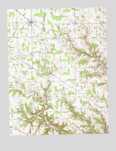
Sunman, IN USGS Topographic Map
Click on map above to begin viewing in our Map Viewer.

This topographic map contains these locations and features:
Feature Name Type Latitude Longitude GNIS ID View Map
Butternut RunStreamN39.1442°W85.0894°431911View Map
Franklin CemeteryCemeteryN39.1775°W85.1127°434763View Map
Harmans StationLocaleN39.1951°W85.0072°452231View Map
Hogan Hill ChurchChurchN39.1409°W85.0652°436294View Map
Holman Post Office (historical)Post OfficeN39.1484°W85.0513°453047View Map
Hubbells CornerPopulated PlaceN39.2345°W85.0400°436562View Map
Johnson HollowValleyN39.1335°W85.0732°437061View Map
Lake PerrineReservoirN39.1667°W85.0166°447283View Map
Mahler CreekStreamN39.1595°W85.0811°438477View Map
ManchesterPopulated PlaceN39.1517°W85.0122°438509View Map
Manchester CemeteryCemeteryN39.1462°W85.0080°438511View Map
Manchester Township Volunteer Fire and RescueBuildingN39.1519°W85.0124°2626108View Map
Negangards CornerPopulated PlaceN39.1912°W85.0947°439984View Map
New AlsacePopulated PlaceN39.2339°W85.0030°440015View Map
Perrine Lake DamDamN39.1667°W85.0166°447284View Map
Ransom CemeteryCemeteryN39.1509°W85.1133°441775View Map
Round HillSummitN39.1584°W85.0808°442345View Map
Saint Johns ChurchChurchN39.2339°W85.0491°442590View Map
Saint Pauls CemeteryCemeteryN39.2346°W85.0008°442763View Map
SunmanPopulated PlaceN39.2370°W85.0947°444410View Map
Sunman Area Life SquadBuildingN39.2321°W85.0941°2719383View Map
Sunman Police DepartmentBuildingN39.2425°W85.0941°2758465View Map
Sunman Rural Fire DepartmentBuildingN39.2425°W85.0950°2625806View Map
Taylor CreekStreamN39.2017°W85.0150°444590View Map
Town of SunmanCivilN39.2373°W85.0931°2397689View Map
Township of ManchesterCivilN39.1480°W85.0123°453601View Map
Union RidgeRidgeN39.1331°W85.0136°445131View Map
Weber's GreenhouseBuildingN39.2428°W85.0961°2649878View Map
WeisburgPopulated PlaceN39.2181°W85.0461°449744View Map

Note: Coordinates in the location and feature list above are referenced to NAD83 datum.


Copyright (C) 2008-2024 Ryan Niemi / Sunset Dynamics ... All Rights Reserved