TopoQuest Logo
Do you find TopoQuest useful?
Help keep TopoQuest running and adding new maps/features by donating!
Bitcoin:  19c7KJd3qBynnjoSw5npx9KScwjBe4ifkT
Litecoin:  LXs6TkuXGGXo1vDsWCkWVdjQX94eUKd6ui
Home View Maps Find Maps Find Places Resources & Links


Blanding South, Utah Topographic Map

USGS Map Title: Blanding South, UT
USGS Map MRC: 37109E4
DRG (GeoTIFF) Download: o37109e4.tif


Neighboring USGS Topographic Map Quads:


  Mancos Jim Butte, UT  
37109F5
 

  Blanding North, UT  
37109F4
 

  Devil Mesa, UT  
37109F3
 

  Black Mesa Butte, UT  
37109E5
 

  Blanding South, UT  
37109E4
 

  Bradford Canyon, UT  
37109E3
 

  No-Mans Island, UT  
37109D5
 

  Big Bench, UT  
37109D4
 

  McCracken Spring, UT  
37109D3


Map MRC Location:

N38°
W110°
N38°
W109°
H8 H7 H6 H5 H4 H3 H2 H1
G8 G7 G6 G5 G4 G3 G2 G1
F8 F7 F6 F5 F4 F3 F2 F1
E8 E7 E6 E5 E4 E3 E2 E1
D8 D7 D6 D5 D4 D3 D2 D1
C8 C7 C6 C5 C4 C3 C2 C1
B8 B7 B6 B5 B4 B3 B2 B1
A8 A7 A6 A5 A4 A3 A2 A1
N37°
W110°
N37°
W109°

Blanding South, UT USGS 1:24K Topographic Map Preview:
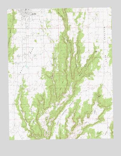
Blanding South, UT USGS Topographic Map
Click on map above to begin viewing in our Map Viewer.

This topographic map contains these locations and features:
Feature Name Type Latitude Longitude GNIS ID View Map
BlandingPopulated PlaceN37.6242°W109.4782°1438903View Map
Blanding Elementary SchoolSchoolN37.6211°W109.4806°1435161View Map
Blanding Fire DepartmentBuildingN37.6228°W109.4844°2627199View Map
Blanding HeliportAirportN37.5833°W109.4840°1435160View Map
Blanding Municipal AirportAirportN37.5830°W109.4833°1434548View Map
Blanding Radar SiteLocaleN37.5472°W109.4760°1454562View Map
Blue Mountain HospitalHospitalN37.6130°W109.4827°2722352View Map
Browns CanyonValleyN37.5308°W109.4443°1454323View Map
Browns PointRidgeN37.5506°W109.4371°1435200View Map
Chief Poseys Indian Battle Historical MarkerParkN37.5422°W109.4901°1448269View Map
Eagle Air MedBuildingN37.5825°W109.4786°2665418View Map
Edge of the Cedars State ParkParkN37.6164°W109.4796°1455257View Map
First Baptist ChurchChurchN37.6233°W109.4829°1436709View Map
Jennys CanyonValleyN37.5572°W109.4187°1435767View Map
Kampark CampgroundLocaleN37.6133°W109.4790°1435799View Map
Lems DrawValleyN37.6142°W109.4340°1448590View Map
Murphy PointCapeN37.5325°W109.4723°1430609View Map
Mustang CanyonValleyN37.5572°W109.4187°1436014View Map
Mustang MesaSummitN37.5833°W109.3857°1443749View Map
Mustang SpringSpringN37.5825°W109.3971°1436015View Map
Richmond SpringSpringN37.5486°W109.3940°1436225View Map
San Juan Emergency Medical ServicesBuildingN37.6242°W109.4790°2665448View Map
The Church of Jesus Christ of Latter Day SaintsChurchN37.6244°W109.4785°1436818View Map
White MesaSummitN37.5628°W109.4890°1447260View Map

Note: Coordinates in the location and feature list above are referenced to NAD83 datum.


Copyright (C) 2008-2024 Ryan Niemi / Sunset Dynamics ... All Rights Reserved