TopoQuest Logo
Do you find TopoQuest useful?
Help keep TopoQuest running and adding new maps/features by donating!
Bitcoin:  19c7KJd3qBynnjoSw5npx9KScwjBe4ifkT
Litecoin:  LXs6TkuXGGXo1vDsWCkWVdjQX94eUKd6ui
Home View Maps Find Maps Find Places Resources & Links


Strom, Virginia Topographic Map

USGS Map Title: Strom, VA
USGS Map MRC: 37079F8
DRG (GeoTIFF) Download: o37079f8.tif


Neighboring USGS Topographic Map Quads:


  Callaghan, VA  
37080G1
 

  Covington, VA  
37079G8
 

  Clifton Forge, VA  
37079G7
 

  Jordan Mines, VA  
37080F1
 

  Strom, VA  
37079F8
 

  Eagle Rock, VA  
37079F7
 

  New Castle, VA  
37080E1
 

  Oriskany, VA  
37079E8
 

  Salisbury, VA  
37079E7


Map MRC Location:

N38°
W80°
N38°
W79°
H8 H7 H6 H5 H4 H3 H2 H1
G8 G7 G6 G5 G4 G3 G2 G1
F8 F7 F6 F5 F4 F3 F2 F1
E8 E7 E6 E5 E4 E3 E2 E1
D8 D7 D6 D5 D4 D3 D2 D1
C8 C7 C6 C5 C4 C3 C2 C1
B8 B7 B6 B5 B4 B3 B2 B1
A8 A7 A6 A5 A4 A3 A2 A1
N37°
W80°
N37°
W79°

Strom, VA USGS 1:24K Topographic Map Preview:
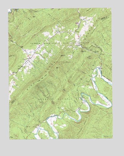
Strom, VA USGS Topographic Map
Click on map above to begin viewing in our Map Viewer.

This topographic map contains these locations and features:
Feature Name Type Latitude Longitude GNIS ID View Map
Bald KnobSummitN37.6935°W79.9398°1481423View Map
Bearwallow MountainSummitN37.7385°W79.8889°1481556View Map
Biggs RunStreamN37.6362°W79.9637°1481799View Map
Boiling Springs Volunteer Fire Department and Rescue Squad Station 2BuildingN37.6942°W79.9840°2721060View Map
Carpenter MountainSummitN37.7301°W79.9878°1499218View Map
Cedar Grove ChurchChurchN37.6362°W79.9670°1482404View Map
Cedar Grove School (historical)SchoolN37.6357°W79.9670°1674415View Map
Crawford BranchStreamN37.6843°W79.8962°1482813View Map
Deisher BranchStreamN37.6921°W79.8942°1482975View Map
Deisher CemeteryCemeteryN37.6940°W79.8964°1482976View Map
Deisher MountainSummitN37.6965°W79.9098°1482977View Map
Deisher-Hook School (historical)SchoolN37.6885°W79.8878°1674411View Map
Finley BranchStreamN37.7137°W79.9117°1483416View Map
Furnace BranchStreamN37.6296°W79.9698°1483564View Map
Grace FurnaceLocaleN37.6368°W79.9795°1483732View Map
Hays GapGapN37.7132°W79.9848°1483994View Map
HipesPopulated PlaceN37.6540°W79.9162°1499564View Map
Hipes BranchStreamN37.6521°W79.9153°1484126View Map
Hollow FordCrossingN37.6590°W79.8767°1674413View Map
Hook School (historical)SchoolN37.7276°W79.9289°1673690View Map
Hooks CemeteryCemeteryN37.7276°W79.9395°1484198View Map
Hooks MillPopulated PlaceN37.7146°W79.9126°1484199View Map
HortonLocaleN37.6646°W79.9117°1484233View Map
Howard KnobSummitN37.7423°W79.9709°1499581View Map
Humphries CemeteryCemeteryN37.7012°W79.9792°1484279View Map
Iron Ore KnobSummitN37.7037°W79.9039°1484360View Map
Johnson MountainSummitN37.7471°W79.9017°1500067View Map
King Memorial CemeteryCemeteryN37.6385°W79.9631°1484605View Map
Lemons BranchStreamN37.6465°W79.9414°1484776View Map
LignitePopulated PlaceN37.6273°W79.9984°1484841View Map
Little MountainSummitN37.7326°W79.9559°1484938View Map
Longdale ChurchChurchN37.6912°W79.8970°1485072View Map
Longdale Church (historical)ChurchN37.6693°W79.8937°1674412View Map
Middle MountainSummitN37.7235°W79.9828°1499737View Map
Montgomery KnobSummitN37.7048°W79.9370°1499759View Map
Mountain Valley ChurchChurchN37.6946°W79.9834°1485693View Map
Mountain Valley School (historical)SchoolN37.6948°W79.9831°1673708View Map
Mud Run MountainSummitN37.7040°W79.9995°1485732View Map
ParrPopulated PlaceN37.6599°W79.9095°1499844View Map
Peanut MineMineN37.6324°W79.9748°1674416View Map
Pine MountainSummitN37.6973°W79.9342°1499872View Map
Porter MountainSummitN37.7382°W79.9273°1486367View Map
Rich PatchPopulated PlaceN37.7268°W79.9192°1499955View Map
Rich Patch MountainsSummitN37.6987°W79.9417°1486590View Map
Rich Patch QuarryMineN37.7342°W79.9167°2724867View Map
Ritchpatch MineMineN37.7479°W79.9392°1673711View Map
Roaring RunStreamN37.6924°W79.8909°1486659View Map
Roaring Run FurnaceLocaleN37.7079°W79.8931°1486663View Map
Roaring Run Furnace Recreation SiteLocaleN37.7068°W79.8964°1488797View Map
Rose Hill CemeteryCemeteryN37.7382°W79.9087°1486769View Map
Shoemaker KnobSummitN37.7090°W79.9120°1487209View Map
Silent DellLocaleN37.6474°W79.9420°1487241View Map
Simmons CemeteryCemeteryN37.6771°W79.9920°1487249View Map
Slash School (historical)SchoolN37.6382°W79.9456°1674414View Map
Stony RunStreamN37.6643°W79.9117°1487629View Map
StromPopulated PlaceN37.6918°W79.8901°1487667View Map
SurberPopulated PlaceN37.6312°W79.9428°1500195View Map
Swanson BranchStreamN37.7035°W79.8906°1487749View Map
Wolf BranchStreamN37.6818°W79.8989°1488436View Map

Note: Coordinates in the location and feature list above are referenced to NAD83 datum.


Copyright (C) 2008-2024 Ryan Niemi / Sunset Dynamics ... All Rights Reserved