TopoQuest Logo
Do you find TopoQuest useful?
Help keep TopoQuest running and adding new maps/features by donating!
Bitcoin:  19c7KJd3qBynnjoSw5npx9KScwjBe4ifkT
Litecoin:  LXs6TkuXGGXo1vDsWCkWVdjQX94eUKd6ui
Home View Maps Find Maps Find Places Resources & Links


Stringtown, Oklahoma Topographic Map

USGS Map Title: Stringtown, OK
USGS Map MRC: 34096D1
DRG (GeoTIFF) Download: o34096d1.tif


Neighboring USGS Topographic Map Quads:


  Coalgate, OK  
34096E2
 

  Coalgate SE, OK  
34096E1
 

  Limestone Gap, OK  
34095E8
 

  Lehigh, OK  
34096D2
 

  Stringtown, OK  
34096D1
 

  Lane NW, OK  
34095D8
 

  Tushka, OK  
34096C2
 

  Bruno, OK  
34096C1
 

  Lane, OK  
34095C8


Map MRC Location:

N35°
W97°
N35°
W96°
H8 H7 H6 H5 H4 H3 H2 H1
G8 G7 G6 G5 G4 G3 G2 G1
F8 F7 F6 F5 F4 F3 F2 F1
E8 E7 E6 E5 E4 E3 E2 E1
D8 D7 D6 D5 D4 D3 D2 D1
C8 C7 C6 C5 C4 C3 C2 C1
B8 B7 B6 B5 B4 B3 B2 B1
A8 A7 A6 A5 A4 A3 A2 A1
N34°
W97°
N34°
W96°

Stringtown, OK USGS 1:24K Topographic Map Preview:
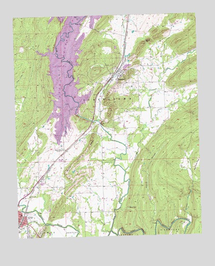
Stringtown, OK USGS Topographic Map
Click on map above to begin viewing in our Map Viewer.

This topographic map contains these locations and features:
Feature Name Type Latitude Longitude GNIS ID View Map
Atoka Fire Department Station 1BuildingN34.3858°W96.1235°2656815View Map
Atoka ReservoirReservoirN34.4344°W96.0819°1757950View Map
Atoka ReservoirReservoirN34.4749°W96.0866°1763543View Map
Atoka Reservoir DamDamN34.4351°W96.0819°1757949View Map
Black Knob RidgeRidgeN34.4212°W96.0811°1090208View Map
Boggy Bend CemeteryCemeteryN34.4956°W96.0775°2704463View Map
Boggy Bend FordLocaleN34.4984°W96.0778°1090331View Map
Boggy Bend SchoolSchoolN34.4948°W96.0778°1090332View Map
Camel CreekStreamN34.4048°W96.0055°1763542View Map
Campbell CreekStreamN34.3812°W96.0080°1089487View Map
Chickasaw CreekStreamN34.4120°W96.0517°1091273View Map
Confederate CemeteryCemeteryN34.3984°W96.1167°1091611View Map
County District 10CivilN34.3803°W96.0427°2418886View Map
Grants GapGapN34.4851°W96.0353°1101903View Map
Green Hill CemeteryCemeteryN34.3808°W96.1186°2701787View Map
Katy LakeReservoirN34.4004°W96.1080°1094294View Map
Little Chickasaw CreekStreamN34.4398°W96.0317°1094735View Map
McKinney CemeteryCemeteryN34.4515°W96.0922°1095256View Map
Mill CreekStreamN34.4981°W96.0786°1095401View Map
Mount Olive CemeteryCemeteryN34.4583°W96.0083°2701789View Map
Mount Olive ChurchChurchN34.4587°W96.0086°1095587View Map
North Boggy CreekStreamN34.3784°W96.0622°1095917View Map
Prairie HollowValleyN34.3837°W96.0336°1096901View Map
Rocky CreekStreamN34.4665°W96.0233°1097373View Map
Sand GapGapN34.3909°W96.0503°1097779View Map
Sandy CreekStreamN34.3826°W96.1067°1097822View Map
StringtownPopulated PlaceN34.4668°W96.0533°1098585View Map
Stringtown CemeteryCemeteryN34.4647°W96.0639°2701792View Map
Stringtown Elementary SchoolSchoolN34.4656°W96.0528°1790729View Map
Stringtown Fire DepartmentBuildingN34.4680°W96.0538°2656934View Map
Stringtown High SchoolSchoolN34.4660°W96.0530°1819370View Map
Stringtown Police DepartmentBuildingN34.4680°W96.0533°2757712View Map
Town of StringtownCivilN34.4696°W96.0548°2413343View Map
Township of StringtownCivilN34.4945°W96.0058°1824965View Map
Wells Street CemeteryCemeteryN34.4669°W96.0594°2701794View Map
West Tellico SchoolLocaleN34.4254°W96.0925°1099614View Map
West Windy PrairieFlatN34.4151°W96.0014°1099624View Map

Note: Coordinates in the location and feature list above are referenced to NAD83 datum.


Copyright (C) 2008-2024 Ryan Niemi / Sunset Dynamics ... All Rights Reserved