TopoQuest Logo
Do you find TopoQuest useful?
Help keep TopoQuest running and adding new maps/features by donating!
Bitcoin:  19c7KJd3qBynnjoSw5npx9KScwjBe4ifkT
Litecoin:  LXs6TkuXGGXo1vDsWCkWVdjQX94eUKd6ui
Home View Maps Find Maps Find Places Resources & Links


Stonefort, Illinois Topographic Map

USGS Map Title: Stonefort, IL
USGS Map MRC: 37088E6
DRG (GeoTIFF) Download: o37088e6.tif


Neighboring USGS Topographic Map Quads:


  Crab Orchard, IL  
37088F7
 

  Carrier Mills, IL  
37088F6
 

  Harrisburg, IL  
37088F5
 

  Creal Springs, IL  
37088E7
 

  Stonefort, IL  
37088E6
 

  Eddyville, IL  
37088E5
 

  Bloomfield, IL  
37088D7
 

  Glendale, IL  
37088D6
 

  Waltersburg, IL  
37088D5


Map MRC Location:

N38°
W89°
N38°
W88°
H8 H7 H6 H5 H4 H3 H2 H1
G8 G7 G6 G5 G4 G3 G2 G1
F8 F7 F6 F5 F4 F3 F2 F1
E8 E7 E6 E5 E4 E3 E2 E1
D8 D7 D6 D5 D4 D3 D2 D1
C8 C7 C6 C5 C4 C3 C2 C1
B8 B7 B6 B5 B4 B3 B2 B1
A8 A7 A6 A5 A4 A3 A2 A1
N37°
W89°
N37°
W88°

Stonefort, IL USGS 1:24K Topographic Map Preview:
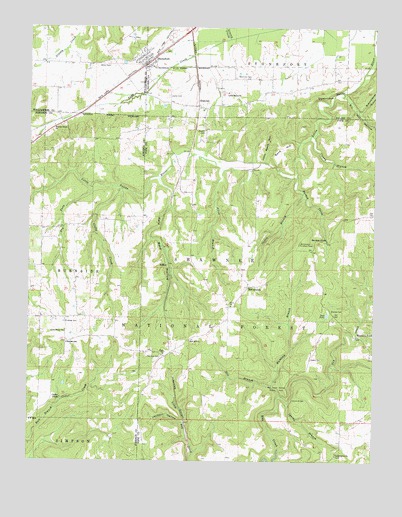
Stonefort, IL USGS Topographic Map
Click on map above to begin viewing in our Map Viewer.

This topographic map contains these locations and features:
Feature Name Type Latitude Longitude GNIS ID View Map
AbbotPopulated PlaceN37.5573°W88.6989°424553View Map
Allen BranchStreamN37.5839°W88.6795°424564View Map
Allen Branch School (historical)SchoolN37.5728°W88.6828°1725749View Map
Beames CemeteryCemeteryN37.5434°W88.6400°424609View Map
Bell Smith Natural BridgeArchN37.5178°W88.6544°2701934View Map
Bell Smith Springs National Natural LandmarkLocaleN37.5209°W88.6595°425991View Map
Bill Hill HollowValleyN37.6058°W88.6365°424647View Map
Blackman CemeteryCemeteryN37.6109°W88.6748°424652View Map
Bolton CemeteryCemeteryN37.6148°W88.7217°424660View Map
Bozarth CemeteryCemeteryN37.5953°W88.6862°424665View Map
Burden CreekStreamN37.5817°W88.6534°424689View Map
Burden FallsFallsN37.5637°W88.6420°424690View Map
Burden Falls WildernessReserveN37.5819°W88.6445°2035075View Map
Buzzard Roost HollowValleyN37.6007°W88.6303°424695View Map
Caney BranchStreamN37.5937°W88.6470°424708View Map
Cedar FallsFallsN37.5181°W88.7384°424729View Map
Cedar Grove CemeteryCemeteryN37.5017°W88.6384°1820638View Map
Cedar Grove ChurchChurchN37.5020°W88.6381°424730View Map
Cedar Grove School (historical)SchoolN37.5062°W88.6276°1725757View Map
Clifty CreekStreamN37.5784°W88.7170°424753View Map
Dry ForkStreamN37.5784°W88.7273°424845View Map
Grassy CreekStreamN37.6217°W88.6773°424943View Map
Griffin CemeteryCemeteryN37.5295°W88.6473°424951View Map
Hill BranchStreamN37.5184°W88.6595°424986View Map
Hunting BranchStreamN37.5220°W88.6620°425022View Map
Jackson HollowValleyN37.5108°W88.6933°425056View Map
John Mack HollowValleyN37.5866°W88.6656°425058View Map
Joyner CemeteryCemeteryN37.6050°W88.6995°425067View Map
Katy Reid HollowValleyN37.5814°W88.7034°425074View Map
Little Flock ChurchChurchN37.5373°W88.7367°425115View Map
Little Saline ChurchChurchN37.6059°W88.6778°425118View Map
McCormickPopulated PlaceN37.5506°W88.6706°425180View Map
McCormick Lookout TowerTowerN37.5628°W88.6520°425182View Map
Mount Carmel Church (historical)ChurchN37.5403°W88.6448°1725778View Map
Ogden BranchStreamN37.5773°W88.6509°425263View Map
Old Zion CemeteryCemeteryN37.5300°W88.7012°425279View Map
OldtownPopulated PlaceN37.6023°W88.6884°425280View Map
Oldtown School (historical)SchoolN37.6100°W88.6762°1820997View Map
Olive ChurchChurchN37.5451°W88.6764°425283View Map
Pleasant Valley School (historical)SchoolN37.6148°W88.7384°1737339View Map
Reagan SchoolSchoolN37.5339°W88.7359°425365View Map
Redbud CampgroundLocaleN37.5198°W88.6578°423612View Map
Rushing CemeteryCemeteryN37.5400°W88.7367°425426View Map
Sand HillSummitN37.5906°W88.6598°425445View Map
Spring BranchStreamN37.5170°W88.6553°425513View Map
StonefortPopulated PlaceN37.6142°W88.7081°425524View Map
Stonefort BluffCliffN37.6045°W88.6437°425525View Map
Stonefort Fire and RescueBuildingN37.6154°W88.7084°2640921View Map
Stonefort Post OfficePost OfficeN37.6147°W88.7071°2788856View Map
Teal PondReservoirN37.5425°W88.6419°425550View Map
Teal Pond CampgroundLocaleN37.5412°W88.6428°423611View Map
Township of StonefortCivilN37.6210°W88.6521°422239View Map
Village of StonefortCivilN37.6177°W88.7052°2399909View Map
Walnut Grove ChurchChurchN37.5967°W88.7414°425614View Map
Walnut Grove School (historical)SchoolN37.5917°W88.7362°1815912View Map
Waltons BranchStreamN37.5817°W88.7028°1820669View Map
Watkins FordPopulated PlaceN37.5359°W88.6312°425625View Map
Wooten School (historical)SchoolN37.5348°W88.6917°1736121View Map
Zion CemeteryCemeteryN37.5312°W88.7001°1820670View Map
Zion ChurchChurchN37.5309°W88.7006°425662View Map
Zion Hill ChurchChurchN37.5348°W88.6914°425663View Map

Note: Coordinates in the location and feature list above are referenced to NAD83 datum.


Copyright (C) 2008-2024 Ryan Niemi / Sunset Dynamics ... All Rights Reserved