TopoQuest Logo
Do you find TopoQuest useful?
Help keep TopoQuest running and adding new maps/features by donating!
Bitcoin:  19c7KJd3qBynnjoSw5npx9KScwjBe4ifkT
Litecoin:  LXs6TkuXGGXo1vDsWCkWVdjQX94eUKd6ui
Home View Maps Find Maps Find Places Resources & Links


Steamboat Springs, Colorado Topographic Map

USGS Map Title: Steamboat Springs, CO
USGS Map MRC: 40106D7
DRG (GeoTIFF) Download: o40106d7.tif


Neighboring USGS Topographic Map Quads:


  Mad Creek, CO  
40106E8
 

  Rocky Peak, CO  
40106E7
 

  Buffalo Pass, CO  
40106E6
 

  Cow Creek, CO  
40106D8
 

  Steamboat Springs, CO  
40106D7
 

  Mount Werner, CO  
40106D6
 

  Oak Creek, CO  
40106C8
 

  Blacktail Mountain, CO  
40106C7
 

  Walton Peak, CO  
40106C6


Map MRC Location:

N41°
W107°
N41°
W106°
H8 H7 H6 H5 H4 H3 H2 H1
G8 G7 G6 G5 G4 G3 G2 G1
F8 F7 F6 F5 F4 F3 F2 F1
E8 E7 E6 E5 E4 E3 E2 E1
D8 D7 D6 D5 D4 D3 D2 D1
C8 C7 C6 C5 C4 C3 C2 C1
B8 B7 B6 B5 B4 B3 B2 B1
A8 A7 A6 A5 A4 A3 A2 A1
N40°
W107°
N40°
W106°

Steamboat Springs, CO USGS 1:24K Topographic Map Preview:
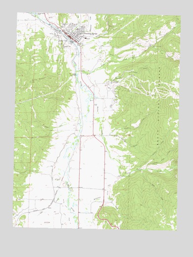
Steamboat Springs, CO USGS Topographic Map
Click on map above to begin viewing in our Map Viewer.

This topographic map contains these locations and features:
Feature Name Type Latitude Longitude GNIS ID View Map
Agate CreekStreamN40.4355°W106.8262°172738View Map
Batton DitchCanalN40.4757°W106.8008°2711043View Map
Batton GulchCanalN40.4750°W106.7995°172744View Map
Baxter DitchCanalN40.3972°W106.8439°172736View Map
Bear CreekStreamN40.4100°W106.7773°172732View Map
Beaver CreekStreamN40.4100°W106.7803°172754View Map
Burgess CreekStreamN40.4514°W106.8117°172742View Map
City of Steamboat SpringsCivilN40.4774°W106.8233°2411976View Map
Colorado Alpine CollegeSchoolN40.4919°W106.8409°172748View Map
Fair-U MineMineN40.4883°W106.7650°1683340View Map
Fish CreekStreamN40.4666°W106.8298°172752View Map
Fish Creek FallsFallsN40.4814°W106.7712°172743View Map
Fish Creek Falls Picnic AreaLocaleN40.4819°W106.7750°196698View Map
Fish Creek Filtration PlantLocaleN40.4761°W106.7847°2678266View Map
Grouse CreekStreamN40.3850°W106.8320°172750View Map
Heart SpringSpringN40.4826°W106.8273°172746View Map
Howelsen HillSummitN40.4805°W106.8406°172745View Map
Howelsen Hill Ski AreaLocaleN40.4828°W106.8389°196697View Map
KBCR-AM (Steamboat Springs)TowerN40.4886°W106.8498°204065View Map
KSBS-TV (Steamboat Springs)TowerN40.4619°W106.8512°204238View Map
KSBT-FM (Steamboat Springs)TowerN40.4619°W106.8512°204196View Map
McKinnis CreekStreamN40.3961°W106.8323°172733View Map
McKinnis CreekStreamN40.3875°W106.8214°196760View Map
Mesa 1 AirportAirportN40.4062°W106.8228°2443898View Map
North Fork Fish CreekStreamN40.4819°W106.7714°172557View Map
Oak CreekStreamN40.4166°W106.8381°172735View Map
Pine Spring GulchValleyN40.4287°W106.8079°172737View Map
Priest CreekStreamN40.4283°W106.8039°172739View Map
Quarry MountainSummitN40.4619°W106.8500°172741View Map
SidneyLocaleN40.3869°W106.8492°172734View Map
Site Two Forest Service FacilityLocaleN40.4897°W106.8475°196701View Map
Soda CreekStreamN40.4914°W106.8409°172527View Map
Spring CreekStreamN40.4816°W106.8298°172729View Map
Steamboat Ski AreaLocaleN40.4564°W106.7728°172740View Map
Steamboat SpringsPopulated PlaceN40.4850°W106.8317°172749View Map
Steamboat Springs CemeteryCemeteryN40.4972°W106.8489°2400553View Map
Steamboat Springs Fire Rescue Ambulance / Search and Rescue BarnBuildingN40.4863°W106.8376°2667048View Map
Steamboat Springs Fire Rescue Central Fire StationBuildingN40.4859°W106.8362°2666859View Map
Steamboat Springs Fire Rescue Mountain Fire StationBuildingN40.4533°W106.8153°2666953View Map
Steamboat Springs Police DepartmentBuildingN40.4858°W106.8360°2757309View Map
Steamboat Springs Post OfficePost OfficeN40.4834°W106.8283°2750864View Map
Storm King CreekStreamN40.4100°W106.7759°172753View Map
Sulphur Cave SpringSpringN40.4837°W106.8401°172747View Map
Suttle DitchCanalN40.3833°W106.8367°202103View Map
Walton CreekStreamN40.4530°W106.8173°172751View Map
Walton Creek DitchCanalN40.4000°W106.8034°172731View Map
Yampa Valley Medical CenterHospitalN40.4632°W106.8148°2695629View Map

Note: Coordinates in the location and feature list above are referenced to NAD83 datum.


Copyright (C) 2008-2024 Ryan Niemi / Sunset Dynamics ... All Rights Reserved