TopoQuest Logo
Do you find TopoQuest useful?
Help keep TopoQuest running and adding new maps/features by donating!
Bitcoin:  19c7KJd3qBynnjoSw5npx9KScwjBe4ifkT
Litecoin:  LXs6TkuXGGXo1vDsWCkWVdjQX94eUKd6ui
Home View Maps Find Maps Find Places Resources & Links


Stamford, New York Topographic Map

USGS Map Title: Stamford, NY
USGS Map MRC: 42074D5
DRG (GeoTIFF) Download: o42074d5.tif


Neighboring USGS Topographic Map Quads:


  Charlotteville, NY  
42074E6
 

  Summit, NY  
42074E5
 

  Breakabeen, NY  
42074E4
 

  Harpersfield, NY  
42074D6
 

  Stamford, NY  
42074D5
 

  Gilboa, NY  
42074D4
 

  Hobart, NY  
42074C6
 

  Roxbury, NY  
42074C5
 

  Prattsville, NY  
42074C4


Map MRC Location:

N43°
W75°
N43°
W74°
H8 H7 H6 H5 H4 H3 H2 H1
G8 G7 G6 G5 G4 G3 G2 G1
F8 F7 F6 F5 F4 F3 F2 F1
E8 E7 E6 E5 E4 E3 E2 E1
D8 D7 D6 D5 D4 D3 D2 D1
C8 C7 C6 C5 C4 C3 C2 C1
B8 B7 B6 B5 B4 B3 B2 B1
A8 A7 A6 A5 A4 A3 A2 A1
N42°
W75°
N42°
W74°

Stamford, NY USGS 1:24K Topographic Map Preview:
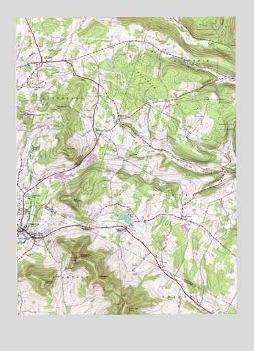
Stamford, NY USGS Topographic Map
Click on map above to begin viewing in our Map Viewer.

This topographic map contains these locations and features:
Feature Name Type Latitude Longitude GNIS ID View Map
Bald MountainSummitN42.4237°W74.5938°942866View Map
Betty BrookStreamN42.4876°W74.5107°943813View Map
Blenheim HillSummitN42.4692°W74.5446°944236View Map
Blenheim Hill CemeteryCemeteryN42.4690°W74.5342°944237View Map
Brimstone ChurchChurchN42.4644°W74.5403°2369767View Map
Buck Hill FarmLocaleN42.4844°W74.6244°2555045View Map
Champlin CemeteryCemeteryN42.4584°W74.5184°946368View Map
Choate CemeteryCemeteryN42.4314°W74.5715°946600View Map
Churchill MountainSummitN42.3887°W74.6099°946685View Map
Cornell HollowValleyN42.4459°W74.5518°947464View Map
Cowley CemeteryCemeteryN42.4278°W74.6182°947603View Map
Darling HollowValleyN42.4733°W74.5076°948039View Map
Evergreen CemeteryCemeteryN42.4801°W74.6088°949752View Map
Holy Cross CemeteryCemeteryN42.4609°W74.5810°953041View Map
JeffersonPopulated PlaceN42.4812°W74.6104°953958View Map
Jefferson CemeteryCemeteryN42.4831°W74.6131°2554555View Map
Jefferson Central SchoolSchoolN42.4821°W74.6078°2669047View Map
Jefferson Post OfficePost OfficeN42.4804°W74.6131°2617980View Map
Jefferson Town HallBuildingN42.4803°W74.6208°2617632View Map
Jefferson Volunteer Fire DepartmentBuildingN42.4796°W74.6134°2718311View Map
Kingdom Hall of Jehovahs WitnessesChurchN42.4077°W74.6178°2616582View Map
Mayham PondReservoirN42.4164°W74.5637°956708View Map
Maynard CemeteryCemeteryN42.4355°W74.5981°2554557View Map
McGregor MountainSummitN42.3901°W74.5790°956775View Map
Mine HillSummitN42.4448°W74.5977°957380View Map
Moore HillSummitN42.4276°W74.5385°957595View Map
Mount JeffersonSummitN42.4584°W74.6196°974768View Map
Peck CemeteryCemeteryN42.3952°W74.5421°2554567View Map
Potter Hill CemeteryCemeteryN42.4521°W74.6174°2554566View Map
Ruliffson CemeteryCemeteryN42.4332°W74.5466°963074View Map
RuthLocaleN42.4648°W74.5399°963123View Map
Sacred Heart CemeteryCemeteryN42.4063°W74.6087°963181View Map
Sacred Heart ChurchChurchN42.4103°W74.6232°2616862View Map
School Number 1 (historical)SchoolN42.4651°W74.5110°974872View Map
School Number 14 (historical)SchoolN42.4150°W74.5283°2369770View Map
School Number 7 (historical)SchoolN42.4117°W74.5628°2369769View Map
School Number 9 (historical)SchoolN42.4506°W74.5767°2369768View Map
Shew CemeteryCemeteryN42.4368°W74.5091°965103View Map
Soule CemeteryCemeteryN42.4080°W74.5399°2554568View Map
South GilboaPopulated PlaceN42.4151°W74.5313°965750View Map
South Gilboa CemeteryCemeteryN42.4153°W74.5281°2554569View Map
South Gilboa StationPopulated PlaceN42.4109°W74.5627°965751View Map
South JeffersonPopulated PlaceN42.4509°W74.5776°973095View Map
StamfordPopulated PlaceN42.4073°W74.6143°966210View Map
Stamford Baptist ChurchChurchN42.4189°W74.6205°2616289View Map
Stamford CemeteryCemeteryN42.4053°W74.6104°966211View Map
Stamford Central SchoolSchoolN42.4121°W74.6206°2669112View Map
Stamford First Presbyterian ChurchChurchN42.4093°W74.6182°2616290View Map
Stamford Post OfficePost OfficeN42.4081°W74.6183°2618139View Map
Stamford ReservoirReservoirN42.4447°W74.6163°966212View Map
Stamford United Methodist ChurchChurchN42.4088°W74.6173°2616291View Map
Stamford Village LibraryBuildingN42.4092°W74.6191°2617435View Map
Stamford Volunteer Fire DepartmentBuildingN42.4085°W74.6178°2734992View Map
Town of JeffersonCivilN42.4896°W74.6128°979106View Map
Trinity Lutheran ChurchChurchN42.4268°W74.6182°2616375View Map
Utsayantha LakeReservoirN42.4251°W74.6182°968332View Map
Utsayantha MountainSummitN42.3992°W74.5896°968333View Map
Village of StamfordCivilN42.4093°W74.6170°2391158View Map
Welch CornersLocaleN42.4573°W74.5665°969020View Map
Welchs Corners CemeteryCemeteryN42.4563°W74.5664°2554570View Map
Whiting HollowValleyN42.4440°W74.5426°971173View Map
Woodchuck HillSummitN42.4623°W74.6032°971615View Map

Note: Coordinates in the location and feature list above are referenced to NAD83 datum.


Copyright (C) 2008-2024 Ryan Niemi / Sunset Dynamics ... All Rights Reserved