TopoQuest Logo
Do you find TopoQuest useful?
Help keep TopoQuest running and adding new maps/features by donating!
Bitcoin:  19c7KJd3qBynnjoSw5npx9KScwjBe4ifkT
Litecoin:  LXs6TkuXGGXo1vDsWCkWVdjQX94eUKd6ui
Home View Maps Find Maps Find Places Resources & Links


Spruce Mountain, Colorado Topographic Map

USGS Map Title: Spruce Mountain, CO
USGS Map MRC: 39107B5
DRG (GeoTIFF) Download: o39107b5.tif


Neighboring USGS Topographic Map Quads:


  Hightower Mountain, CO  
39107C6
 

  Flatiron Mountain, CO  
39107C5
 

  Quaker Mesa, CO  
39107C4
 

  Porter Mountain, CO  
39107B6
 

  Spruce Mountain, CO  
39107B5
 

  Elk Knob, CO  
39107B4
 

  Chalk Mountain, CO  
39107A6
 

  Electric Mountain, CO  
39107A5
 

  Bull Mountain, CO  
39107A4


Map MRC Location:

N40°
W108°
N40°
W107°
H8 H7 H6 H5 H4 H3 H2 H1
G8 G7 G6 G5 G4 G3 G2 G1
F8 F7 F6 F5 F4 F3 F2 F1
E8 E7 E6 E5 E4 E3 E2 E1
D8 D7 D6 D5 D4 D3 D2 D1
C8 C7 C6 C5 C4 C3 C2 C1
B8 B7 B6 B5 B4 B3 B2 B1
A8 A7 A6 A5 A4 A3 A2 A1
N39°
W108°
N39°
W107°

Spruce Mountain, CO USGS 1:24K Topographic Map Preview:
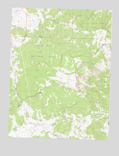
Spruce Mountain, CO USGS Topographic Map
Click on map above to begin viewing in our Map Viewer.

This topographic map contains these locations and features:
Feature Name Type Latitude Longitude GNIS ID View Map
Bird CreekStreamN39.1736°W107.6189°175091View Map
Buzzard Cow CampLocaleN39.2125°W107.6234°175141View Map
Cox SpringSpringN39.2407°W107.5712°175146View Map
Crane CreekStreamN39.2153°W107.6242°175142View Map
Crooked CreekStreamN39.1911°W107.6209°175139View Map
Dry Owens CreekStreamN39.2458°W107.6189°175145View Map
Dyke CreekStreamN39.1272°W107.5587°175438View Map
Dyke Creek CampgroundLocaleN39.1255°W107.5595°175121View Map
Gas CreekStreamN39.2383°W107.6248°175144View Map
Gold CreekStreamN39.1311°W107.5753°175132View Map
Hayrack ParkFlatN39.1389°W107.5339°175122View Map
Logpile FlatFlatN39.2341°W107.5564°175147View Map
Muddy BasinBasinN39.1847°W107.5231°175135View Map
Mule ParkFlatN39.1372°W107.5867°175125View Map
No Good ParkFlatN39.1972°W107.5495°175134View Map
Oil Well CampLocaleN39.1714°W107.6187°175140View Map
Oil Well MountainSummitN39.1680°W107.5892°175120View Map
Range CreekStreamN39.1261°W107.5312°175127View Map
Ruth MountainSummitN39.2228°W107.5901°175143View Map
Spruce MountainSummitN39.1972°W107.5223°175129View Map
The BurnAreaN39.1819°W107.5517°175133View Map
Turner CreekStreamN39.1289°W107.5453°175126View Map
Willow CreekStreamN39.1947°W107.6234°175092View Map

Note: Coordinates in the location and feature list above are referenced to NAD83 datum.


Copyright (C) 2008-2024 Ryan Niemi / Sunset Dynamics ... All Rights Reserved