TopoQuest Logo
Do you find TopoQuest useful?
Help keep TopoQuest running and adding new maps/features by donating!
Bitcoin:  19c7KJd3qBynnjoSw5npx9KScwjBe4ifkT
Litecoin:  LXs6TkuXGGXo1vDsWCkWVdjQX94eUKd6ui
Home View Maps Find Maps Find Places Resources & Links


Springfield, Kentucky Topographic Map

USGS Map Title: Springfield, KY
USGS Map MRC: 37085F2
DRG (GeoTIFF) Download: o37085f2.tif


Neighboring USGS Topographic Map Quads:


  Maud, KY  
37085G3
 

  Brush Grove, KY  
37085G2
 

  Cardwell, KY  
37085G1
 

  Saint Catharine, KY  
37085F3
 

  Springfield, KY  
37085F2
 

  Mackville, KY  
37085F1
 

  Lebanon West, KY  
37085E3
 

  Lebanon East, KY  
37085E2
 

  Gravel Switch, KY  
37085E1


Map MRC Location:

N38°
W86°
N38°
W85°
H8 H7 H6 H5 H4 H3 H2 H1
G8 G7 G6 G5 G4 G3 G2 G1
F8 F7 F6 F5 F4 F3 F2 F1
E8 E7 E6 E5 E4 E3 E2 E1
D8 D7 D6 D5 D4 D3 D2 D1
C8 C7 C6 C5 C4 C3 C2 C1
B8 B7 B6 B5 B4 B3 B2 B1
A8 A7 A6 A5 A4 A3 A2 A1
N37°
W86°
N37°
W85°

Springfield, KY USGS 1:24K Topographic Map Preview:
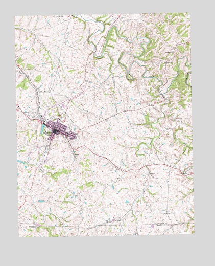
Springfield, KY USGS Topographic Map
Click on map above to begin viewing in our Map Viewer.

This topographic map contains these locations and features:
Feature Name Type Latitude Longitude GNIS ID View Map
Armory HillSummitN37.6822°W85.2260°2567684View Map
Arnolds AirportAirportN37.6556°W85.1539°517491View Map
Barbours Mill Pike (historical)Populated PlaceN37.6289°W85.2434°2566853View Map
Ben Hardin Historical MarkerParkN37.6606°W85.2359°2744860View Map
Bethlehem ChurchChurchN37.6595°W85.1322°487027View Map
Booker BranchStreamN37.6665°W85.2438°487675View Map
Brady BranchStreamN37.6748°W85.1288°487810View Map
BriartownPopulated PlaceN37.6940°W85.2425°487876View Map
Buck BranchStreamN37.6265°W85.1655°488201View Map
Cemetery HillSummitN37.6804°W85.2190°2567716View Map
City of SpringfieldCivilN37.6922°W85.2195°2405510View Map
Dorseys Mill (historical)LocaleN37.6583°W85.1302°2567719View Map
Elenores Historical MarkerParkN37.6891°W85.2180°2744858View Map
Elmwood Historical MarkerParkN37.6758°W85.2270°2744857View Map
Fenwick Post Office (historical)Post OfficeN37.7279°W85.1367°2567722View Map
Frog HollowValleyN37.7286°W85.1867°492566View Map
Hardins ChapelChurchN37.6826°W85.1377°493727View Map
Haydon BranchStreamN37.7059°W85.2250°493905View Map
House of History Historical MarkerParkN37.6859°W85.2199°2744861View Map
Jesse Head Historical MarkerParkN37.6866°W85.2213°2744856View Map
JimtownPopulated PlaceN37.6698°W85.2094°495280View Map
John Hunt Morgans Raids Historical MarkerParkN37.6846°W85.2200°2744851View Map
John Pope Historical MarkerParkN37.6857°W85.2199°2744853View Map
Keene CemeteryCemeteryN37.7134°W85.2002°495593View Map
Lebanon Springfield Airport-George Hoerter FieldAirportN37.6336°W85.2422°517492View Map
Logan BranchStreamN37.6392°W85.1683°496977View Map
Lone StarLocaleN37.6388°W85.1461°2567739View Map
Maple GroveLocaleN37.6705°W85.1719°2567743View Map
Matthew Walton Historical MarkerParkN37.6938°W85.2426°2744854View Map
Mill CreekStreamN37.6698°W85.1627°498248View Map
Oakland (historical)Populated PlaceN37.6959°W85.1668°2567753View Map
Pleasant RunStreamN37.7040°W85.1455°500907View Map
Poorhouse BranchStreamN37.7059°W85.2250°501078View Map
RineltownPopulated PlaceN37.6595°W85.1561°508939View Map
Saint Dominics CemeteryCemeteryN37.6939°W85.2380°502609View Map
Saint Ivos ChurchChurchN37.6251°W85.1730°502632View Map
Shay BranchStreamN37.7076°W85.2350°503298View Map
Simms Post Office (historical)Post OfficeN37.6344°W85.1789°2567690View Map
SimstownPopulated PlaceN37.6340°W85.1777°503550View Map
SpringfieldPopulated PlaceN37.6853°W85.2222°504157View Map
Springfield DivisionCivilN37.7188°W85.1914°1937272View Map
Springfield Fire DepartmentBuildingN37.6825°W85.2258°2636705View Map
Springfield Police DepartmentBuildingN37.6858°W85.2228°2767677View Map
Sugar GroveLocaleN37.6345°W85.1290°2567692View Map
ThompsonvillePopulated PlaceN37.7270°W85.1369°509204View Map
Thompsonville Baptist Church (historical)ChurchN37.7310°W85.1360°2567698View Map
Thompsonville ChurchChurchN37.7217°W85.1433°505216View Map
Walker RunStreamN37.7176°W85.2446°2567703View Map
Washington County Ambulance ServiceBuildingN37.6825°W85.2258°2719145View Map
Washington County Fire DepartmentBuildingN37.6824°W85.2259°2636891View Map
Washington County Sheriff's OfficeBuildingN37.6849°W85.2215°2767697View Map

Note: Coordinates in the location and feature list above are referenced to NAD83 datum.


Copyright (C) 2008-2024 Ryan Niemi / Sunset Dynamics ... All Rights Reserved