TopoQuest Logo
Do you find TopoQuest useful?
Help keep TopoQuest running and adding new maps/features by donating!
Bitcoin:  19c7KJd3qBynnjoSw5npx9KScwjBe4ifkT
Litecoin:  LXs6TkuXGGXo1vDsWCkWVdjQX94eUKd6ui
Home View Maps Find Maps Find Places Resources & Links


Sparta, Mississippi Topographic Map

USGS Map Title: Sparta, MS
USGS Map MRC: 33088G8
DRG (GeoTIFF) Download: o33088g8.tif


Neighboring USGS Topographic Map Quads:


  Houston West, MS  
33089H1
 

  Houston East, MS  
33088H8
 

  Buena Vista, MS  
33088H7
 

  Woodland, MS  
33089G1
 

  Sparta, MS  
33088G8
 

  Trebloc, MS  
33088G7
 

  Mantee, MS  
33089F1
 

  Montpelier, MS  
33088F8
 

  Palo Alto, MS  
33088F7


Map MRC Location:

N34°
W89°
N34°
W88°
H8 H7 H6 H5 H4 H3 H2 H1
G8 G7 G6 G5 G4 G3 G2 G1
F8 F7 F6 F5 F4 F3 F2 F1
E8 E7 E6 E5 E4 E3 E2 E1
D8 D7 D6 D5 D4 D3 D2 D1
C8 C7 C6 C5 C4 C3 C2 C1
B8 B7 B6 B5 B4 B3 B2 B1
A8 A7 A6 A5 A4 A3 A2 A1
N33°
W89°
N33°
W88°

Sparta, MS USGS 1:24K Topographic Map Preview:
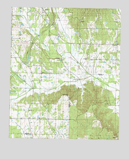
Sparta, MS USGS Topographic Map
Click on map above to begin viewing in our Map Viewer.

This topographic map contains these locations and features:
Feature Name Type Latitude Longitude GNIS ID View Map
Amity Baptist Church (historical)ChurchN33.7834°W88.9570°710247View Map
Arbor Grove Baptist ChurchChurchN33.8259°W88.9445°666346View Map
Bethel School (historical)SchoolN33.8271°W88.9906°688701View Map
Bluff Springs School (historical)SchoolN33.8707°W88.9612°688700View Map
Bray CreekStreamN33.8723°W88.9862°705363View Map
Brown School (historical)SchoolN33.8554°W88.9031°688703View Map
Cane CreekStreamN33.8104°W88.9062°668024View Map
Chewawah CreekStreamN33.7973°W88.9739°668382View Map
Chickasaw Memorial GardensCemeteryN33.8732°W88.9626°688705View Map
Chico CreekStreamN33.8312°W88.9312°692891View Map
Elize (historical)Populated PlaceN33.8409°W88.9001°688709View Map
EnonPopulated PlaceN33.8265°W88.8959°710286View Map
Enon Primitive Baptist ChurchChurchN33.8271°W88.8964°669789View Map
Enon School (historical)SchoolN33.8265°W88.8962°710287View Map
Fellowship Baptist ChurchChurchN33.8268°W88.9131°666411View Map
Gene Verell Lake DamDamN33.8068°W88.9517°682348View Map
Hatchet CemeteryCemeteryN33.7837°W88.8873°671006View Map
Hollomans Lake DamDamN33.8251°W88.9784°682356View Map
Hope Zion SchoolSchoolN33.8529°W88.8756°671404View Map
Horse Nation CreekStreamN33.8068°W88.9223°684768View Map
Hughes CemeteryCemeteryN33.7918°W88.9367°688713View Map
Johnson School (historical)SchoolN33.8190°W88.9648°688714View Map
Johnsons Chapel Methodist Church (historical)ChurchN33.8190°W88.9662°710319View Map
Kimmel AirportAirportN33.8385°W88.9221°2676394View Map
Linn LakeReservoirN33.8426°W88.8789°688715View Map
Macedonia CemeteryCemeteryN33.8632°W88.9217°1805870View Map
Macedonia ChurchChurchN33.8626°W88.9206°673019View Map
Macedonia School (historical)SchoolN33.8490°W88.9231°688717View Map
McCrory Lake DamDamN33.7651°W88.9851°682329View Map
Midway School (historical)SchoolN33.8551°W88.9989°688719View Map
Moon Chapel (historical)ChurchN33.7690°W88.9937°688720View Map
New Hope CemeteryCemeteryN33.8404°W88.8789°674665View Map
New Hope ChurchChurchN33.8412°W88.8803°688721View Map
New Zion ChurchChurchN33.8126°W88.9639°688722View Map
Oak Grove CemeteryCemeteryN33.7693°W88.9653°675016View Map
Oak Grove School (historical)SchoolN33.7690°W88.9651°688725View Map
Oak Grove Shool (historical)SchoolN33.7690°W88.9651°688726View Map
Pleasant Ridge Missionary Baptist ChurchChurchN33.7762°W88.9781°688730View Map
Prospect (historical)Populated PlaceN33.8576°W88.9514°688732View Map
Prospect ChurchChurchN33.8484°W88.9909°676361View Map
SonoraPopulated PlaceN33.8451°W88.9992°688735View Map
SpartaPopulated PlaceN33.7687°W88.9792°678038View Map
Sparta Methodist ChurchChurchN33.7707°W88.9795°710378View Map
Sparta School (historical)SchoolN33.7707°W88.9784°710379View Map
Stevens Lake DamDamN33.7501°W88.8867°682324View Map
Supervisor District 5CivilN33.8468°W88.9399°711802View Map
WCBI-TV (Columbus)TowerN33.7551°W88.8787°680285View Map
Woodland Volunteer Fire Department Station 2BuildingN33.8050°W88.9736°2665926View Map
Zion Springs ChurchChurchN33.8626°W88.8792°679999View Map

Note: Coordinates in the location and feature list above are referenced to NAD83 datum.


Copyright (C) 2008-2024 Ryan Niemi / Sunset Dynamics ... All Rights Reserved