TopoQuest Logo
Do you find TopoQuest useful?
Help keep TopoQuest running and adding new maps/features by donating!
Bitcoin:  19c7KJd3qBynnjoSw5npx9KScwjBe4ifkT
Litecoin:  LXs6TkuXGGXo1vDsWCkWVdjQX94eUKd6ui
Home View Maps Find Maps Find Places Resources & Links


Sooner Bench, Utah Topographic Map

USGS Map Title: Sooner Bench, UT
USGS Map MRC: 37111C1
DRG (GeoTIFF) Download: o37111c1.tif


Neighboring USGS Topographic Map Quads:


  Big Hollow Wash, UT  
37111D2
 

  King Mesa, UT  
37111D1
 

  Stevens Canyon South, UT  
37110D8
 

  Blackburn Canyon, UT  
37111C2
 

  Sooner Bench, UT  
37111C1
 

  Davis Gulch, UT  
37110C8
 

  Mazuki Point, UT  
37111B2
 

  Navajo Point, UT  
37111B1
 

  Nasja Mesa, UT  
37110B8


Map MRC Location:

N38°
W112°
N38°
W111°
H8 H7 H6 H5 H4 H3 H2 H1
G8 G7 G6 G5 G4 G3 G2 G1
F8 F7 F6 F5 F4 F3 F2 F1
E8 E7 E6 E5 E4 E3 E2 E1
D8 D7 D6 D5 D4 D3 D2 D1
C8 C7 C6 C5 C4 C3 C2 C1
B8 B7 B6 B5 B4 B3 B2 B1
A8 A7 A6 A5 A4 A3 A2 A1
N37°
W112°
N37°
W111°

Sooner Bench, UT USGS 1:24K Topographic Map Preview:
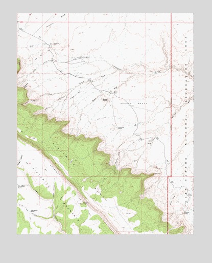
Sooner Bench, UT USGS Topographic Map
Click on map above to begin viewing in our Map Viewer.

This topographic map contains these locations and features:
Feature Name Type Latitude Longitude GNIS ID View Map
Blondie KnollSummitN37.2672°W111.0793°1425774View Map
Broken Bow ArchArchN37.3286°W111.0002°1437247View Map
Burnt RidgeRidgeN37.2686°W111.0952°1426190View Map
Carcass WashValleyN37.3428°W111.0549°1426353View Map
Cave PointCapeN37.2836°W111.0293°1426426View Map
Cave SpringSpringN37.2873°W111.0277°1426429View Map
Cottonwood SpringSpringN37.3100°W111.0545°1426935View Map
Dance Hall RockPillarN37.3572°W111.1002°1427198View Map
Dance Hall Rock (historical)LocaleN37.3572°W111.1002°1435385View Map
Elbow HollowValleyN37.2697°W111.0999°1427776View Map
Fiftymile SpringSpringN37.2618°W111.0077°1427927View Map
Fortymile SlideSlopeN37.3339°W111.1182°1428048View Map
Fortymile SpringSpringN37.3494°W111.0818°1428049View Map
Left Fork Carcass WashValleyN37.3317°W111.0852°1429529View Map
Left Fork Fortymile GulchValleyN37.3500°W111.0846°1429537View Map
Lone RockPillarN37.3636°W111.0824°1429873View Map
Pool HollowValleyN37.2778°W111.1168°1431404View Map
Pool Hollow SpringSpringN37.2773°W111.1247°1431405View Map
Right Fork Carcass WashValleyN37.3317°W111.0852°1431790View Map
Right Fork Fortymile GulchValleyN37.3500°W111.0843°1431800View Map
Soda SlideSlopeN37.2689°W111.0152°1432617View Map
Soda SpringSpringN37.2723°W111.0053°1432619View Map
Sooner BenchBenchN37.3228°W111.0457°1432632View Map
Sooner RocksSummitN37.3255°W111.0610°1432633View Map
Sooner SlideSlopeN37.2939°W111.0538°1432634View Map
Sooner WashValleyN37.3397°W111.0421°1432635View Map
Sooner WaterSpringN37.3297°W111.0578°1432636View Map
Sunset Natural BridgeArchN37.3472°W111.0207°1436454View Map
Tank HollowValleyN37.2594°W111.0999°1433182View Map
Tank Hollow SpringSpringN37.2629°W111.1163°1433183View Map

Note: Coordinates in the location and feature list above are referenced to NAD83 datum.


Copyright (C) 2008-2024 Ryan Niemi / Sunset Dynamics ... All Rights Reserved