TopoQuest Logo
Do you find TopoQuest useful?
Help keep TopoQuest running and adding new maps/features by donating!
Bitcoin:  19c7KJd3qBynnjoSw5npx9KScwjBe4ifkT
Litecoin:  LXs6TkuXGGXo1vDsWCkWVdjQX94eUKd6ui
Home View Maps Find Maps Find Places Resources & Links


Soldier Peak, Nevada Topographic Map

USGS Map Title: Soldier Peak, NV
USGS Map MRC: 40115G3
DRG (GeoTIFF) Download: o40115g3.tif


Neighboring USGS Topographic Map Quads:


  Halleck, NV  
40115H4
 

  Heelfly Creek, NV  
40115H3
 

  Tent Mountain, NV  
40115H2
 

  Halleck SW, NV  
40115G4
 

  Soldier Peak, NV  
40115G3
 

  Secret Valley, NV  
40115G2
 

  Lamoille, NV  
40115F4
 

  Verdi Peak, NV  
40115F3
 

  Ruby City Creek, NV  
40115F2


Map MRC Location:

N41°
W116°
N41°
W115°
H8 H7 H6 H5 H4 H3 H2 H1
G8 G7 G6 G5 G4 G3 G2 G1
F8 F7 F6 F5 F4 F3 F2 F1
E8 E7 E6 E5 E4 E3 E2 E1
D8 D7 D6 D5 D4 D3 D2 D1
C8 C7 C6 C5 C4 C3 C2 C1
B8 B7 B6 B5 B4 B3 B2 B1
A8 A7 A6 A5 A4 A3 A2 A1
N40°
W116°
N40°
W115°

Soldier Peak, NV USGS 1:24K Topographic Map Preview:
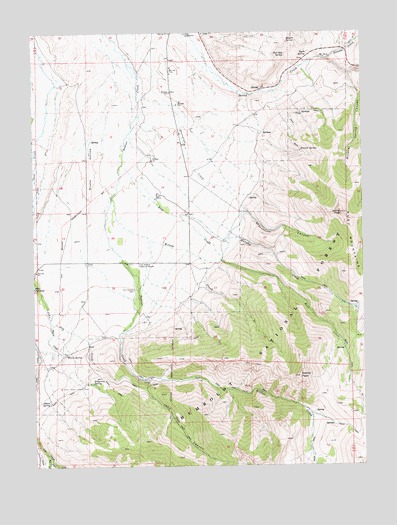
Soldier Peak, NV USGS Topographic Map
Click on map above to begin viewing in our Map Viewer.

This topographic map contains these locations and features:
Feature Name Type Latitude Longitude GNIS ID View Map
Camp Halleck (historical)LocaleN40.8060°W115.3362°862724View Map
Campbell CreekStreamN40.7749°W115.3339°862750View Map
Chevallier RanchLocaleN40.8094°W115.3426°862729View Map
Dorsey CreekStreamN40.8671°W115.2637°859543View Map
Emigrant SpringSpringN40.7738°W115.3533°859676View Map
Fort Halleck CemeteryCemeteryN40.8008°W115.3378°859738View Map
Fort Halleck Historical MarkerParkN40.8083°W115.3362°859739View Map
Fort Halleck Post Office (historical)Post OfficeN40.8055°W115.3370°864274View Map
Gheen SpringSpringN40.7682°W115.3701°859816View Map
Granite SpringSpringN40.8405°W115.2740°859877View Map
Hoot Owl SpringSpringN40.8684°W115.2797°860026View Map
John Day CanyonValleyN40.7744°W115.3331°860212View Map
Magpie SpringSpringN40.8719°W115.2791°860450View Map
Middle Fork Cold CreekStreamN40.7502°W115.3664°860563View Map
Mineral Spring CanyonValleyN40.8627°W115.2556°860602View Map
Mineral Springs CreekStreamN40.8630°W115.2556°862857View Map
Murphy CreekStreamN40.8227°W115.3234°860692View Map
North Fork Cold CreekStreamN40.7502°W115.3664°860763View Map
Old Camp Halleck Military Reservation (historical)MilitaryN40.7800°W115.3450°863968View Map
Ross CreekStreamN40.8369°W115.3423°861175View Map
Ryan SpringSpringN40.8685°W115.2713°861208View Map
Secret CanyonValleyN40.8671°W115.2639°863021View Map
Secret PeakSummitN40.8230°W115.2587°861303View Map
Snake HollowValleyN40.8455°W115.3534°861434View Map
Soldier PeakSummitN40.7758°W115.2756°861447View Map
South Fork Cold CreekStreamN40.7527°W115.3701°861468View Map
Starvation CanyonValleyN40.8241°W115.2967°861566View Map
Starvation CreekStreamN40.8563°W115.3334°861568View Map
Success School (historical)SchoolN40.8085°W115.3414°862861View Map
Warm CreekStreamN40.7910°W115.3692°861889View Map
Warm SpringSpringN40.7822°W115.3638°861897View Map
Wilson CreekStreamN40.8271°W115.3462°862067View Map

Note: Coordinates in the location and feature list above are referenced to NAD83 datum.


Copyright (C) 2008-2024 Ryan Niemi / Sunset Dynamics ... All Rights Reserved