TopoQuest Logo
Do you find TopoQuest useful?
Help keep TopoQuest running and adding new maps/features by donating!
Bitcoin:  19c7KJd3qBynnjoSw5npx9KScwjBe4ifkT
Litecoin:  LXs6TkuXGGXo1vDsWCkWVdjQX94eUKd6ui
Home View Maps Find Maps Find Places Resources & Links


Sinking Cove, Tennessee Topographic Map

USGS Map Title: Sinking Cove, TN
USGS Map MRC: 35085A8
DRG (GeoTIFF) Download: o35085a8.tif


Neighboring USGS Topographic Map Quads:


  Winchester, TN  
35086B1
 

  Sewanee, TN  
35085B8
 

  Monteagle, TN  
35085B7
 

  Pitcher Ridge, TN  
35086A1
 

  Sinking Cove, TN  
35085A8
 

  Orme, TN  
35085A7
 

  Hytop, AL  
34086H1
 

  Eureka, AL  
34085H8
 

  Doran Cove, AL  
34085H7


Map MRC Location:

N36°
W86°
N36°
W85°
H8 H7 H6 H5 H4 H3 H2 H1
G8 G7 G6 G5 G4 G3 G2 G1
F8 F7 F6 F5 F4 F3 F2 F1
E8 E7 E6 E5 E4 E3 E2 E1
D8 D7 D6 D5 D4 D3 D2 D1
C8 C7 C6 C5 C4 C3 C2 C1
B8 B7 B6 B5 B4 B3 B2 B1
A8 A7 A6 A5 A4 A3 A2 A1
N35°
W86°
N35°
W85°

Sinking Cove, TN USGS 1:24K Topographic Map Preview:
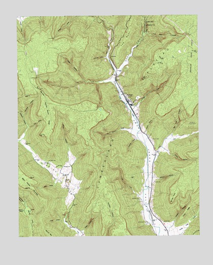
Sinking Cove, TN USGS Topographic Map
Click on map above to begin viewing in our Map Viewer.

This topographic map contains these locations and features:
Feature Name Type Latitude Longitude GNIS ID View Map
Anderson SchoolSchoolN35.0129°W85.9080°1275728View Map
Apps HollowValleyN35.0031°W85.9571°1275832View Map
Barnes PointCapeN35.0187°W85.8941°1276359View Map
Bear HollowValleyN35.0325°W85.9735°1276613View Map
Bee Cliff HollowValleyN35.0571°W85.8934°1276769View Map
Brush CreekStreamN35.1167°W85.9330°1278675View Map
Buck CreekStreamN35.0223°W85.9141°1278805View Map
Burned Stand RidgeRidgeN35.0715°W85.9780°1305545View Map
Cane HollowValleyN35.0881°W85.9535°1279531View Map
Cedar RidgeRidgeN35.0137°W85.8841°1280089View Map
Clark Branch CreekStreamN35.0881°W85.9539°1311140View Map
Commissioner District 5CivilN35.0825°W85.9793°2464442View Map
Crabtree HollowValleyN35.0553°W85.9178°1281529View Map
Cross CreekStreamN35.0345°W85.9103°1281698View Map
Crow Creek Valley Volunteer Fire Department Station 1BuildingN35.0240°W85.9080°2654396View Map
Crownover CemeteryCemeteryN35.0076°W85.9111°1281759View Map
Custard HollowValleyN35.0625°W85.9932°1281907View Map
Dry CreekStreamN35.0865°W85.9322°1282902View Map
Dry Creek School (historical)SchoolN35.0931°W85.9900°1318402View Map
Garner CemeteryCemeteryN35.0937°W85.9275°1285172View Map
Gass CemeteryCemeteryN35.1126°W85.9780°1285223View Map
Gonce CemeteryCemeteryN35.0079°W85.8997°1285600View Map
Hamp HollowValleyN35.0365°W85.9634°1286692View Map
Holly Flat CoveValleyN35.0010°W85.8906°1288101View Map
Hoosier CemeteryCemeteryN35.0206°W85.9166°1288257View Map
Jackson CemeteryCemeteryN35.0426°W85.9789°1289189View Map
Lick HollowValleyN35.0624°W85.9927°1291227View Map
Long HollowValleyN35.0084°W85.9693°1291945View Map
Los CoveValleyN35.0927°W85.9310°1292065View Map
Lynch CemeteryCemeteryN35.0306°W85.9058°1292334View Map
Mandy HollowValleyN35.0580°W85.9120°1292565View Map
Mister and Mrs Larry Lee Carter Natural AreaParkN35.1195°W85.9111°1318403View Map
Mokay HollowValleyN35.0493°W85.8985°1294148View Map
Morris CemeteryCemeteryN35.0904°W85.9908°1294411View Map
Narrows HollowValleyN35.0685°W85.9958°1295239View Map
No Business CreekStreamN35.0592°W85.9166°1295780View Map
Presley CemeteryCemeteryN35.0067°W85.9900°1318400View Map
Pumplog HollowValleyN35.1018°W85.9382°1298684View Map
Red Hill CemeteryCemeteryN35.0540°W85.9078°1299057View Map
Round CoveValleyN35.0202°W85.9967°1300152View Map
Rush CreekStreamN35.0898°W85.9322°1300263View Map
SherwoodPopulated PlaceN35.0762°W85.9233°1303571View Map
Sherwood CemeteryCemeteryN35.0742°W85.9194°1318405View Map
Sherwood Division (historical)CensusN35.0490°W85.9400°1648694View Map
Sherwood Elementary SchoolSchoolN35.0690°W85.9175°1318406View Map
Sherwood Post OfficePost OfficeN35.0759°W85.9233°1650986View Map
Sinking CoveLocaleN35.0395°W85.9694°1318401View Map
Sinking CoveValleyN35.0153°W85.9660°1270375View Map
Sinking Cove SchoolSchoolN35.0395°W85.9691°1270376View Map
Stubblefield HollowValleyN35.0200°W85.9976°1303886View Map
TantallonPopulated PlaceN35.1017°W85.9350°1314375View Map
The NarrowsGapN35.0834°W85.9836°1272419View Map
The SpurRidgeN35.1204°W85.9214°1272445View Map
Tom Pack HollowValleyN35.1156°W85.9110°1272747View Map
Vaughn HollowValleyN35.0069°W85.8940°1273413View Map
Vine BranchStreamN35.0034°W85.9028°1311141View Map
Wilkinson HollowValleyN35.0152°W85.9961°1304594View Map
Wilkson HollowValleyN35.0324°W85.9058°1274606View Map
Willard CemeteryCemeteryN35.0692°W85.9405°1318404View Map
Winding StairsTrailN35.0015°W85.8775°1274858View Map
Youngs CreekStreamN35.0715°W85.9216°1304714View Map

Note: Coordinates in the location and feature list above are referenced to NAD83 datum.


Copyright (C) 2008-2024 Ryan Niemi / Sunset Dynamics ... All Rights Reserved