TopoQuest Logo
Do you find TopoQuest useful?
Help keep TopoQuest running and adding new maps/features by donating!
Bitcoin:  19c7KJd3qBynnjoSw5npx9KScwjBe4ifkT
Litecoin:  LXs6TkuXGGXo1vDsWCkWVdjQX94eUKd6ui
Home View Maps Find Maps Find Places Resources & Links


Silver Bay, New York Topographic Map

USGS Map Title: Silver Bay, NY
USGS Map MRC: 43073F5
DRG (GeoTIFF) Download: o43073f5.tif


Neighboring USGS Topographic Map Quads:


  Pharaoh Mountain, NY  
43073G6
 

  Graphite, NY  
43073G5
 

  Ticonderoga, NY  
43073G4
 

  Brant Lake, NY  
43073F6
 

  Silver Bay, NY  
43073F5
 

  Putnam, NY  
43073F4
 

  Bolton Landing, NY  
43073E6
 

  Shelving Rock, NY  
43073E5
 

  Whitehall, NY  
43073E4


Map MRC Location:

N44°
W74°
N44°
W73°
H8 H7 H6 H5 H4 H3 H2 H1
G8 G7 G6 G5 G4 G3 G2 G1
F8 F7 F6 F5 F4 F3 F2 F1
E8 E7 E6 E5 E4 E3 E2 E1
D8 D7 D6 D5 D4 D3 D2 D1
C8 C7 C6 C5 C4 C3 C2 C1
B8 B7 B6 B5 B4 B3 B2 B1
A8 A7 A6 A5 A4 A3 A2 A1
N43°
W74°
N43°
W73°

Silver Bay, NY USGS 1:24K Topographic Map Preview:
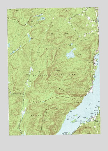
Silver Bay, NY USGS Topographic Map
Click on map above to begin viewing in our Map Viewer.

This topographic map contains these locations and features:
Feature Name Type Latitude Longitude GNIS ID View Map
Barton MountainSummitN43.7467°W73.5915°943119View Map
Bass BayBayN43.6803°W73.5068°943139View Map
Beech MountainSummitN43.7245°W73.5660°943518View Map
Bloomer MountainSummitN43.6667°W73.5429°944283View Map
Brace HillSummitN43.7478°W73.6126°944562View Map
Brown MountainSummitN43.6509°W73.5604°944922View Map
Brown PondLakeN43.6579°W73.5773°944926View Map
Burgess IslandIslandN43.6406°W73.5182°945209View Map
Buttermilk PondLakeN43.7141°W73.6231°945377View Map
Catamount MountainSummitN43.6881°W73.5593°946026View Map
Cook BayBayN43.6378°W73.5160°947336View Map
Davis BayBayN43.6478°W73.5410°948053View Map
Deer LeapCliffN43.6559°W73.5307°948204View Map
Fivemile MountainSummitN43.6395°W73.5773°950214View Map
Fly BrookStreamN43.6787°W73.5971°950327View Map
Hague Volunteer Fire Department and Emergency Squad Station 2BuildingN43.6882°W73.5069°2735481View Map
Hague Wesleyan ChurchChurchN43.7489°W73.5018°2598162View Map
Harbor IslandsIslandN43.6381°W73.5362°952191View Map
Hauge Baptist ChurchChurchN43.7466°W73.5005°2598163View Map
Hulett's Golf CourseLocaleN43.6413°W73.5072°2599522View Map
Huletts IslandIslandN43.6453°W73.5093°953421View Map
Huletts LandingPopulated PlaceN43.6392°W73.5071°953422View Map
Huletts Landing Post OfficePost OfficeN43.6416°W73.5086°2598364View Map
Indian MountainSummitN43.7176°W73.5360°953678View Map
Jabe PondLakeN43.7041°W73.5384°953867View Map
Kitchal BayBayN43.6365°W73.5218°954728View Map
Little Jabe PondLakeN43.7140°W73.5369°955570View Map
Loon IslandIslandN43.6512°W73.5043°955976View Map
Meadow PointCapeN43.6517°W73.5023°956884View Map
Middle MountainSummitN43.7034°W73.5576°957123View Map
Narrow IslandIslandN43.6456°W73.5065°958266View Map
Nobles IslandIslandN43.6378°W73.5235°958638View Map
North PondLakeN43.7430°W73.5811°958887View Map
Number One Hundred and Eight MountainSummitN43.7037°W73.5290°958627View Map
Rock Dunder IslandIslandN43.6481°W73.5026°962698View Map
Round MountainSummitN43.7478°W73.5457°970545View Map
Round Pond BrookStreamN43.6645°W73.6029°963009View Map
Sabbath Day PointPopulated PlaceN43.6676°W73.5140°963155View Map
Sabbath-Day PointCapeN43.6656°W73.5097°2567534View Map
Saint Sacrament IslandIslandN43.6259°W73.5437°964208View Map
Silver BayBayN43.6951°W73.5018°965233View Map
Silver BayPopulated PlaceN43.6965°W73.5057°965234View Map
Slim PointCapeN43.6915°W73.5015°965420View Map
Spectacle PondLakeN43.7207°W73.5937°965966View Map
Spruce MountainSummitN43.7245°W73.5462°966138View Map
Steere IslandIslandN43.6401°W73.5460°966338View Map
Swede MountainSummitN43.7365°W73.5912°966906View Map
Swede PondLakeN43.7396°W73.5767°966907View Map
Tongue Mountain RangeRangeN43.6298°W73.5826°967661View Map
Town of HagueCivilN43.7275°W73.5482°979033View Map
Union ChapelChurchN43.6698°W73.5107°968178View Map
Van Buren BayBayN43.7012°W73.5021°968387View Map
Vicars IslandIslandN43.6437°W73.5332°968528View Map
Wardsboro CemeteryCemeteryN43.6842°W73.5965°968798View Map
Wolf PondLakeN43.7077°W73.6157°971563View Map

Note: Coordinates in the location and feature list above are referenced to NAD83 datum.


Copyright (C) 2008-2024 Ryan Niemi / Sunset Dynamics ... All Rights Reserved