TopoQuest Logo
Do you find TopoQuest useful?
Help keep TopoQuest running and adding new maps/features by donating!
Bitcoin:  19c7KJd3qBynnjoSw5npx9KScwjBe4ifkT
Litecoin:  LXs6TkuXGGXo1vDsWCkWVdjQX94eUKd6ui
Home View Maps Find Maps Find Places Resources & Links


Signal Peak, Utah Topographic Map

USGS Map Title: Signal Peak, UT
USGS Map MRC: 37113C4
DRG (GeoTIFF) Download: o37113c4.tif


Neighboring USGS Topographic Map Quads:


  Central East, UT  
37113D5
 

  Grass Valley, UT  
37113D4
 

  New Harmony, UT  
37113D3
 

  Saddle Mountain, UT  
37113C5
 

  Signal Peak, UT  
37113C4
 

  Pintura, UT  
37113C3
 

  Washington, UT  
37113B5
 

  Harrisburg Junction, UT  
37113B4
 

  Hurricane, UT  
37113B3


Map MRC Location:

N38°
W114°
N38°
W113°
H8 H7 H6 H5 H4 H3 H2 H1
G8 G7 G6 G5 G4 G3 G2 G1
F8 F7 F6 F5 F4 F3 F2 F1
E8 E7 E6 E5 E4 E3 E2 E1
D8 D7 D6 D5 D4 D3 D2 D1
C8 C7 C6 C5 C4 C3 C2 C1
B8 B7 B6 B5 B4 B3 B2 B1
A8 A7 A6 A5 A4 A3 A2 A1
N37°
W114°
N37°
W113°

Signal Peak, UT USGS 1:24K Topographic Map Preview:
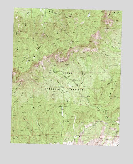
Signal Peak, UT USGS Topographic Map
Click on map above to begin viewing in our Map Viewer.

This topographic map contains these locations and features:
Feature Name Type Latitude Longitude GNIS ID View Map
Ash Grove SpringSpringN37.2964°W113.4138°1438279View Map
Big CoveBasinN37.3728°W113.3752°1448131View Map
Big CreekStreamN37.3103°W113.4350°1438652View Map
Big Hollow SpringSpringN37.2930°W113.4762°1438690View Map
Big Hollow TrailTrailN37.2761°W113.4758°1438692View Map
Blake Harmony TrailTrailN37.3222°W113.3902°1438898View Map
Blue Springs CampgroundLocaleN37.3711°W113.4572°1451194View Map
Browns Point TrailTrailN37.3566°W113.4725°1450041View Map
Browns Point TrailheadLocaleN37.3722°W113.4708°1449966View Map
Cedar RidgeRidgeN37.2978°W113.3858°1439589View Map
Columbine SpringSpringN37.3243°W113.4507°1439903View Map
Dan SpringSpringN37.3339°W113.4025°1440249View Map
Danish RanchLocaleN37.2583°W113.4288°1440265View Map
Deer FlatFlatN37.3300°W113.4730°1440379View Map
Dry ForkStreamN37.3725°W113.4600°1440613View Map
Further WaterLakeN37.3264°W113.4827°1441258View Map
Highline TrailTrailN37.3316°W113.4136°1441767View Map
Horse CreekStreamN37.3022°W113.4238°1441864View Map
Italian SpringSpringN37.2948°W113.3805°1442070View Map
Jones HollowValleyN37.2828°W113.3933°1442210View Map
Jones Hollow ReservoirReservoirN37.3230°W113.3927°1442215View Map
Maple SpringSpringN37.3044°W113.4447°1443177View Map
Milltown (historical)LocaleN37.2503°W113.3805°1448664View Map
Mud SpringSpringN37.2892°W113.4376°1443680View Map
Oak Grove CampgroundLocaleN37.3172°W113.4533°1451311View Map
Oak Grove Recreation AreaParkN37.3175°W113.4530°1444022View Map
Oak Grove TrailTrailN37.3214°W113.4658°1444023View Map
Pig CreekStreamN37.3105°W113.4347°1448830View Map
Pine Valley Recreation AreaParkN37.3733°W113.4555°1444417View Map
Pines CampgroundLocaleN37.3728°W113.4591°1451330View Map
Point TrailTrailN37.3555°W113.4719°1444498View Map
Right Fork Santa Clara RiverStreamN37.3747°W113.4641°1444954View Map
Seven Pines Recreation SiteLocaleN37.3736°W113.4616°1455687View Map
Signal PeakSummitN37.3197°W113.4916°1445580View Map
South ValleyBasinN37.3697°W113.4144°1445930View Map
Spirit CreekStreamN37.3058°W113.4219°1445962View Map
Three Pine CreekStreamN37.2636°W113.4408°1446571View Map
Trail PeakSummitN37.3078°W113.4730°1446690View Map
Upper Pines CampgroundLocaleN37.3739°W113.4616°1451374View Map
West Summit TrailTrailN37.3525°W113.3966°1450042View Map
Whipple TrailTrailN37.3716°W113.4291°1447222View Map
Whipple TrailheadLocaleN37.3705°W113.4555°1450040View Map

Note: Coordinates in the location and feature list above are referenced to NAD83 datum.


Copyright (C) 2008-2024 Ryan Niemi / Sunset Dynamics ... All Rights Reserved