TopoQuest Logo
Do you find TopoQuest useful?
Help keep TopoQuest running and adding new maps/features by donating!
Bitcoin:  19c7KJd3qBynnjoSw5npx9KScwjBe4ifkT
Litecoin:  LXs6TkuXGGXo1vDsWCkWVdjQX94eUKd6ui
Home View Maps Find Maps Find Places Resources & Links


Sibley East, Iowa Topographic Map

USGS Map Title: Sibley East, IA
USGS Map MRC: 43095D6
DRG (GeoTIFF) Download: o43095d6.tif


Neighboring USGS Topographic Map Quads:


  Rushmore, MN  
43095E7
 

  Bigelow, MN  
43095E6
 

  Worthington South, MN  
43095E5
 

  Sibley West, IA  
43095D7
 

  Sibley East, IA  
43095D6
 

  Ocheyedan, IA  
43095D5
 

  Ashton, IA  
43095C7
 

  Cloverdale, IA  
43095C6
 

  Melvin, IA  
43095C5


Map MRC Location:

N44°
W96°
N44°
W95°
H8 H7 H6 H5 H4 H3 H2 H1
G8 G7 G6 G5 G4 G3 G2 G1
F8 F7 F6 F5 F4 F3 F2 F1
E8 E7 E6 E5 E4 E3 E2 E1
D8 D7 D6 D5 D4 D3 D2 D1
C8 C7 C6 C5 C4 C3 C2 C1
B8 B7 B6 B5 B4 B3 B2 B1
A8 A7 A6 A5 A4 A3 A2 A1
N43°
W96°
N43°
W95°

Sibley East, IA USGS 1:24K Topographic Map Preview:
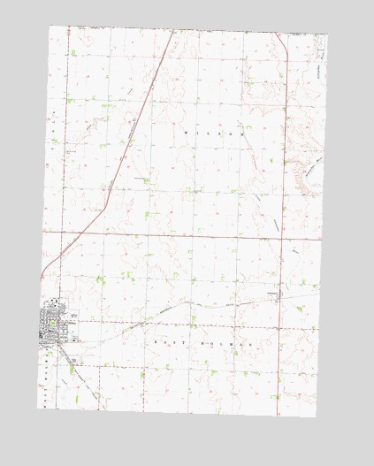
Sibley East, IA USGS Topographic Map
Click on map above to begin viewing in our Map Viewer.

This topographic map contains these locations and features:
Feature Name Type Latitude Longitude GNIS ID View Map
Alex FarmsLocaleN43.4272°W95.6847°2723208View Map
AllendorfLocaleN43.4133°W95.6442°1907289View Map
AllendorfPopulated PlaceN43.4147°W95.6433°454138View Map
Allendorf Post Office (historical)Post OfficeN43.4147°W95.6433°1907290View Map
Beltman FarmsLocaleN43.3878°W95.6272°2723173View Map
Braaksma Grain FarmsLocaleN43.4178°W95.6439°2723236View Map
Central ParkParkN43.4033°W95.7439°1907343View Map
Christian Reformed ChurchChurchN43.4086°W95.7486°1907328View Map
City of SibleyCivilN43.4013°W95.7438°2395880View Map
Country View Manor IncorporatedHospitalN43.4105°W95.7450°1907318View Map
Family Medicine ClinicHospitalN43.4102°W95.7431°1907323View Map
Feldkamp FarmsLocaleN43.4058°W95.7261°2723168View Map
First Baptist ChurchChurchN43.4027°W95.7483°1907330View Map
First Presbyterian ChurchChurchN43.4022°W95.7461°1907334View Map
First Reformed ChurchChurchN43.4027°W95.7389°1907331View Map
Hawkeye PointSummitN43.4600°W95.7089°1851955View Map
Holman (historical)LocaleN43.4139°W95.6447°1907284View Map
Holman Post Office (historical)Post OfficeN43.4139°W95.6447°1907285View Map
J D K FarmsLocaleN43.4772°W95.7292°2723207View Map
Jacobsma FarmsLocaleN43.4336°W95.7464°2723162View Map
Jet FarmsLocaleN43.4461°W95.7403°2723209View Map
Johnson Wilderness AreaParkN43.4133°W95.6406°1907292View Map
McCallum Museum and Brunson Heritage HouseBuildingN43.4036°W95.7433°1907337View Map
North Sibley CemeteryCemeteryN43.4589°W95.7408°459630View Map
Northwest Iowa Urologists CenterHospitalN43.4102°W95.7431°1907324View Map
Osceola Community HospitalHospitalN43.4103°W95.7430°1907325View Map
Osceola Community Hospital HeliportAirportN43.4102°W95.7422°466936View Map
Osceola County CourthouseBuildingN43.4022°W95.7495°1907336View Map
Osceola County Sheriff's OfficeBuildingN43.4024°W95.7497°1907314View Map
Ransom Wildlife Management AreaParkN43.4833°W95.7392°1907311View Map
Robinson ParkParkN43.3986°W95.7370°1907342View Map
Saint Andrews ChurchChurchN43.4002°W95.7442°1907327View Map
Sharbondy ParkParkN43.4041°W95.6436°1907291View Map
Sibley - Ocheyedan Elementary SchoolSchoolN43.4050°W95.7413°1907339View Map
Sibley - Ocheyedan High SchoolSchoolN43.4058°W95.7359°1907338View Map
Sibley - Ocheyedan Middle SchoolSchoolN43.4048°W95.7356°2719844View Map
Sibley Care CenterHospitalN43.4114°W95.7431°1907326View Map
Sibley Golf and Country ClubLocaleN43.4027°W95.7350°1907341View Map
Sibley Post OfficePost OfficeN43.3994°W95.7483°1907317View Map
Sibley Public LibraryBuildingN43.3994°W95.7486°1907316View Map
Sibley Volunteer Fire DepartmentBuildingN43.4000°W95.7499°2577318View Map
Township of East HolmanCivilN43.3892°W95.6824°468047View Map
Township of Holman (historical)CivilN43.3963°W95.7429°2397814View Map
Township of WilsonCivilN43.4663°W95.6825°469007View Map
Trinity Lutheran ChurchChurchN43.4086°W95.7422°1907329View Map
Trinity Reformed ChurchChurchN43.4005°W95.7456°1907333View Map
United Church of ChristChurchN43.4011°W95.7483°1907335View Map
United Methodist ChurchChurchN43.4111°W95.7378°1907332View Map
Wasmund SloughSwampN43.4916°W95.7031°1907309View Map
Wilson TownhallBuildingN43.4480°W95.6836°463350View Map
Wilson Township CemeteryCemeteryN43.4514°W95.7042°463351View Map
Winkel Memorial TrailTrailN43.4083°W95.6933°1907280View Map

Note: Coordinates in the location and feature list above are referenced to NAD83 datum.


Copyright (C) 2008-2024 Ryan Niemi / Sunset Dynamics ... All Rights Reserved