TopoQuest Logo
Do you find TopoQuest useful?
Help keep TopoQuest running and adding new maps/features by donating!
Bitcoin:  19c7KJd3qBynnjoSw5npx9KScwjBe4ifkT
Litecoin:  LXs6TkuXGGXo1vDsWCkWVdjQX94eUKd6ui
Home View Maps Find Maps Find Places Resources & Links


Shelbyville, Missouri Topographic Map

USGS Map Title: Shelbyville, MO
USGS Map MRC: 39092G1
DRG (GeoTIFF) Download: o39092g1.tif


Neighboring USGS Topographic Map Quads:


  Leonard, MO  
39092H2
 

  Bethel, MO  
39092H1
 

  Newark, MO  
39091H8
 

  Hagers Grove, MO  
39092G2
 

  Shelbyville, MO  
39092G1
 

  Burksville, MO  
39091G8
 

  Lentner, MO  
39092F2
 

  Shelbina, MO  
39092F1
 

  Lakenan, MO  
39091F8


Map MRC Location:

N40°
W93°
N40°
W92°
H8 H7 H6 H5 H4 H3 H2 H1
G8 G7 G6 G5 G4 G3 G2 G1
F8 F7 F6 F5 F4 F3 F2 F1
E8 E7 E6 E5 E4 E3 E2 E1
D8 D7 D6 D5 D4 D3 D2 D1
C8 C7 C6 C5 C4 C3 C2 C1
B8 B7 B6 B5 B4 B3 B2 B1
A8 A7 A6 A5 A4 A3 A2 A1
N39°
W93°
N39°
W92°

Shelbyville, MO USGS 1:24K Topographic Map Preview:
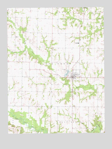
Shelbyville, MO USGS Topographic Map
Click on map above to begin viewing in our Map Viewer.

This topographic map contains these locations and features:
Feature Name Type Latitude Longitude GNIS ID View Map
Black Creek BridgeBridgeN39.8081°W92.0613°754983View Map
Bloom Lake DamDamN39.7867°W92.0185°761816View Map
Briggs BranchStreamN39.7531°W92.0868°714702View Map
City of ShelbyvilleCivilN39.8072°W92.0404°2395866View Map
Duncan School (historical)SchoolN39.7773°W92.0977°733542View Map
Eaton CemeteryCemeteryN39.7623°W92.0046°717372View Map
Eaton School (historical)SchoolN39.7687°W92.0004°733544View Map
Forest Grove CemeteryCemeteryN39.8509°W92.1021°718079View Map
Forest Grove Church (historical)ChurchN39.8506°W92.1013°733546View Map
Freeman School (historical)SchoolN39.8148°W92.0977°733541View Map
Hale School (historical)SchoolN39.7614°W92.0418°733545View Map
Hiles CemeteryCemeteryN39.8059°W92.0693°719593View Map
KirbyPopulated PlaceN39.8456°W92.1146°740987View Map
MamrePopulated PlaceN39.8734°W92.0246°733547View Map
Mesner BranchStreamN39.8539°W92.0032°735722View Map
North Shelby High SchoolSchoolN39.8398°W92.0335°723494View Map
Pollard BranchStreamN39.8356°W92.1013°735800View Map
Robinson School (historical)SchoolN39.8506°W92.0874°733540View Map
Rookwood School (historical)SchoolN39.8423°W92.0305°733543View Map
Shelby Community Fire DepartmentBuildingN39.8052°W92.0409°2621216View Map
Shelby CountyCivilN39.7978°W92.0766°758555View Map
Shelby County AirportAirportN39.8158°W92.0500°758937View Map
Shelby County Sheriff's OfficeBuildingN39.8065°W92.0411°2752318View Map
Shelby High SchoolSchoolN39.8064°W92.0377°733548View Map
ShelbyvillePopulated PlaceN39.8059°W92.0416°726308View Map
Shelbyville LakeReservoirN39.8094°W92.0488°726309View Map
Shelbyville Lake DamDamN39.8070°W92.0516°760234View Map
Shelbyville Post OfficePost OfficeN39.8071°W92.0407°2782989View Map
Township of Black CreekCivilN39.8206°W92.0689°767407View Map
Trenhaile Lake DamDamN39.8584°W92.0985°761815View Map

Note: Coordinates in the location and feature list above are referenced to NAD83 datum.


Copyright (C) 2008-2024 Ryan Niemi / Sunset Dynamics ... All Rights Reserved