TopoQuest Logo
Do you find TopoQuest useful?
Help keep TopoQuest running and adding new maps/features by donating!
Bitcoin:  19c7KJd3qBynnjoSw5npx9KScwjBe4ifkT
Litecoin:  LXs6TkuXGGXo1vDsWCkWVdjQX94eUKd6ui
Home View Maps Find Maps Find Places Resources & Links


Seeley, California Topographic Map

USGS Map Title: Seeley, CA
USGS Map MRC: 32115G6
DRG (GeoTIFF) Download: o32115g6.tif


Neighboring USGS Topographic Map Quads:


  Superstition Mountain, CA  
32115H7
 

  Brawley NW, CA  
32115H6
 

  Brawley, CA  
32115H5
 

  Plaster City, CA  
32115G7
 

  Seeley, CA  
32115G6
 

  El Centro, CA  
32115G5
 

  Yuha Basin, CA  
32115F7
 

  Mount Signal, CA  
32115F6
 

  Heber, CA  
32115F5


Map MRC Location:

N33°
W116°
N33°
W115°
H8 H7 H6 H5 H4 H3 H2 H1
G8 G7 G6 G5 G4 G3 G2 G1
F8 F7 F6 F5 F4 F3 F2 F1
E8 E7 E6 E5 E4 E3 E2 E1
D8 D7 D6 D5 D4 D3 D2 D1
C8 C7 C6 C5 C4 C3 C2 C1
B8 B7 B6 B5 B4 B3 B2 B1
A8 A7 A6 A5 A4 A3 A2 A1
N32°
W116°
N32°
W115°

Seeley, CA USGS 1:24K Topographic Map Preview:
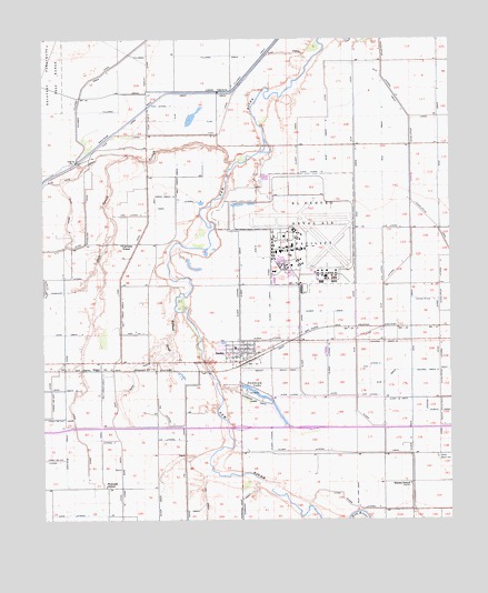
Seeley, CA USGS Topographic Map
Click on map above to begin viewing in our Map Viewer.

This topographic map contains these locations and features:
Feature Name Type Latitude Longitude GNIS ID View Map
Blue Lake DrainCanalN32.7559°W115.6550°239498View Map
Bullhead SloughStreamN32.8039°W115.7106°239826View Map
Central Drain EightCanalN32.7959°W115.6461°255456View Map
Central Drain NineCanalN32.7889°W115.6331°255457View Map
Diehl DrainCanalN32.7526°W115.7061°241497View Map
Dixie Drain OneCanalN32.8442°W115.7342°254022View Map
Dixie Drain One-ACanalN32.8267°W115.7433°254023View Map
Dixie Drain ThreeCanalN32.7689°W115.7381°254025View Map
Dixie Lateral OneCanalN32.7517°W115.7425°254030View Map
EdgarPopulated PlaceN32.7889°W115.7333°1660589View Map
El Centro Naval Air FacilityAirportN32.8207°W115.6708°2650968View Map
Elder CanalCanalN32.8473°W115.6731°241936View Map
Elder CanalCanalN32.7703°W115.6461°241937View Map
Elder Fourteen DrainCanalN32.8178°W115.6825°254096View Map
Elder Fourteen-A DrainCanalN32.8042°W115.6814°254097View Map
Elder Lateral EightCanalN32.7709°W115.6811°254109View Map
Elder Lateral FifteenCanalN32.8401°W115.6694°254104View Map
Elder Lateral FiveCanalN32.7531°W115.6547°254107View Map
Elder Lateral OneCanalN32.7820°W115.6758°254101View Map
Elder Lateral SevenCanalN32.7681°W115.6719°254108View Map
Elder Lateral TenCanalN32.7912°W115.6639°254102View Map
Elder Lateral ThirteenCanalN32.7967°W115.6831°254103View Map
Elder Six DrainCanalN32.7726°W115.6381°254098View Map
Elder Six-A DrainCanalN32.7814°W115.6411°254099View Map
Elder Thirteen DrainCanalN32.8137°W115.6908°254095View Map
Elm CanalCanalN32.8014°W115.6553°241981View Map
Elm DrainCanalN32.7862°W115.6456°241982View Map
Elm Lateral FourCanalN32.8134°W115.6464°254117View Map
Elm Lateral OneCanalN32.7817°W115.6514°254114View Map
Elm Lateral SixCanalN32.8259°W115.6419°254118View Map
Elm Lateral ThreeCanalN32.8151°W115.6422°254116View Map
Elm Lateral TwoCanalN32.7895°W115.6508°254115View Map
Elm School (historical)SchoolN32.8106°W115.6472°1693399View Map
Eucalyptus Five DrainCanalN32.8070°W115.6314°242078View Map
Eucalyptus Lateral FourteenCanalN32.8676°W115.6464°242082View Map
Federal Fire Department El Centro Naval Air FacilityBuildingN32.8201°W115.6794°2664757View Map
Fern CanalCanalN32.7720°W115.7286°242203View Map
Fern Lateral EightCanalN32.8317°W115.7106°242213View Map
Fern Lateral FourCanalN32.7984°W115.7231°242212View Map
Fern Lateral NineCanalN32.8292°W115.7247°242214View Map
Fern Lateral ThreeCanalN32.7709°W115.7336°242211View Map
Fig CanalCanalN32.7659°W115.7078°242236View Map
Fig LateralCanalN32.7709°W115.7131°242239View Map
Fig Lateral FourCanalN32.7776°W115.7150°242240View Map
Fillaree DrainCanalN32.8684°W115.6869°242247View Map
Fillaree Drain FourCanalN32.8706°W115.6964°242249View Map
Fillaree Drain ThreeCanalN32.8653°W115.7328°242248View Map
Fillaree Lateral OneCanalN32.8673°W115.7192°242250View Map
Flax CanalCanalN32.8501°W115.7264°242300View Map
Flax DrainCanalN32.8584°W115.6983°242301View Map
Flax Drain OneCanalN32.8598°W115.7108°242302View Map
Flax Lateral ThreeCanalN32.8576°W115.7161°242304View Map
Flax Lateral TwoCanalN32.8531°W115.7192°242303View Map
Flax WasteCanalN32.8709°W115.6761°242305View Map
Forget-Me-Not CanalCanalN32.7878°W115.7467°242367View Map
Forget-Me-Not Lateral OneCanalN32.7659°W115.7478°242369View Map
Forget-Me-Not Lateral TwoCanalN32.7731°W115.7475°242370View Map
Foxglove CanalCanalN32.8198°W115.7494°242425View Map
Foxglove Lateral SevenCanalN32.8128°W115.7431°242426View Map
Imperial County Fire Department Station 3BuildingN32.7926°W115.6930°1868340View Map
Lantana SchoolSchoolN32.8217°W115.7272°244588View Map
Naval Air Facility El CentroMilitaryN32.8254°W115.6724°2512301View Map
Rice Drain FiveCanalN32.8364°W115.6547°255717View Map
Rice Drain FourCanalN32.8489°W115.6467°255716View Map
Rice Drain SixCanalN32.8476°W115.6642°255718View Map
Rice Drain ThreeCanalN32.8578°W115.6411°255715View Map
Rice Drain TwoCanalN32.8484°W115.6289°255714View Map
Salt Creek Drain OneCanalN32.8395°W115.7106°254194View Map
Salt Creek Drain One ACanalN32.8339°W115.7167°254195View Map
Salt Creek Drain TwoCanalN32.7856°W115.7333°254196View Map
Salt Creek SloughStreamN32.8423°W115.6928°248763View Map
SeeleyPopulated PlaceN32.7931°W115.6911°1661418View Map
Seeley Census Designated PlaceCensusN32.7897°W115.6830°2409303View Map
Seeley Community ChurchChurchN32.7945°W115.6881°1868338View Map
Seeley DrainCanalN32.7917°W115.6817°249250View Map
Seeley Drain OneCanalN32.7889°W115.6761°254231View Map
Seeley Elementary SchoolSchoolN32.7951°W115.6913°1868339View Map
Seeley Post OfficePost OfficeN32.7922°W115.6907°1868341View Map
Silsbee SchoolSchoolN32.7592°W115.6381°249462View Map
Sunbeam DrainCanalN32.7812°W115.6864°250086View Map
Sunbeam LakeLakeN32.7828°W115.6850°250087View Map
Sunbeam Lake County ParkParkN32.7801°W115.6864°1868346View Map
Sunbeam Recreation AreaParkN32.7834°W115.6892°250088View Map
Westside DrainCanalN32.7687°W115.7444°251421View Map
Westside Elementary SchoolSchoolN32.7586°W115.7319°251423View Map
Wixom DrainCanalN32.7576°W115.7153°251754View Map

Note: Coordinates in the location and feature list above are referenced to NAD83 datum.


Copyright (C) 2008-2024 Ryan Niemi / Sunset Dynamics ... All Rights Reserved