TopoQuest Logo
Do you find TopoQuest useful?
Help keep TopoQuest running and adding new maps/features by donating!
Bitcoin:  19c7KJd3qBynnjoSw5npx9KScwjBe4ifkT
Litecoin:  LXs6TkuXGGXo1vDsWCkWVdjQX94eUKd6ui
Home View Maps Find Maps Find Places Resources & Links


Bison Canyon, Montana Topographic Map

USGS Map Title: Bison Canyon, MT
USGS Map MRC: 46112B3
DRG (GeoTIFF) Download: o46112b3.tif


Neighboring USGS Topographic Map Quads:


  Thunderbolt Creek, MT  
46112C4
 

  Basin, MT  
46112C3
 

  Mount Thompson, MT  
46112C2
 

  Sheepshead Mountain, MT  
46112B4
 

  Bison Canyon, MT  
46112B3
 

  Boulder West, MT  
46112B2
 

  Elk Park Pass, MT  
46112A4
 

  Whitetail Peak, MT  
46112A3
 

  Ratio Mountain, MT  
46112A2


Map MRC Location:

N47°
W113°
N47°
W112°
H8 H7 H6 H5 H4 H3 H2 H1
G8 G7 G6 G5 G4 G3 G2 G1
F8 F7 F6 F5 F4 F3 F2 F1
E8 E7 E6 E5 E4 E3 E2 E1
D8 D7 D6 D5 D4 D3 D2 D1
C8 C7 C6 C5 C4 C3 C2 C1
B8 B7 B6 B5 B4 B3 B2 B1
A8 A7 A6 A5 A4 A3 A2 A1
N46°
W113°
N46°
W112°

Bison Canyon, MT USGS 1:24K Topographic Map Preview:
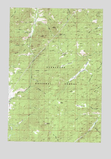
Bison Canyon, MT USGS Topographic Map
Click on map above to begin viewing in our Map Viewer.

This topographic map contains these locations and features:
Feature Name Type Latitude Longitude GNIS ID View Map
Alport MineMineN46.2310°W112.2764°803298View Map
Alport MineMineN46.2277°W112.2803°794106View Map
Bear GulchValleyN46.2369°W112.3403°779527View Map
Bear MountainSummitN46.2224°W112.3297°779553View Map
Berrys MeadowsFlatN46.1880°W112.2861°806756View Map
Big Major GulchValleyN46.1394°W112.2606°806197View Map
Bison CanyonValleyN46.2097°W112.3472°779946View Map
Bison Creek CampgroundLocaleN46.2033°W112.3392°779948View Map
Busch GulchValleyN46.1833°W112.3453°780667View Map
Dunks MeadowFlatN46.1619°W112.3078°806198View Map
Elk ParkPopulated PlaceN46.1649°W112.3722°783110View Map
Elk Park (historical)LocaleN46.1649°W112.3722°1762689View Map
Elk Park CampgroundLocaleN46.1708°W112.3525°783111View Map
Elk Park Post Office (historical)Post OfficeN46.1649°W112.3722°1762576View Map
Eureka MineMineN46.1674°W112.2764°801917View Map
Eureka MineMineN46.1680°W112.2761°803541View Map
Eureka MineMineN46.1674°W112.2758°783248View Map
Gray GulchValleyN46.2363°W112.3456°784238View Map
Haystack MountainSummitN46.1413°W112.3264°784670View Map
Hidden MeadowsFlatN46.1977°W112.2989°806200View Map
Homesite CreekStreamN46.1758°W112.3470°784970View Map
La Belle GulchValleyN46.1897°W112.3497°785866View Map
Long GulchValleyN46.2422°W112.3331°806201View Map
McGinley GulchValleyN46.1922°W112.2720°787053View Map
McLeod GulchValleyN46.2060°W112.3461°787103View Map
Moose MeadowsFlatN46.1594°W112.2761°787660View Map
Mount PisgahSummitN46.1772°W112.2517°788958View Map
Mount Pisgah MineMineN46.1752°W112.2622°803576View Map
Porphyry MineMineN46.2341°W112.3114°803488View Map
Sawmill CreekStreamN46.2049°W112.3417°790050View Map
Shamrock CampgroundLocaleN46.2130°W112.3489°790275View Map
Shamrock GulchValleyN46.2149°W112.3547°790276View Map
Shiels and Ironsides MineMineN46.1424°W112.2625°803540View Map
Shiels and Ironsides MineMineN46.1424°W112.2620°794114View Map
Silversmith MineMineN46.2452°W112.2542°803233View Map
Sullivan MountainSummitN46.2322°W112.3139°791655View Map
SW NW Section 6 MineMineN46.2158°W112.2814°803258View Map
SW SE Section 21 MineMineN46.1660°W112.2506°803539View Map
Tims MeadowFlatN46.1722°W112.2886°806199View Map
Upper Bear Gulch MeadowsFlatN46.2069°W112.3014°792608View Map
Whiskey GulchValleyN46.1922°W112.3447°793176View Map
Wilder (historical)LocaleN46.2258°W112.3495°1762636View Map
Wilder GulchValleyN46.2266°W112.3497°793304View Map

Note: Coordinates in the location and feature list above are referenced to NAD83 datum.


Copyright (C) 2008-2024 Ryan Niemi / Sunset Dynamics ... All Rights Reserved