TopoQuest Logo
Do you find TopoQuest useful?
Help keep TopoQuest running and adding new maps/features by donating!
Bitcoin:  19c7KJd3qBynnjoSw5npx9KScwjBe4ifkT
Litecoin:  LXs6TkuXGGXo1vDsWCkWVdjQX94eUKd6ui
Home View Maps Find Maps Find Places Resources & Links


Scotland, Pennsylvania Topographic Map

USGS Map Title: Scotland, PA
USGS Map MRC: 39077H5
DRG (GeoTIFF) Download: o39077h5.tif


Neighboring USGS Topographic Map Quads:


  Roxbury, PA  
40077A6
 

  Shippensburg, PA  
40077A5
 

  Walnut Bottom, PA  
40077A4
 

  Chambersburg, PA  
39077H6
 

  Scotland, PA  
39077H5
 

  Caledonia Park, PA  
39077H4
 

  Greencastle, PA  
39077G6
 

  Waynesboro, PA  
39077G5
 

  Iron Springs, PA  
39077G4


Map MRC Location:

N40°
W78°
N40°
W77°
H8 H7 H6 H5 H4 H3 H2 H1
G8 G7 G6 G5 G4 G3 G2 G1
F8 F7 F6 F5 F4 F3 F2 F1
E8 E7 E6 E5 E4 E3 E2 E1
D8 D7 D6 D5 D4 D3 D2 D1
C8 C7 C6 C5 C4 C3 C2 C1
B8 B7 B6 B5 B4 B3 B2 B1
A8 A7 A6 A5 A4 A3 A2 A1
N39°
W78°
N39°
W77°

Scotland, PA USGS 1:24K Topographic Map Preview:
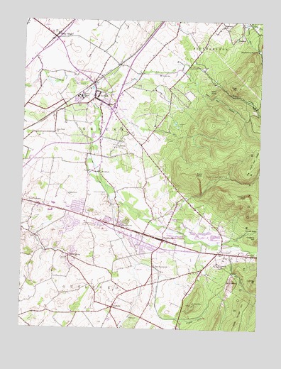
Scotland, PA USGS Topographic Map
Click on map above to begin viewing in our Map Viewer.

This topographic map contains these locations and features:
Feature Name Type Latitude Longitude GNIS ID View Map
5 Lakes AirportAirportN39.9128°W77.5317°1193769View Map
AquaPopulated PlaceN39.9120°W77.6169°1202982View Map
BrownsvillePopulated PlaceN39.9009°W77.5211°1170415View Map
Camp Legion Environmental CenterLocaleN39.9659°W77.5022°1212846View Map
Chambersburg MallLocaleN39.9609°W77.5764°1211801View Map
Cold SpringPopulated PlaceN39.9245°W77.5433°1212845View Map
Cold Spring RunStreamN39.9218°W77.5636°1172157View Map
Conococheague IslandIslandN39.9304°W77.5780°1172356View Map
Conocodell Golf CourseLocaleN39.9143°W77.5469°1205601View Map
Crawford SpringsSpringN39.9373°W77.5192°1172658View Map
Devil Alex HollowValleyN39.9702°W77.5302°1173195View Map
DuffieldPopulated PlaceN39.8837°W77.5758°1173577View Map
Duffield Elementary SchoolSchoolN39.8843°W77.5753°1207280View Map
Eagle RockSummitN39.9376°W77.5339°1173696View Map
East FayettevillePopulated PlaceN39.9006°W77.5550°1173809View Map
Edgewood SchoolSchoolN39.9979°W77.5200°1174016View Map
English ValleyValleyN39.8790°W77.5486°1174267View Map
Faith Valley Christian SchoolSchoolN39.9154°W77.5350°1207278View Map
Falling SpringSpringN39.9031°W77.6003°1174591View Map
Falling SpringPopulated PlaceN39.9045°W77.5994°1174592View Map
Falling Spring Elementary SchoolSchoolN39.9143°W77.6250°1207285View Map
FayettevillePopulated PlaceN39.9112°W77.5500°1174651View Map
Fayetteville Census Designated PlaceCensusN39.9114°W77.5651°2389077View Map
Fayetteville Elementary SchoolSchoolN39.9109°W77.5497°1207279View Map
Fayetteville Post OfficePost OfficeN39.9108°W77.5599°2779657View Map
Fayetteville StationLocaleN39.9001°W77.5547°1206698View Map
Fayetteville Volunteer Fire Department and Emergency Medical Service Company 7BuildingN39.9126°W77.5551°2645430View Map
Furnace Spring LodgeLocaleN39.9415°W77.5150°1211128View Map
GermantownPopulated PlaceN39.9206°W77.5455°1175561View Map
Grand Point SchoolSchoolN39.9545°W77.6083°1175930View Map
Grandview Elementary SchoolSchoolN39.9959°W77.6128°1207283View Map
Green VillagePopulated PlaceN39.9931°W77.6083°1176129View Map
GreenwoodPopulated PlaceN39.9059°W77.5194°1176183View Map
Griers HollowValleyN39.9740°W77.5211°1176227View Map
Guilford Census Designated PlaceCensusN39.9173°W77.5995°2389887View Map
Guilford HillsPopulated PlaceN39.9209°W77.5928°1212847View Map
Guilford Hills Elementary SchoolSchoolN39.9190°W77.5828°1207281View Map
Kettle Springs MountainSummitN39.8762°W77.5100°1178426View Map
Lincoln Way Shopping CenterLocaleN39.9226°W77.6097°1214522View Map
Little MountainSummitN39.8848°W77.5336°1179604View Map
Locust GapGapN39.9151°W77.5014°1179771View Map
Lost Acres AirportAirportN39.9381°W77.6160°1193779View Map
Mount CydoniaSummitN39.8943°W77.5128°1172876View Map
Mount UnionPopulated PlaceN39.9054°W77.5030°1213387View Map
Mount Vernon SchoolSchoolN39.9784°W77.5533°1181880View Map
Mountain RunStreamN39.9723°W77.5875°1181958View Map
Penn National Golf CourseLocaleN39.8945°W77.5383°1205600View Map
Pennsylvania State Police Troop H Chambersburg StationBuildingN39.9354°W77.6250°2754607View Map
Phillaman RunStreamN39.9704°W77.5805°1183667View Map
Pleasant PeakSummitN39.9287°W77.5058°1184048View Map
Poke HillSummitN39.9734°W77.5119°1184183View Map
Rocktop AirportAirportN39.9754°W77.5580°1193792View Map
ScotlandPopulated PlaceN39.9687°W77.5872°1187156View Map
Scotland Census Designated PlaceCensusN39.9698°W77.5844°2633813View Map
Scotland Elementary SchoolSchoolN39.9676°W77.5839°1207282View Map
Scotland Lodge Number 1LocaleN39.9593°W77.5339°1211127View Map
Scotland Lodge Number 2LocaleN39.9540°W77.5214°1211126View Map
Scotland Post OfficePost OfficeN39.9682°W77.5884°2780073View Map
Sharps SchoolSchoolN39.9493°W77.5619°1211029View Map
Shippensburg ReservoirReservoirN39.9885°W77.5010°1193348View Map
Shirley RunStreamN39.9993°W77.5075°1187567View Map
SmoketownPopulated PlaceN39.9490°W77.5755°1204676View Map
Soldiers Orphan SchoolSchoolN39.9690°W77.5944°1187981View Map
Stony KnobSummitN39.9715°W77.5222°1188777View Map
Stump RunStreamN39.9090°W77.5139°1188906View Map
Township of GreeneCivilN39.9543°W77.5668°1216461View Map
Township of GuilfordCivilN39.8812°W77.6010°1216462View Map
Waynesboro JunctionLocaleN39.9634°W77.6047°1212844View Map
West FayettevillePopulated PlaceN39.9168°W77.5742°1191022View Map
WoodstockPopulated PlaceN39.9387°W77.5836°1204990View Map

Note: Coordinates in the location and feature list above are referenced to NAD83 datum.


Copyright (C) 2008-2024 Ryan Niemi / Sunset Dynamics ... All Rights Reserved