TopoQuest Logo
Do you find TopoQuest useful?
Help keep TopoQuest running and adding new maps/features by donating!
Bitcoin:  19c7KJd3qBynnjoSw5npx9KScwjBe4ifkT
Litecoin:  LXs6TkuXGGXo1vDsWCkWVdjQX94eUKd6ui
Home View Maps Find Maps Find Places Resources & Links


Santa Ysabel, California Topographic Map

USGS Map Title: Santa Ysabel, CA
USGS Map MRC: 33116A6
DRG (GeoTIFF) Download: o33116a6.tif


Neighboring USGS Topographic Map Quads:


  Mesa Grande, CA  
33116B7
 

  Warners Ranch, CA  
33116B6
 

  Ranchita, CA  
33116B5
 

  Ramona, CA  
33116A7
 

  Santa Ysabel, CA  
33116A6
 

  Julian, CA  
33116A5
 

  El Cajon Mountain, CA  
32116H7
 

  Tule Springs, CA  
32116H6
 

  Cuyamaca Peak, CA  
32116H5


Map MRC Location:

N34°
W117°
N34°
W116°
H8 H7 H6 H5 H4 H3 H2 H1
G8 G7 G6 G5 G4 G3 G2 G1
F8 F7 F6 F5 F4 F3 F2 F1
E8 E7 E6 E5 E4 E3 E2 E1
D8 D7 D6 D5 D4 D3 D2 D1
C8 C7 C6 C5 C4 C3 C2 C1
B8 B7 B6 B5 B4 B3 B2 B1
A8 A7 A6 A5 A4 A3 A2 A1
N33°
W117°
N33°
W116°

Santa Ysabel, CA USGS 1:24K Topographic Map Preview:
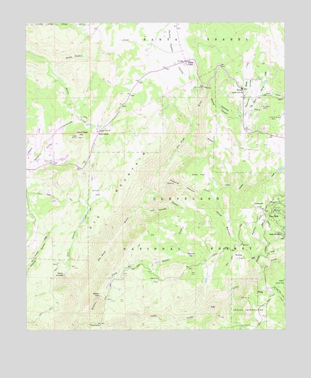
Santa Ysabel, CA USGS Topographic Map
Click on map above to begin viewing in our Map Viewer.

This topographic map contains these locations and features:
Feature Name Type Latitude Longitude GNIS ID View Map
Bailey CreekStreamN33.0878°W116.6453°238887View Map
BallenaPopulated PlaceN33.0653°W116.7467°1701295View Map
Boring CreekStreamN33.0950°W116.6384°239577View Map
Bunton FlatFlatN33.0431°W116.6381°239836View Map
Camp DavidsonLocaleN33.0387°W116.6267°240083View Map
Coleman CreekStreamN33.0978°W116.6620°240774View Map
Coleman FlatFlatN33.0495°W116.6384°240775View Map
Collie FlatFlatN33.0559°W116.7150°240790View Map
Daley FlatFlatN33.0631°W116.6670°241233View Map
Deadman FlatFlatN33.0317°W116.6711°241322View Map
Dehr CreekStreamN33.0198°W116.6414°241386View Map
Devils JumpoffLocaleN33.0220°W116.7334°241469View Map
Dye CanyonValleyN33.0189°W116.7314°241692View Map
Dye MountainSummitN33.0717°W116.6914°241693View Map
Inaja and Cosmit ReservationCivilN33.0105°W116.6416°243797View Map
Inaja Indian Reservation CemeteryCemeteryN33.0057°W116.6355°2773327View Map
Inaja Memorial ParkParkN33.0987°W116.6642°243798View Map
Inaja Nature National Recreation TrailTrailN33.0973°W116.6650°274870View Map
Iron Springs CanyonValleyN33.0506°W116.6959°243905View Map
Jim Green CreekStreamN33.0892°W116.6447°244063View Map
Juch CanyonValleyN33.0962°W116.6353°244159View Map
Kessler FlatFlatN33.0189°W116.6878°244281View Map
McGee FlatFlatN33.0298°W116.6484°245677View Map
Mildred FallsFallsN33.0142°W116.7147°245898View Map
Nichols RanchLocaleN33.0217°W116.6625°1692668View Map
Old Virginia MineMineN33.0900°W116.6359°246863View Map
Orinoco CreekStreamN33.0556°W116.6620°246963View Map
Paine BottomValleyN33.0556°W116.6620°247106View Map
Peacefield OrchardLocaleN33.0936°W116.6419°2515357View Map
Penin CanyonValleyN33.0562°W116.6906°247370View Map
Pine HillsPopulated PlaceN33.0484°W116.6309°1661223View Map
Pine Hills Fire StationLocaleN33.0159°W116.6347°274871View Map
Pine Hills Guard Station (historical)LocaleN33.0162°W116.6345°1692671View Map
Pride of the West MineMineN33.0853°W116.6320°247782View Map
Quanai CanyonValleyN33.0978°W116.6620°247868View Map
Ritchie CreekStreamN33.0056°W116.7264°248226View Map
SaddlebackGapN33.0023°W116.7147°248514View Map
Sandy CreekStreamN33.0192°W116.6403°249014View Map
Santa YsabelPopulated PlaceN33.1092°W116.6731°249137View Map
Santa Ysabel Post OfficePost OfficeN33.1101°W116.6735°2769554View Map
Santa Ysabel SchoolSchoolN33.0814°W116.7147°249142View Map
Santa Ysabel ValleyValleyN33.1164°W116.6897°249143View Map
Sentenac CreekStreamN33.0798°W116.6717°249270View Map
Spencer ValleyValleyN33.0878°W116.6453°249795View Map
Spencer Valley Elementary SchoolSchoolN33.0967°W116.6453°249796View Map
Temescal CreekStreamN33.0562°W116.6909°250325View Map
Witch CreekLocaleN33.0806°W116.7147°251747View Map
Witch CreekStreamN33.1084°W116.7392°251748View Map
Witch Creek Fire Control StationLocaleN33.0689°W116.7417°251750View Map
Witch Creek MountainSummitN33.0787°W116.7256°251751View Map
WynolaPopulated PlaceN33.0975°W116.6456°251832View Map

Note: Coordinates in the location and feature list above are referenced to NAD83 datum.


Copyright (C) 2008-2024 Ryan Niemi / Sunset Dynamics ... All Rights Reserved