TopoQuest Logo
Do you find TopoQuest useful?
Help keep TopoQuest running and adding new maps/features by donating!
Bitcoin:  19c7KJd3qBynnjoSw5npx9KScwjBe4ifkT
Litecoin:  LXs6TkuXGGXo1vDsWCkWVdjQX94eUKd6ui
Home View Maps Find Maps Find Places Resources & Links


Sand Hollow, Oregon Topographic Map

USGS Map Title: Sand Hollow, OR
USGS Map MRC: 43120H1
DRG (GeoTIFF) Download: o43120h1.tif


Neighboring USGS Topographic Map Quads:


  Arrowwood Point, OR  
44120A2
 

  Liggett Table, OR  
44120A1
 

  Maupin Butte, OR  
44119A8
 

  Gerry Mountain, OR  
43120H2
 

  Sand Hollow, OR  
43120H1
 

  Hardin Ranch, OR  
43119H8
 

  Long Barn, OR  
43120G2
 

  G I Ranch, OR  
43120G1
 

  Ibex Butte, OR  
43119G8


Map MRC Location:

N44°
W121°
N44°
W120°
H8 H7 H6 H5 H4 H3 H2 H1
G8 G7 G6 G5 G4 G3 G2 G1
F8 F7 F6 F5 F4 F3 F2 F1
E8 E7 E6 E5 E4 E3 E2 E1
D8 D7 D6 D5 D4 D3 D2 D1
C8 C7 C6 C5 C4 C3 C2 C1
B8 B7 B6 B5 B4 B3 B2 B1
A8 A7 A6 A5 A4 A3 A2 A1
N43°
W121°
N43°
W120°

Sand Hollow, OR USGS 1:24K Topographic Map Preview:
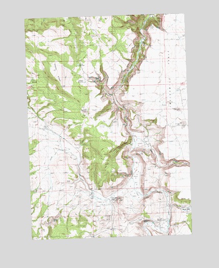
Sand Hollow, OR USGS Topographic Map
Click on map above to begin viewing in our Map Viewer.

This topographic map contains these locations and features:
Feature Name Type Latitude Longitude GNIS ID View Map
Bedell CanyonValleyN43.9985°W120.0247°1160713View Map
Coffelt RanchLocaleN43.9332°W120.0447°1638530View Map
Cold Spring RanchLocaleN43.8965°W120.0639°1160705View Map
Coldspring Post Office (historical)Post OfficeN43.8932°W120.0633°1164279View Map
Corner ReservoirReservoirN43.9987°W120.1105°1129531View Map
Dagus LakeLakeN43.9475°W120.0808°1160701View Map
Divide WaterholeReservoirN43.9729°W120.0850°1133169View Map
Division WaterholeReservoirN43.9654°W120.1217°1133170View Map
Furnace WaterholeReservoirN43.9629°W120.0806°1160710View Map
Hackleman RanchLocaleN43.8763°W120.0211°1638531View Map
Lillard LakeReservoirN43.9366°W120.0045°1133171View Map
Lower Sherman RanchLocaleN43.8901°W120.0025°1160706View Map
Orr PointCliffN43.9915°W120.0428°1160714View Map
Pickett LakeLakeN43.9459°W120.0086°1133172View Map
Reservoir Number SixReservoirN43.9819°W120.0555°1129532View Map
Sand HollowBasinN43.9262°W120.0969°1160703View Map
Sand Hollow CreekStreamN43.9051°W120.0436°1126566View Map
Sand Hollow WellWellN43.9378°W120.1124°1160702View Map
Sheep Head CanyonValleyN43.9276°W120.0469°1160704View Map
Soda SpringSpringN43.9842°W120.0360°1160712View Map
South Dagus ReservoirReservoirN43.9413°W120.0569°1153044View Map
Steens RidgeRidgeN43.9693°W120.1025°1160715View Map
Twelvemile CreekStreamN43.9315°W120.0422°1151548View Map

Note: Coordinates in the location and feature list above are referenced to NAD83 datum.


Copyright (C) 2008-2024 Ryan Niemi / Sunset Dynamics ... All Rights Reserved