TopoQuest Logo
Do you find TopoQuest useful?
Help keep TopoQuest running and adding new maps/features by donating!
Bitcoin:  19c7KJd3qBynnjoSw5npx9KScwjBe4ifkT
Litecoin:  LXs6TkuXGGXo1vDsWCkWVdjQX94eUKd6ui
Home View Maps Find Maps Find Places Resources & Links


Albany, Vermont Topographic Map

USGS Map Title: Albany, VT
USGS Map MRC: 44072F4
DRG (GeoTIFF) Download: o44072f4.tif


Neighboring USGS Topographic Map Quads:


  Hazens Notch, VT  
44072G5
 

  Lowell, VT  
44072G4
 

  Irasburg, VT  
44072G3
 

  Eden, VT  
44072F5
 

  Albany, VT  
44072F4
 

  Craftsbury, VT  
44072F3
 

  Morrisville, VT  
44072E5
 

  Wolcott, VT  
44072E4
 

  Caspian Lake, VT  
44072E3


Map MRC Location:

N45°
W73°
N45°
W72°
H8 H7 H6 H5 H4 H3 H2 H1
G8 G7 G6 G5 G4 G3 G2 G1
F8 F7 F6 F5 F4 F3 F2 F1
E8 E7 E6 E5 E4 E3 E2 E1
D8 D7 D6 D5 D4 D3 D2 D1
C8 C7 C6 C5 C4 C3 C2 C1
B8 B7 B6 B5 B4 B3 B2 B1
A8 A7 A6 A5 A4 A3 A2 A1
N44°
W73°
N44°
W72°

Albany, VT USGS 1:24K Topographic Map Preview:
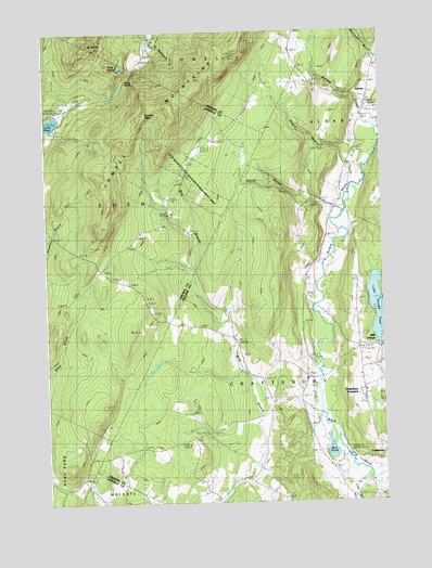
Albany, VT USGS Topographic Map
Click on map above to begin viewing in our Map Viewer.

This topographic map contains these locations and features:
Feature Name Type Latitude Longitude GNIS ID View Map
AlbanyPopulated PlaceN44.7309°W72.3798°1456118View Map
Albany Community SchoolSchoolN44.7382°W72.3767°1921662View Map
Albany Fire DepartmentBuildingN44.7283°W72.3790°2121431View Map
Albany Post OfficePost OfficeN44.7314°W72.3793°1921664View Map
Albany Village CemeteryCemeteryN44.7367°W72.3773°1921667View Map
Bigelow BasinBasinN44.7281°W72.4621°1456421View Map
Branch SchoolSchoolN44.6317°W72.4259°1456552View Map
Cass BrookStreamN44.6334°W72.3832°1461843View Map
Craftsbury AcademySchoolN44.6542°W72.3820°1919963View Map
Craftsbury CommonParkN44.6537°W72.3832°1919964View Map
Craftsbury CommonPopulated PlaceN44.6542°W72.3821°1457042View Map
Craftsbury Common CemeteryCemeteryN44.6511°W72.3810°1919965View Map
Craftsbury Common Congregational ChurchChurchN44.6545°W72.3840°1919966View Map
Craftsbury Common Post OfficePost OfficeN44.6532°W72.3818°1919967View Map
Craftsbury SchoolsSchoolN44.6542°W72.3820°1919968View Map
Craftsbury Village CemeteryCemeteryN44.6291°W72.3823°1919973View Map
Eden NotchGapN44.7370°W72.4696°1457338View Map
Little Hosmer PondReservoirN44.6766°W72.3765°1458240View Map
Little Hosmer Pond DamDamN44.6665°W72.3758°1766463View Map
Mill VillagePopulated PlaceN44.6662°W72.3754°1458474View Map
Mount NorrisSummitN44.7464°W72.4829°1458580View Map
Mount Norris Boy Scout ReservationLocaleN44.7239°W72.4954°1918419View Map
Mud PondLakeN44.6389°W72.3945°1458621View Map
Mud PondLakeN44.7410°W72.4711°1458624View Map
Old Covenater Church (historical)ChurchN44.6545°W72.3818°1920086View Map
Rogers BranchStreamN44.7092°W72.3865°1459240View Map
Seaver BranchStreamN44.7023°W72.3904°1459439View Map
Shalney BranchStreamN44.7214°W72.3757°1459457View Map
Sterling CollegeSchoolN44.6522°W72.3822°2427496View Map
Town of CraftsburyCivilN44.6536°W72.3961°1462078View Map
Tromp PointCapeN44.6498°W72.4018°1459949View Map
Village of AlbanyCivilN44.7301°W72.3810°2378297View Map

Note: Coordinates in the location and feature list above are referenced to NAD83 datum.


Copyright (C) 2008-2024 Ryan Niemi / Sunset Dynamics ... All Rights Reserved