TopoQuest Logo
Do you find TopoQuest useful?
Help keep TopoQuest running and adding new maps/features by donating!
Bitcoin:  19c7KJd3qBynnjoSw5npx9KScwjBe4ifkT
Litecoin:  LXs6TkuXGGXo1vDsWCkWVdjQX94eUKd6ui
Home View Maps Find Maps Find Places Resources & Links


Sage, California Topographic Map

USGS Map Title: Sage, CA
USGS Map MRC: 33116E8
DRG (GeoTIFF) Download: o33116e8.tif


Neighboring USGS Topographic Map Quads:


  Winchester, CA  
33117F1
 

  Hemet, CA  
33116F8
 

  Blackburn Canyon, CA  
33116F7
 

  Bachelor Mountain, CA  
33117E1
 

  Sage, CA  
33116E8
 

  Cahuilla Mountain, CA  
33116E7
 

  Pechanga, CA  
33117D1
 

  Vail Lake, CA  
33116D8
 

  Aguanga, CA  
33116D7


Map MRC Location:

N34°
W117°
N34°
W116°
H8 H7 H6 H5 H4 H3 H2 H1
G8 G7 G6 G5 G4 G3 G2 G1
F8 F7 F6 F5 F4 F3 F2 F1
E8 E7 E6 E5 E4 E3 E2 E1
D8 D7 D6 D5 D4 D3 D2 D1
C8 C7 C6 C5 C4 C3 C2 C1
B8 B7 B6 B5 B4 B3 B2 B1
A8 A7 A6 A5 A4 A3 A2 A1
N33°
W117°
N33°
W116°

Sage, CA USGS 1:24K Topographic Map Preview:
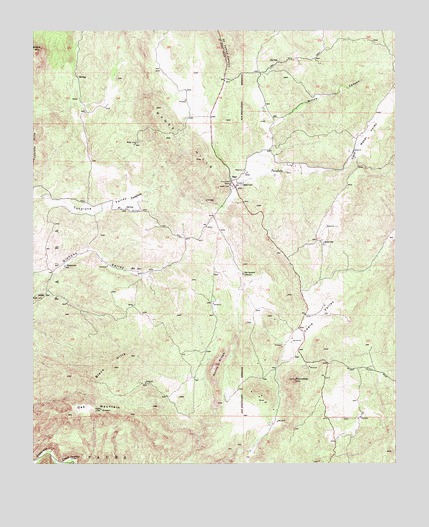
Sage, CA USGS Topographic Map
Click on map above to begin viewing in our Map Viewer.

This topographic map contains these locations and features:
Feature Name Type Latitude Longitude GNIS ID View Map
Adobe SpringSpringN33.5490°W116.9990°238429View Map
Black HillsRangeN33.5273°W116.9728°239405View Map
Clark Ranch Airpark (historical)AirportN33.5445°W116.9775°1653849View Map
Crossroads New Life Educational MinistriesSchoolN33.5791°W116.9311°2455940View Map
Ernst FieldAirportN33.6000°W116.8803°1653521View Map
Glenoak HillsPopulated PlaceN33.5375°W116.9806°1868078View Map
Glenoak Hills ParkParkN33.5486°W116.9961°1868079View Map
Glenoak ValleyValleyN33.5503°W116.9989°242744View Map
Indian Oaks CampgroundLocaleN33.5792°W116.9997°1868087View Map
Lewis ValleyValleyN33.5298°W116.9156°244770View Map
Oak MountainSummitN33.5159°W116.9772°246743View Map
Oakridge RanchesPopulated PlaceN33.6061°W116.9753°1868101View Map
Red Mountain Christian SchoolSchoolN33.6090°W116.8991°2455756View Map
Riverside County Fire Department Station 28 SageBuildingN33.6048°W116.9381°2664936View Map
Rocky RidgeRidgeN33.5284°W116.9381°248319View Map
RoundtopSummitN33.5242°W116.9106°248429View Map
SagePopulated PlaceN33.5817°W116.9322°1661354View Map
Saint Johns GradeSlopeN33.6231°W116.9353°248639View Map
San Ignacio SchoolSchoolN33.5547°W116.9281°248860View Map
Sycamore HillsPopulated PlaceN33.5953°W116.9525°1868122View Map
Sycamore SpringsPopulated PlaceN33.6178°W116.9564°1868134View Map
Tucalota ValleyValleyN33.5767°W116.9964°250650View Map
Weber ValleyValleyN33.5872°W116.8917°251276View Map
Willow CanyonValleyN33.5972°W116.9192°251609View Map

Note: Coordinates in the location and feature list above are referenced to NAD83 datum.


Copyright (C) 2008-2024 Ryan Niemi / Sunset Dynamics ... All Rights Reserved