TopoQuest Logo
Do you find TopoQuest useful?
Help keep TopoQuest running and adding new maps/features by donating!
Bitcoin:  19c7KJd3qBynnjoSw5npx9KScwjBe4ifkT
Litecoin:  LXs6TkuXGGXo1vDsWCkWVdjQX94eUKd6ui
Home View Maps Find Maps Find Places Resources & Links


Sackets Harbor, New York Topographic Map

USGS Map Title: Sackets Harbor, NY
USGS Map MRC: 43076H1
DRG (GeoTIFF) Download: o43076h1.tif


Neighboring USGS Topographic Map Quads:


  Chaumont, NY  
44076A2
 

  Dexter, NY  
44076A1
 

  Brownville, NY  
44075A8
 

  Henderson Bay, NY  
43076H2
 

  Sackets Harbor, NY  
43076H1
 

  Watertown, NY  
43075H8
 

  Henderson, NY  
43076G2
 

  Adams, NY  
43076G1
 

  Rodman, NY  
43075G8


Map MRC Location:

N44°
W77°
N44°
W76°
H8 H7 H6 H5 H4 H3 H2 H1
G8 G7 G6 G5 G4 G3 G2 G1
F8 F7 F6 F5 F4 F3 F2 F1
E8 E7 E6 E5 E4 E3 E2 E1
D8 D7 D6 D5 D4 D3 D2 D1
C8 C7 C6 C5 C4 C3 C2 C1
B8 B7 B6 B5 B4 B3 B2 B1
A8 A7 A6 A5 A4 A3 A2 A1
N43°
W77°
N43°
W76°

Sackets Harbor, NY USGS 1:24K Topographic Map Preview:
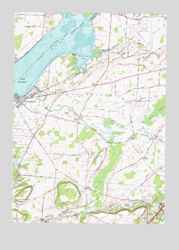
Sackets Harbor, NY USGS Topographic Map
Click on map above to begin viewing in our Map Viewer.

This topographic map contains these locations and features:
Feature Name Type Latitude Longitude GNIS ID View Map
Allens MarinaHarborN43.9099°W76.1200°2615012View Map
Allens Marina CampgroundLocaleN43.9099°W76.1200°2615178View Map
AlversonPopulated PlaceN43.9478°W76.0241°972165View Map
Baggs CornerPopulated PlaceN43.9570°W76.0577°972190View Map
Bedford Creek CampgroundLocaleN43.9111°W76.1202°2615184View Map
Bedford Creek Golf CourseLocaleN43.9127°W76.1157°2615345View Map
Black RiverStreamN43.9942°W76.0649°944180View Map
Black River BayBayN43.9701°W76.1081°944181View Map
Black River ChannelChannelN43.9834°W76.0996°1851783View Map
Camps MillsPopulated PlaceN43.9367°W76.0713°972293View Map
Christ Episcopal ChurchChurchN43.9445°W76.1158°2615714View Map
Gill CreekStreamN43.9995°W76.0921°951112View Map
Greens Crossing (historical)LocaleN43.9494°W76.0133°2353060View Map
Grunerts MarinaLocaleN43.9492°W76.1233°973899View Map
Hay Memorial LibraryBuildingN43.9459°W76.1189°2617303View Map
Jefferson CountyCivilN43.9989°W76.0521°974121View Map
JewettvillePopulated PlaceN43.9539°W76.0902°972667View Map
Liberty Yacht BasinHarborN43.9486°W76.1203°2615035View Map
Madison Barracks (historical)MilitaryN43.9532°W76.1078°2463331View Map
Madison ParkLocaleN43.9534°W76.1074°973898View Map
Market Square ParkParkN43.9487°W76.1224°973896View Map
Maxon CornersLocaleN43.9142°W76.0188°956692View Map
Military CemeteryCemeteryN43.9485°W76.1054°957186View Map
Mill CreekStreamN43.9564°W76.1077°957245View Map
Muskalonge CemeteryCemeteryN43.9773°W76.0144°958208View Map
Muskellunge BayBayN43.9734°W76.0702°974239View Map
Muskellunge CreekStreamN43.9753°W76.0602°958209View Map
Navy PointCapeN43.9503°W76.1241°958306View Map
Navy Point MarineHarborN43.9498°W76.1219°2615038View Map
North AdamsPopulated PlaceN43.8862°W76.0294°973900View Map
North Adams CemeteryCemeteryN43.8891°W76.0284°958662View Map
Perch RiverStreamN43.9956°W76.0824°970469View Map
Reed Haven FarmsLocaleN43.8964°W76.0236°2702784View Map
Rustic Golf and Country ClubLocaleN43.9959°W76.0973°2615468View Map
Sackets HarborBayN43.9492°W76.1208°963165View Map
Sackets HarborPopulated PlaceN43.9462°W76.1191°963166View Map
Sackets Harbor Central SchoolSchoolN43.9436°W76.1208°2669090View Map
Sackets Harbor LightLocaleN43.9434°W76.0624°977556View Map
Sackets Harbor Town DockLocaleN43.9487°W76.1219°2614864View Map
Sackets Harbor Volunteer Fire Company Sackets Harbor Station 1BuildingN43.9466°W76.1181°2718658View Map
Sackets Harbor Volunteer Fire Company Sulphur Springs Station 2BuildingN43.9269°W76.0279°2734739View Map
Saint Andrews Catholic ChurchChurchN43.9449°W76.1175°2616871View Map
Sanford CornersLocaleN43.8959°W76.0649°964445View Map
School Number 10 (historical)SchoolN43.9986°W76.1167°2353065View Map
School Number 3 (historical)SchoolN43.9731°W76.0342°2353061View Map
School Number 5 (historical)SchoolN43.9350°W76.0722°2353062View Map
School Number 6 (historical)SchoolN43.9553°W76.0236°2353063View Map
School Number 8 (historical)SchoolN43.9572°W76.0575°2353064View Map
SmithvillePopulated PlaceN43.8762°W76.0999°965535View Map
Smithville Volunteer Fire DepartmentBuildingN43.8766°W76.0998°2734738View Map
Storrs PointCapeN43.9753°W76.0746°966605View Map
Stowell CornersLocaleN43.9259°W76.0085°966609View Map
Sulphur SpringsPopulated PlaceN43.9256°W76.0294°973126View Map
United Presbyterian ChurchChurchN43.9459°W76.1189°2617140View Map
Valley Stock FarmLocaleN43.8847°W76.0711°2702870View Map
Village of Sackets HarborCivilN43.9418°W76.1181°2391108View Map
Watertown International AirportAirportN43.9952°W76.0225°978354View Map
Watertown International Airport Fire DepartmentBuildingN43.9949°W76.0224°2734772View Map
Watertown Seventh Day Adventist ChurchChurchN43.9667°W76.0096°2617180View Map
Westcott Beach State ParkParkN43.8970°W76.1135°970905View Map

Note: Coordinates in the location and feature list above are referenced to NAD83 datum.


Copyright (C) 2008-2024 Ryan Niemi / Sunset Dynamics ... All Rights Reserved