TopoQuest Logo
Do you find TopoQuest useful?
Help keep TopoQuest running and adding new maps/features by donating!
Bitcoin:  19c7KJd3qBynnjoSw5npx9KScwjBe4ifkT
Litecoin:  LXs6TkuXGGXo1vDsWCkWVdjQX94eUKd6ui
Home View Maps Find Maps Find Places Resources & Links


Roosevelt, Texas Topographic Map

USGS Map Title: Roosevelt, TX
USGS Map MRC: 30100D1
DRG (GeoTIFF) Download: o30100d1.tif


Neighboring USGS Topographic Map Quads:


  Brokeleg Mountain, TX  
30100E2
 

  McKegan Draw, TX  
30100E1
 

  Stark Creek, TX  
30099E8
 

  Fort Terrett Ranch, TX  
30100D2
 

  Roosevelt, TX  
30100D1
 

  Bailey Creek, TX  
30099D8
 

  Bundy Ranch, TX  
30100C2
 

  Hill Ranch, TX  
30100C1
 

  Telegraph, TX  
30099C8


Map MRC Location:

N31°
W101°
N31°
W100°
H8 H7 H6 H5 H4 H3 H2 H1
G8 G7 G6 G5 G4 G3 G2 G1
F8 F7 F6 F5 F4 F3 F2 F1
E8 E7 E6 E5 E4 E3 E2 E1
D8 D7 D6 D5 D4 D3 D2 D1
C8 C7 C6 C5 C4 C3 C2 C1
B8 B7 B6 B5 B4 B3 B2 B1
A8 A7 A6 A5 A4 A3 A2 A1
N30°
W101°
N30°
W100°

Roosevelt, TX USGS 1:24K Topographic Map Preview:
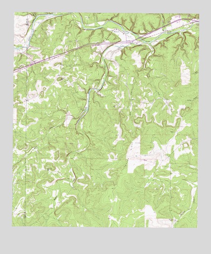
Roosevelt, TX USGS Topographic Map
Click on map above to begin viewing in our Map Viewer.

This topographic map contains these locations and features:
Feature Name Type Latitude Longitude GNIS ID View Map
Buck HollowValleyN30.4891°W100.0237°1353137View Map
Buck HollowPopulated PlaceN30.4902°W100.0206°1379467View Map
Cedar Hill CemeteryCemeteryN30.4941°W100.1076°1354103View Map
Cedar KnobSummitN30.4616°W100.0940°1354121View Map
Deep HollowValleyN30.4957°W100.0597°1355821View Map
Frog CreekStreamN30.4832°W100.0326°1357775View Map
Holland RanchLocaleN30.4307°W100.0165°1359412View Map
Joes PointSummitN30.4457°W100.0554°1360286View Map
Mansfield RanchLocaleN30.3802°W100.0167°1362148View Map
Maynard CreekStreamN30.4835°W100.0367°1374827View Map
Maynard RanchLocaleN30.4438°W100.0759°1362336View Map
Mexican GapGapN30.4082°W100.1023°1362681View Map
Patterson RidgeRidgeN30.4149°W100.0465°1364880View Map
Reick DrawValleyN30.4679°W100.0370°1366330View Map
RooseveltPopulated PlaceN30.4910°W100.0551°1366846View Map
Roosevelt Post OfficePost OfficeN30.4906°W100.0563°2731367View Map
Spring HollowValleyN30.4973°W100.1102°1369020View Map
West Fork Maynard CreekStreamN30.4441°W100.0748°1376702View Map
Wilson PlacePopulated PlaceN30.4030°W100.0862°1380791View Map

Note: Coordinates in the location and feature list above are referenced to NAD83 datum.


Copyright (C) 2008-2024 Ryan Niemi / Sunset Dynamics ... All Rights Reserved