TopoQuest Logo
Do you find TopoQuest useful?
Help keep TopoQuest running and adding new maps/features by donating!
Bitcoin:  19c7KJd3qBynnjoSw5npx9KScwjBe4ifkT
Litecoin:  LXs6TkuXGGXo1vDsWCkWVdjQX94eUKd6ui
Home View Maps Find Maps Find Places Resources & Links


Rodeo Butte, Oregon Topographic Map

USGS Map Title: Rodeo Butte, OR
USGS Map MRC: 42121E1
DRG (GeoTIFF) Download: o42121e1.tif


Neighboring USGS Topographic Map Quads:


  Riverbed Butte Spring, OR  
42121F2
 

  Riverbed Butte, OR  
42121F1
 

  Shake Butte, OR  
42120F8
 

  Ponina Butte, OR  
42121E2
 

  Rodeo Butte, OR  
42121E1
 

  Sandhill Crossing, OR  
42120E8
 

  Ferguson Mountain, OR  
42121D2
 

  Bly, OR  
42121D1
 

  Campbell Reservoir, OR  
42120D8


Map MRC Location:

N43°
W122°
N43°
W121°
H8 H7 H6 H5 H4 H3 H2 H1
G8 G7 G6 G5 G4 G3 G2 G1
F8 F7 F6 F5 F4 F3 F2 F1
E8 E7 E6 E5 E4 E3 E2 E1
D8 D7 D6 D5 D4 D3 D2 D1
C8 C7 C6 C5 C4 C3 C2 C1
B8 B7 B6 B5 B4 B3 B2 B1
A8 A7 A6 A5 A4 A3 A2 A1
N42°
W122°
N42°
W121°

Rodeo Butte, OR USGS 1:24K Topographic Map Preview:
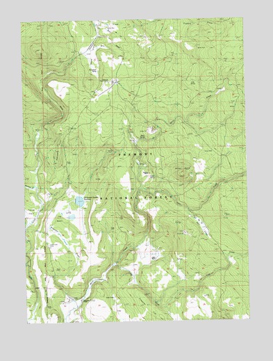
Rodeo Butte, OR USGS Topographic Map
Click on map above to begin viewing in our Map Viewer.

This topographic map contains these locations and features:
Feature Name Type Latitude Longitude GNIS ID View Map
Anderson CabinLocaleN42.5915°W121.0094°1137196View Map
Cain CreekStreamN42.5546°W121.0605°1139140View Map
Camp SixLocaleN42.5993°W121.0772°1139268View Map
Camp Six Guard StationLocaleN42.5990°W121.0703°1155446View Map
Cold SpringSpringN42.5994°W121.0302°1139925View Map
Foster FieldParkN42.5457°W121.1233°1142339View Map
Griffin RanchLocaleN42.5265°W121.0525°1143085View Map
Horse GladeFlatN42.6040°W121.0833°1122000View Map
Horseglade SpringSpringN42.6040°W121.0830°1143795View Map
Long CreekStreamN42.5240°W121.0758°1145395View Map
McCartie RanchLocaleN42.5618°W121.0569°1145923View Map
Meryl SpringsSpringN42.5752°W121.0574°1146111View Map
O'Connors Puddle DamDamN42.5499°W121.0978°1155631View Map
O'Connors Puddle ReservoirReservoirN42.5500°W121.0951°1155632View Map
Obenchain RanchLocaleN42.5099°W121.0950°1147129View Map
Preacher FlatFlatN42.5046°W121.0575°1147992View Map
Rail GladeFlatN42.5379°W121.0253°1148155View Map
Reservoir CreekStreamN42.5057°W121.0994°1148384View Map
Rimrock PointRidgeN42.5729°W121.1064°1148465View Map
Rodeo ButteSummitN42.5604°W121.0364°1148681View Map
Rodeo SpringSpringN42.5596°W121.0520°1148682View Map
Swamp CreekStreamN42.5563°W121.1203°1150744View Map
The BasinBasinN42.5432°W121.1019°1150997View Map

Note: Coordinates in the location and feature list above are referenced to NAD83 datum.


Copyright (C) 2008-2024 Ryan Niemi / Sunset Dynamics ... All Rights Reserved