TopoQuest Logo
Do you find TopoQuest useful?
Help keep TopoQuest running and adding new maps/features by donating!
Bitcoin:  19c7KJd3qBynnjoSw5npx9KScwjBe4ifkT
Litecoin:  LXs6TkuXGGXo1vDsWCkWVdjQX94eUKd6ui
Home View Maps Find Maps Find Places Resources & Links


Reddish Knob, Virginia Topographic Map

USGS Map Title: Reddish Knob, VA
USGS Map MRC: 38079D2
DRG (GeoTIFF) Download: o38079d2.tif


Neighboring USGS Topographic Map Quads:


  Sugar Grove, WV  
38079E3
 

  Brandywine, WV  
38079E2
 

  Rawley Springs, VA  
38079E1
 

  Palo Alto, VA  
38079D3
 

  Reddish Knob, VA  
38079D2
 

  Briery Branch, VA  
38079D1
 

  West Augusta, VA  
38079C3
 

  Stokesville, VA  
38079C2
 

  Parnassus, VA  
38079C1


Map MRC Location:

N39°
W80°
N39°
W79°
H8 H7 H6 H5 H4 H3 H2 H1
G8 G7 G6 G5 G4 G3 G2 G1
F8 F7 F6 F5 F4 F3 F2 F1
E8 E7 E6 E5 E4 E3 E2 E1
D8 D7 D6 D5 D4 D3 D2 D1
C8 C7 C6 C5 C4 C3 C2 C1
B8 B7 B6 B5 B4 B3 B2 B1
A8 A7 A6 A5 A4 A3 A2 A1
N38°
W80°
N38°
W79°

Reddish Knob, VA USGS 1:24K Topographic Map Preview:
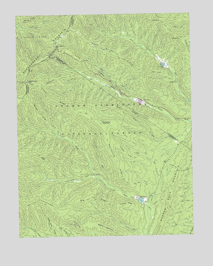
Reddish Knob, VA USGS Topographic Map
Click on map above to begin viewing in our Map Viewer.

This topographic map contains these locations and features:
Feature Name Type Latitude Longitude GNIS ID View Map
Big Hollow TrailTrailN38.4662°W79.1453°1481736View Map
Big RidgeRidgeN38.3965°W79.1936°1481772View Map
Big RunStreamN38.3848°W79.1550°1481777View Map
Briery Branch DamDamN38.4501°W79.1598°1481997View Map
Briery Branch GapGapN38.4821°W79.2209°1481998View Map
Briery Branch OverlookLocaleN38.4768°W79.2250°1481999View Map
Briery Branch ReservoirReservoirN38.4485°W79.1598°1490812View Map
Buck MountainSummitN38.4204°W79.2303°1482120View Map
Buck Mountain TrailTrailN38.4212°W79.2234°1482121View Map
California RidgeRidgeN38.4637°W79.2214°1482224View Map
California Ridge TrailTrailN38.4635°W79.1936°1482225View Map
Chestnut RidgeRidgeN38.3862°W79.2142°1482503View Map
Chestnut Ridge TrailTrailN38.3860°W79.2170°1482508View Map
Dunkard RidgeRidgeN38.4215°W79.1717°1483173View Map
Grooms RidgeRidgeN38.3937°W79.1728°1483845View Map
Grooms Ridge TrailTrailN38.3937°W79.1861°1483846View Map
Hearthstone LakeReservoirN38.3956°W79.1632°1502033View Map
Hearthstone RidgeRidgeN38.4160°W79.1786°1484008View Map
Heiliger Kanzel OverlookLocaleN38.4626°W79.2445°1551405View Map
Hog RunStreamN38.4012°W79.1800°1484135View Map
Hone Quarry DamDamN38.4707°W79.1434°1484178View Map
Hone Quarry Recreation SiteLocaleN38.4621°W79.1359°1484179View Map
Hone Quarry ReservoirReservoirN38.4714°W79.1445°1490814View Map
Hone Quarry RidgeRidgeN38.4707°W79.1667°1484180View Map
Hone Quarry Ridge TrailTrailN38.4571°W79.1467°1484181View Map
Lower North River Number 78 DamDamN38.4485°W79.1598°1490811View Map
Lower North River Number 83 DamDamN38.4701°W79.1431°1490813View Map
Middle MountainSummitN38.3801°W79.1906°1485378View Map
Middle RidgeRidgeN38.4437°W79.2342°1485386View Map
Mines RunStreamN38.4518°W79.1623°1485491View Map
Mines Run TrailTrailN38.4621°W79.1795°1485492View Map
Narrow Back TrailTrailN38.3937°W79.1448°1485791View Map
Narrow Buck TrailTrailN38.4118°W79.1331°1485792View Map
North Fork Little RiverStreamN38.4096°W79.1945°1487064View Map
Oak KnobSummitN38.4857°W79.1323°1499814View Map
Path RidgeRidgeN38.4710°W79.1970°1486080View Map
Pond KnobSummitN38.4960°W79.1456°1499891View Map
Reddish KnobSummitN38.4623°W79.2417°1486547View Map
Sand Spring MountainSummitN38.4373°W79.1878°1500022View Map
Sand Spring Mountain TrailTrailN38.4260°W79.1639°1486922View Map
Slate Springs Trail ATrailN38.4918°W79.1406°1487303View Map
Slate Springs Trail AATrailN38.4985°W79.1692°1487304View Map
Slate Springs Trail BTrailN38.4846°W79.1450°1487305View Map
South Fork Little RiverStreamN38.4096°W79.1945°1487401View Map
Stony Run OverlookLocaleN38.4693°W79.2414°1553087View Map
Timber RidgeRidgeN38.4526°W79.2245°1487919View Map
Timber Ridge TrailTrailN38.4512°W79.2206°1487924View Map
Upper North Number 77 DamDamN38.3935°W79.1598°1489180View Map
WKCY-FM (Harrisonburg)TowerN38.3946°W79.1403°1502650View Map
Wolf RidgeRidgeN38.4454°W79.1709°1488453View Map

Note: Coordinates in the location and feature list above are referenced to NAD83 datum.


Copyright (C) 2008-2024 Ryan Niemi / Sunset Dynamics ... All Rights Reserved