TopoQuest Logo
Do you find TopoQuest useful?
Help keep TopoQuest running and adding new maps/features by donating!
Bitcoin:  19c7KJd3qBynnjoSw5npx9KScwjBe4ifkT
Litecoin:  LXs6TkuXGGXo1vDsWCkWVdjQX94eUKd6ui
Home View Maps Find Maps Find Places Resources & Links


Big Hole Pass, Idaho Topographic Map

USGS Map Title: Big Hole Pass, ID
USGS Map MRC: 45113E7
DRG (GeoTIFF) Download: o45113e7.tif


Neighboring USGS Topographic Map Quads:


  Lost Trail Pass, MT  
45113F8
 

  Elk Creek, MT  
45113F7
 

  Big Hole Battlefield, MT  
45113F6
 

  Gibbonsville, ID  
45113E8
 

  Big Hole Pass, ID  
45113E7
 

  Isaac Meadows, MT  
45113E6
 

  North Fork, ID  
45113D8
 

  Shewag Lake, ID  
45113D7
 

  Jumbo Mountain, MT  
45113D6


Map MRC Location:

N46°
W114°
N46°
W113°
H8 H7 H6 H5 H4 H3 H2 H1
G8 G7 G6 G5 G4 G3 G2 G1
F8 F7 F6 F5 F4 F3 F2 F1
E8 E7 E6 E5 E4 E3 E2 E1
D8 D7 D6 D5 D4 D3 D2 D1
C8 C7 C6 C5 C4 C3 C2 C1
B8 B7 B6 B5 B4 B3 B2 B1
A8 A7 A6 A5 A4 A3 A2 A1
N45°
W114°
N45°
W113°

Big Hole Pass, ID USGS 1:24K Topographic Map Preview:
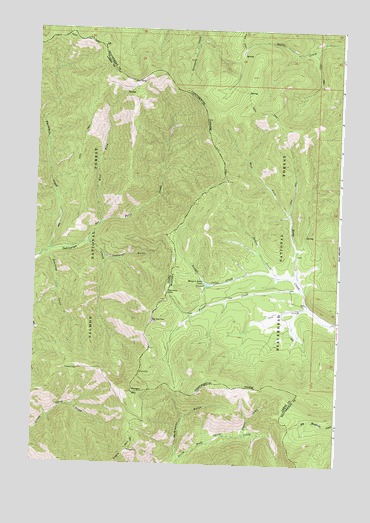
Big Hole Pass, ID USGS Topographic Map
Click on map above to begin viewing in our Map Viewer.

This topographic map contains these locations and features:
Feature Name Type Latitude Longitude GNIS ID View Map
Alpine CreekStreamN45.5083°W113.7898°376570View Map
Beartrap CreekStreamN45.5599°W113.8717°377220View Map
Big Hole PassGapN45.5494°W113.8212°377554View Map
Bradley GulchValleyN45.5027°W113.8151°378179View Map
Cow CreekStreamN45.5452°W113.7631°781773View Map
Morgan Jones LakeReservoirN45.5520°W113.8043°787683View Map
Morgan MountainSummitN45.5205°W113.8342°387217View Map
Nez Perce CreekStreamN45.5635°W113.8540°387548View Map
Nugget CreekStreamN45.5541°W113.7751°788332View Map
Pioneer (historical)LocaleN45.5499°W113.7676°1797285View Map
Pioneer CreekStreamN45.5505°W113.7656°788931View Map
Rabbit CreekStreamN45.5535°W113.7690°789309View Map
Thompson GulchValleyN45.5594°W113.8465°392038View Map
Threemile CreekStreamN45.5605°W113.8704°400136View Map
West Fork Nez Perce CreekStreamN45.5691°W113.8492°393157View Map
West Fork Ruby CreekStreamN45.5719°W113.7709°793073View Map

Note: Coordinates in the location and feature list above are referenced to NAD83 datum.


Copyright (C) 2008-2024 Ryan Niemi / Sunset Dynamics ... All Rights Reserved