TopoQuest Logo
Do you find TopoQuest useful?
Help keep TopoQuest running and adding new maps/features by donating!
Bitcoin:  19c7KJd3qBynnjoSw5npx9KScwjBe4ifkT
Litecoin:  LXs6TkuXGGXo1vDsWCkWVdjQX94eUKd6ui
Home View Maps Find Maps Find Places Resources & Links


Raymond, Colorado Topographic Map

USGS Map Title: Raymond, CO
USGS Map MRC: 40105B4
DRG (GeoTIFF) Download: o40105b4.tif


Neighboring USGS Topographic Map Quads:


  Longs Peak, CO  
40105C5
 

  Panorama Peak, CO  
40105C4
 

  Pinewood Lake, CO  
40105C3
 

  Allenspark, CO  
40105B5
 

  Raymond, CO  
40105B4
 

  Lyons, CO  
40105B3
 

  Ward, CO  
40105A5
 

  Gold Hill, CO  
40105A4
 

  Boulder, CO  
40105A3


Map MRC Location:

N41°
W106°
N41°
W105°
H8 H7 H6 H5 H4 H3 H2 H1
G8 G7 G6 G5 G4 G3 G2 G1
F8 F7 F6 F5 F4 F3 F2 F1
E8 E7 E6 E5 E4 E3 E2 E1
D8 D7 D6 D5 D4 D3 D2 D1
C8 C7 C6 C5 C4 C3 C2 C1
B8 B7 B6 B5 B4 B3 B2 B1
A8 A7 A6 A5 A4 A3 A2 A1
N40°
W106°
N40°
W105°

Raymond, CO USGS 1:24K Topographic Map Preview:
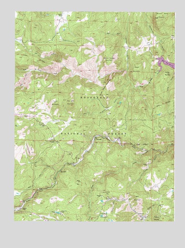
Raymond, CO USGS Topographic Map
Click on map above to begin viewing in our Map Viewer.

This topographic map contains these locations and features:
Feature Name Type Latitude Longitude GNIS ID View Map
Alice Open PitMineN40.1292°W105.3958°1683598View Map
Allenspark Fire Department Station 2BuildingN40.1594°W105.4548°2368786View Map
Argo MineMineN40.1297°W105.4005°178254View Map
Atlantic MineMineN40.1397°W105.4275°1683602View Map
BalaratPopulated PlaceN40.1592°W105.3964°178281View Map
Balarat HillSlopeN40.1342°W105.3928°178255View Map
Bald MountainSummitN40.1386°W105.4036°178257View Map
Bear GulchValleyN40.2330°W105.4145°178276View Map
Big Elk RanchLocaleN40.2480°W105.4642°178280View Map
Big John MountainSummitN40.1958°W105.4569°178269View Map
Bradshaw MineMineN40.1592°W105.4583°1683604View Map
Bright TrailTrailN40.2147°W105.4592°197825View Map
Buck LakeLakeN40.1818°W105.4976°178267View Map
Buckhorn MineMineN40.1264°W105.3908°1683605View Map
Bunce SchoolLocaleN40.1733°W105.4692°178264View Map
Burlington MineMineN40.1278°W105.3983°178253View Map
Button Rock ReservoirReservoirN40.2178°W105.3767°178306View Map
Cabin CreekStreamN40.2172°W105.4617°178239View Map
Cannon MountainSummitN40.1425°W105.4294°178259View Map
Cave CreekStreamN40.1542°W105.4664°178242View Map
Ceran Vrain TrailTrailN40.1342°W105.4400°169430View Map
Consolation MineMineN40.1389°W105.4119°1683606View Map
Cook MountainSummitN40.2153°W105.4058°178272View Map
Coulson GulchValleyN40.2080°W105.4107°178274View Map
Dry Saint Vrain CreekStreamN40.2080°W105.4106°178266View Map
Emmit MineMineN40.1264°W105.4000°178252View Map
Fourth of July MineMineN40.1611°W105.4033°1683607View Map
Gillman GulchValleyN40.1379°W105.4217°178251View Map
Glacier View CampLocaleN40.1303°W105.4636°178250View Map
Gold Cross MineMineN40.1350°W105.3855°1683608View Map
Goldfinch MineMineN40.1350°W105.3925°1683609View Map
GreshamLocaleN40.1403°W105.4322°178258View Map
Higgins ParkFlatN40.2286°W105.4136°178278View Map
Hopewell and Rusty MineMineN40.1383°W105.4350°1683620View Map
Johnny ParkFlatN40.2453°W105.4206°178277View Map
Long GulchValleyN40.1662°W105.3852°178262View Map
Maud S MineMineN40.1294°W105.3855°1683610View Map
McKinley-Stanley MineMineN40.1339°W105.4031°1683611View Map
Middle Saint Vrain CreekStreamN40.1675°W105.3969°178142View Map
Miller RockSummitN40.1489°W105.4503°178260View Map
Minnie LakeLakeN40.1302°W105.4659°178248View Map
Miranda A Johnson LodeMineN40.1367°W105.3844°1683799View Map
Mount Pleasant MineMineN40.1347°W105.4086°1683612View Map
Nations Treasure MineMineN40.1258°W105.3958°1683613View Map
North Sheep MountainSummitN40.2225°W105.4300°178273View Map
North Sheep Mountain TrailTrailN40.2244°W105.4350°197783View Map
Orofino MineMineN40.1422°W105.3855°1683614View Map
Overland MineMineN40.1378°W105.4264°1683615View Map
Park CreekStreamN40.1575°W105.4744°178241View Map
Peaceful ValleyPopulated PlaceN40.1314°W105.4978°202549View Map
Peaceful Valley Post Office (historical)Post OfficeN40.1314°W105.4978°2026880View Map
Pine ValleyPopulated PlaceN40.1917°W105.4831°197824View Map
Porphyry MountainSummitN40.1269°W105.3880°178249View Map
Rattlesnake GulchValleyN40.2235°W105.3859°178275View Map
RaymondPopulated PlaceN40.1550°W105.4644°178261View Map
Red Spruce MineMineN40.1347°W105.3869°178256View Map
RiversidePopulated PlaceN40.1755°W105.4372°178265View Map
Rock CreekStreamN40.2150°W105.4881°178240View Map
Rock Ledge ParkParkN40.1789°W105.4761°197785View Map
Sky Ranch EstatesLocaleN40.1317°W105.4336°197784View Map
Smithy MountainSummitN40.2130°W105.3817°178271View Map
Smuggler MineMineN40.1586°W105.3947°1683617View Map
South Sheep MountainSummitN40.2089°W105.4264°178270View Map
Taylor MountainSummitN40.1958°W105.4683°178268View Map
The IroncladsRangeN40.1680°W105.4883°178263View Map

Note: Coordinates in the location and feature list above are referenced to NAD83 datum.


Copyright (C) 2008-2024 Ryan Niemi / Sunset Dynamics ... All Rights Reserved