TopoQuest Logo
Do you find TopoQuest useful?
Help keep TopoQuest running and adding new maps/features by donating!
Bitcoin:  19c7KJd3qBynnjoSw5npx9KScwjBe4ifkT
Litecoin:  LXs6TkuXGGXo1vDsWCkWVdjQX94eUKd6ui
Home View Maps Find Maps Find Places Resources & Links


Rathbun Ranch, Wyoming Topographic Map

USGS Map Title: Rathbun Ranch, WY
USGS Map MRC: 43107E7
DRG (GeoTIFF) Download: o43107e7.tif


Neighboring USGS Topographic Map Quads:


  Coyote Hill, WY  
43107F8
 

  Packsaddle Creek, WY  
43107F7
 

  Bader Draw, WY  
43107F6
 

  Blue Hill, WY  
43107E8
 

  Rathbun Ranch, WY  
43107E7
 

  Bull Mountain, WY  
43107E6
 

  Guffy Peak, WY  
43107D8
 

  De Pass, WY  
43107D7
 

  Arapahoe Butte, WY  
43107D6


Map MRC Location:

N44°
W108°
N44°
W107°
H8 H7 H6 H5 H4 H3 H2 H1
G8 G7 G6 G5 G4 G3 G2 G1
F8 F7 F6 F5 F4 F3 F2 F1
E8 E7 E6 E5 E4 E3 E2 E1
D8 D7 D6 D5 D4 D3 D2 D1
C8 C7 C6 C5 C4 C3 C2 C1
B8 B7 B6 B5 B4 B3 B2 B1
A8 A7 A6 A5 A4 A3 A2 A1
N43°
W108°
N43°
W107°

Rathbun Ranch, WY USGS 1:24K Topographic Map Preview:
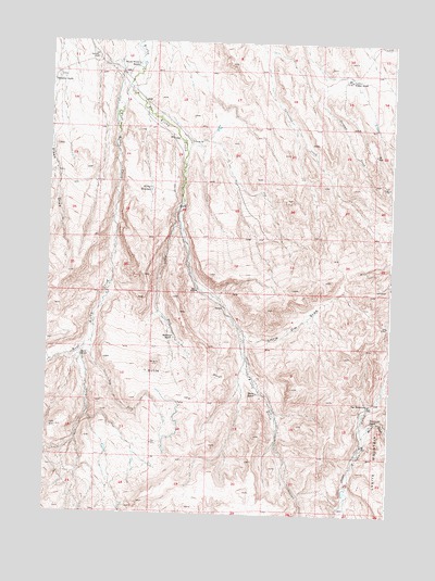
Rathbun Ranch, WY USGS Topographic Map
Click on map above to begin viewing in our Map Viewer.

This topographic map contains these locations and features:
Feature Name Type Latitude Longitude GNIS ID View Map
Ackles ForkStreamN43.5816°W107.8265°1584694View Map
Day HomesteadLocaleN43.5294°W107.7573°1587383View Map
Dry ForkStreamN43.5455°W107.8590°1587835View Map
East Kirby CreekStreamN43.6136°W107.8451°1597159View Map
Gardner DamDamN43.6116°W107.7623°1607578View Map
Gardner ReservoirReservoirN43.6116°W107.7623°1607579View Map
Gardner Winter RanchLocaleN43.6155°W107.7662°1588812View Map
Hall ButteSummitN43.5383°W107.8359°1589250View Map
Hayes RanchLocaleN43.5319°W107.7984°1589422View Map
Hayes Winter RanchLocaleN43.6188°W107.8445°1589424View Map
Kirby ReservoirReservoirN43.5861°W107.8382°1590380View Map
Little V-H DrawValleyN43.5477°W107.8051°1590890View Map
Maimes CreekStreamN43.5208°W107.7598°1591183View Map
Rathbun Irrigation Number 1 DamDamN43.5166°W107.8323°1607642View Map
Rathbun Irrigation Number 1 ReservoirReservoirN43.5169°W107.8317°1607643View Map
Rathbun RanchLocaleN43.5458°W107.8284°1593185View Map
Reed CreekStreamN43.5441°W107.8615°1593362View Map
Reed RanchLocaleN43.5419°W107.8631°1593364View Map
Swallow RanchLocaleN43.6144°W107.8740°1595228View Map
West Kirby CreekStreamN43.6133°W107.8479°1596223View Map

Note: Coordinates in the location and feature list above are referenced to NAD83 datum.


Copyright (C) 2008-2024 Ryan Niemi / Sunset Dynamics ... All Rights Reserved