TopoQuest Logo
Do you find TopoQuest useful?
Help keep TopoQuest running and adding new maps/features by donating!
Bitcoin:  19c7KJd3qBynnjoSw5npx9KScwjBe4ifkT
Litecoin:  LXs6TkuXGGXo1vDsWCkWVdjQX94eUKd6ui
Home View Maps Find Maps Find Places Resources & Links


Ralph, Michigan Topographic Map

USGS Map Title: Ralph, MI
USGS Map MRC: 46087A7
DRG (GeoTIFF) Download: o46087a7.tif


Neighboring USGS Topographic Map Quads:


  Ralph NW, MI  
46087B8
 

  Ralph NE, MI  
46087B7
 

  Northland NW, MI  
46087B6
 

  Ralph SW, MI  
46087A8
 

  Ralph, MI  
46087A7
 

  Alfred, MI  
46087A6
 

  Carney Lake, MI  
45087H8
 

  Felch, MI  
45087H7
 

  Foster City, MI  
45087H6


Map MRC Location:

N47°
W88°
N47°
W87°
H8 H7 H6 H5 H4 H3 H2 H1
G8 G7 G6 G5 G4 G3 G2 G1
F8 F7 F6 F5 F4 F3 F2 F1
E8 E7 E6 E5 E4 E3 E2 E1
D8 D7 D6 D5 D4 D3 D2 D1
C8 C7 C6 C5 C4 C3 C2 C1
B8 B7 B6 B5 B4 B3 B2 B1
A8 A7 A6 A5 A4 A3 A2 A1
N46°
W88°
N46°
W87°

Ralph, MI USGS 1:24K Topographic Map Preview:
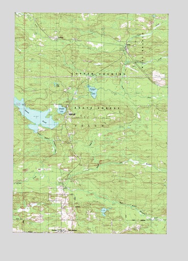
Ralph, MI USGS Topographic Map
Click on map above to begin viewing in our Map Viewer.

This topographic map contains these locations and features:
Feature Name Type Latitude Longitude GNIS ID View Map
Dickinson CountyCivilN46.0092°W87.8703°1622964View Map
East Branch Skunk CreekStreamN46.0383°W87.8051°625151View Map
Felch MountainPopulated PlaceN46.0011°W87.8321°625869View Map
Felch Mountain Bible ChapelChurchN46.0014°W87.8336°2128889View Map
Gene PondLakeN46.0670°W87.8591°1618839View Map
Genes Pond State Forest CampgroundLocaleN46.0725°W87.8639°2128582View Map
Hayes CreekStreamN46.1038°W87.7860°627985View Map
HendersonLocaleN46.1111°W87.8408°2098023View Map
Mud LakeLakeN46.0839°W87.8414°2098022View Map
Norway LakeLakeN46.0697°W87.8362°633757View Map
Norway Lake County ParkParkN46.0675°W87.8306°2098021View Map
Pickerel LakeLakeN46.0806°W87.8110°634793View Map
RalphPopulated PlaceN46.1086°W87.7837°635613View Map
Ralph Cemetery - Whispering Pines CemeteryCemeteryN46.1087°W87.7726°635615View Map
Ralph Post Office (historical)Post OfficeN46.1067°W87.7839°2128839View Map
Ralph Station (historical)LocaleN46.1050°W87.7842°2128838View Map
Sixmile CreekStreamN46.0322°W87.8496°638027View Map
Skunk CreekStreamN46.0261°W87.8326°638074View Map
Stafford CreekStreamN46.0963°W87.7840°638696View Map
TheodorePopulated PlaceN46.0013°W87.8368°1614725View Map
West Branch Township Volunteer Fire DepartmentBuildingN46.1053°W87.7843°2627036View Map

Note: Coordinates in the location and feature list above are referenced to NAD83 datum.


Copyright (C) 2008-2024 Ryan Niemi / Sunset Dynamics ... All Rights Reserved