TopoQuest Logo
Do you find TopoQuest useful?
Help keep TopoQuest running and adding new maps/features by donating!
Bitcoin:  19c7KJd3qBynnjoSw5npx9KScwjBe4ifkT
Litecoin:  LXs6TkuXGGXo1vDsWCkWVdjQX94eUKd6ui
Home View Maps Find Maps Find Places Resources & Links


Prairie Hill, Texas Topographic Map

USGS Map Title: Prairie Hill, TX
USGS Map MRC: 31096F7
DRG (GeoTIFF) Download: o31096f7.tif


Neighboring USGS Topographic Map Quads:


  Penelope, TX  
31096G8
 

  Hubbard, TX  
31096G7
 

  Coolidge, TX  
31096G6
 

  Axtell, TX  
31096F8
 

  Prairie Hill, TX  
31096F7
 

  Echols, TX  
31096F6
 

  Elk, TX  
31096E8
 

  Mart, TX  
31096E7
 

  Ben Hur, TX  
31096E6


Map MRC Location:

N32°
W97°
N32°
W96°
H8 H7 H6 H5 H4 H3 H2 H1
G8 G7 G6 G5 G4 G3 G2 G1
F8 F7 F6 F5 F4 F3 F2 F1
E8 E7 E6 E5 E4 E3 E2 E1
D8 D7 D6 D5 D4 D3 D2 D1
C8 C7 C6 C5 C4 C3 C2 C1
B8 B7 B6 B5 B4 B3 B2 B1
A8 A7 A6 A5 A4 A3 A2 A1
N31°
W97°
N31°
W96°

Prairie Hill, TX USGS 1:24K Topographic Map Preview:
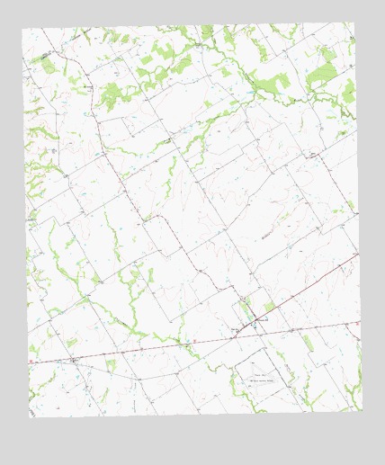
Prairie Hill, TX USGS Topographic Map
Click on map above to begin viewing in our Map Viewer.

This topographic map contains these locations and features:
Feature Name Type Latitude Longitude GNIS ID View Map
American Truck Driving SchoolSchoolN31.6367°W96.7886°2351843View Map
Archer BridgeBridgeN31.7438°W96.8086°1351238View Map
Billington CemeteryCemeteryN31.6888°W96.8750°1352195View Map
Board CreekStreamN31.7296°W96.7872°1352533View Map
DeliaPopulated PlaceN31.7068°W96.7678°1355895View Map
Delia CemeteryCemeteryN31.7135°W96.7547°1355896View Map
Grays BranchStreamN31.7429°W96.8028°1373906View Map
Mount Antioch ChurchChurchN31.7296°W96.8494°1363224View Map
Mount Calm CemeteryCemeteryN31.7335°W96.8744°1363228View Map
Prairie HillPopulated PlaceN31.6552°W96.7889°1365731View Map
Prairie Hill Air Force Auxiliary Airfield (historical)MilitaryN31.6367°W96.7886°2351824View Map
Prairie Hill CemeteryCemeteryN31.6629°W96.7953°2038268View Map
Prairie Hill DivisionCivilN31.6524°W96.7860°1939108View Map
Prairie Hill Post OfficePost OfficeN31.6551°W96.7905°2731118View Map
Prairie Hill Volunteer Fire DepartmentBuildingN31.6550°W96.7905°2552666View Map
Turkey CreekStreamN31.7488°W96.8164°1376525View Map
WattPopulated PlaceN31.6438°W96.8589°1370943View Map

Note: Coordinates in the location and feature list above are referenced to NAD83 datum.


Copyright (C) 2008-2024 Ryan Niemi / Sunset Dynamics ... All Rights Reserved