TopoQuest Logo
Do you find TopoQuest useful?
Help keep TopoQuest running and adding new maps/features by donating!
Bitcoin:  19c7KJd3qBynnjoSw5npx9KScwjBe4ifkT
Litecoin:  LXs6TkuXGGXo1vDsWCkWVdjQX94eUKd6ui
Home View Maps Find Maps Find Places Resources & Links


Poudre Park, Colorado Topographic Map

USGS Map Title: Poudre Park, CO
USGS Map MRC: 40105F3
DRG (GeoTIFF) Download: o40105f3.tif


Neighboring USGS Topographic Map Quads:


  Haystack Gulch, CO  
40105G4
 

  Livermore Mountain, CO  
40105G3
 

  Livermore, CO  
40105G2
 

  Big Narrows, CO  
40105F4
 

  Poudre Park, CO  
40105F3
 

  Laporte, CO  
40105F2
 

  Crystal Mountain, CO  
40105E4
 

  Buckhorn Mountain, CO  
40105E3
 

  Horsetooth Reservoir, CO  
40105E2


Map MRC Location:

N41°
W106°
N41°
W105°
H8 H7 H6 H5 H4 H3 H2 H1
G8 G7 G6 G5 G4 G3 G2 G1
F8 F7 F6 F5 F4 F3 F2 F1
E8 E7 E6 E5 E4 E3 E2 E1
D8 D7 D6 D5 D4 D3 D2 D1
C8 C7 C6 C5 C4 C3 C2 C1
B8 B7 B6 B5 B4 B3 B2 B1
A8 A7 A6 A5 A4 A3 A2 A1
N40°
W106°
N40°
W105°

Poudre Park, CO USGS 1:24K Topographic Map Preview:
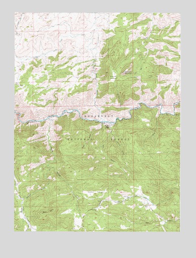
Poudre Park, CO USGS Topographic Map
Click on map above to begin viewing in our Map Viewer.

This topographic map contains these locations and features:
Feature Name Type Latitude Longitude GNIS ID View Map
Alice M Beryl MineMineN40.6416°W105.3589°1683378View Map
Ansel Watrous CampgroundLocaleN40.6894°W105.3500°177179View Map
Bania Family CemeteryCemeteryN40.6364°W105.3083°2036973View Map
Beryl Dike ClaimMineN40.6425°W105.3480°1683379View Map
Beryl Number Three ClaimMineN40.6428°W105.3478°1683381View Map
Beryl Number Two MineMineN40.6425°W105.3480°1683380View Map
Boyd GulchValleyN40.6930°W105.2651°177189View Map
Brinkhoff MineMineN40.7136°W105.2714°177171View Map
Diamond Rock Picnic AreaLocaleN40.6858°W105.3297°177181View Map
Dilky RanchLocaleN40.6400°W105.2747°177172View Map
Falls GulchValleyN40.6875°W105.3092°177186View Map
Glen O Barrett MineMineN40.6416°W105.3547°1683481View Map
Gordon CreekStreamN40.6878°W105.3072°170207View Map
Green Crystals Number Three ClaimMineN40.6355°W105.3417°1683482View Map
Green Cystals Number Four ClaimMineN40.6355°W105.3417°1683483View Map
Green Rock MineMineN40.7103°W105.3125°1683484View Map
Greyrock MeadowFlatN40.7130°W105.3005°177182View Map
Greyrock MountainSummitN40.7155°W105.2925°177183View Map
Greyrock TrailTrailN40.7005°W105.2958°177184View Map
Greyrock TrailheadLocaleN40.6950°W105.2839°197706View Map
Hanks Hole ClaimsMineN40.6286°W105.3586°1683485View Map
Harlan GulchValleyN40.6302°W105.3646°177167View Map
HE and M Number Nine ClaimMineN40.6308°W105.3533°1683486View Map
Hewlett GulchValleyN40.6879°W105.3075°177190View Map
HG and J Number Fifteen ClaimMineN40.6458°W105.3503°1683488View Map
HG and J Number Three ClaimMineN40.6455°W105.3744°1683487View Map
HG and J Number Twenty-three ClaimMineN40.6458°W105.3503°1683489View Map
Hill GulchValleyN40.6855°W105.3033°177187View Map
Langston PitMineN40.6903°W105.2922°1683490View Map
Little NarrowsValleyN40.6871°W105.3690°177149View Map
MishawakaPopulated PlaceN40.6872°W105.3658°177180View Map
Mishawaka Rest AreaLocaleN40.6914°W105.3392°197705View Map
Mount EthelSummitN40.6355°W105.3528°177177View Map
Mount Ethyl Beryl ClaimMineN40.6316°W105.3539°1683491View Map
Pamige RanchLocaleN40.6525°W105.3736°177178View Map
Poudre Canyon Fire Protection District Station 1 Poudre ParkBuildingN40.6870°W105.3073°2667368View Map
Poudre ParkPopulated PlaceN40.6861°W105.3047°204671View Map
Poudre Park Picnic AreaLocaleN40.6897°W105.3247°197713View Map
Poudre Rest AreaLocaleN40.6886°W105.3203°197712View Map
Rist Canyon Picnic AreaLocaleN40.6372°W105.3169°177174View Map
Rist Canyon Volunteer Fire Department Station 1 Rist CanyonBuildingN40.6420°W105.2752°2057456View Map
Spaulding MineMineN40.7039°W105.3139°1683492View Map
Stoney Park CemeteryCemeteryN40.6286°W105.3225°2036909View Map
Stove Prairie GulchValleyN40.6614°W105.3470°171275View Map
Stratton ParkFlatN40.6472°W105.3144°177176View Map
Stratton Park SchoolSchoolN40.6444°W105.2892°177173View Map
Stratton SchoolSchoolN40.6428°W105.3094°177175View Map
Valley View Claims Number 142MineN40.6328°W105.3133°1683493View Map
Vona Mae MineMineN40.7047°W105.2761°1683494View Map
Watha GulchValleyN40.6819°W105.3021°177188View Map
Williams Family CemeteryCemeteryN40.6272°W105.3025°2036923View Map
Wintersteen TrailTrailN40.7139°W105.2783°202431View Map
Young GulchValleyN40.6898°W105.3493°177185View Map

Note: Coordinates in the location and feature list above are referenced to NAD83 datum.


Copyright (C) 2008-2024 Ryan Niemi / Sunset Dynamics ... All Rights Reserved