TopoQuest Logo
Do you find TopoQuest useful?
Help keep TopoQuest running and adding new maps/features by donating!
Bitcoin:  19c7KJd3qBynnjoSw5npx9KScwjBe4ifkT
Litecoin:  LXs6TkuXGGXo1vDsWCkWVdjQX94eUKd6ui
Home View Maps Find Maps Find Places Resources & Links


Poplar Mountain, Maine Topographic Map

USGS Map Title: Poplar Mountain, ME
USGS Map MRC: 45070A2
DRG (GeoTIFF) Download: o45070a2.tif


Neighboring USGS Topographic Map Quads:


  The Horns, ME  
45070B3
 

  Little Bigelow Mountain, ME  
45070B2
 

  East Carry Pond, ME  
45070B1
 

  Sugarloaf Mountain, ME  
45070A3
 

  Poplar Mountain, ME  
45070A2
 

  Witham Mountain, ME  
45070A1
 

  Mount Abraham, ME  
44070H3
 

  Kingfield, ME  
44070H2
 

  New Portland, ME  
44070H1


Map MRC Location:

N46°
W71°
N46°
W70°
H8 H7 H6 H5 H4 H3 H2 H1
G8 G7 G6 G5 G4 G3 G2 G1
F8 F7 F6 F5 F4 F3 F2 F1
E8 E7 E6 E5 E4 E3 E2 E1
D8 D7 D6 D5 D4 D3 D2 D1
C8 C7 C6 C5 C4 C3 C2 C1
B8 B7 B6 B5 B4 B3 B2 B1
A8 A7 A6 A5 A4 A3 A2 A1
N45°
W71°
N45°
W70°

Poplar Mountain, ME USGS 1:24K Topographic Map Preview:
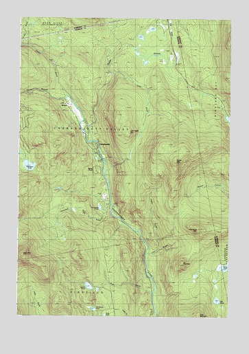
Poplar Mountain, ME USGS Topographic Map
Click on map above to begin viewing in our Map Viewer.

This topographic map contains these locations and features:
Feature Name Type Latitude Longitude GNIS ID View Map
Butler PondLakeN45.0211°W70.1265°563297View Map
CarrabassettPopulated PlaceN45.0778°W70.2120°579177View Map
Carrabassett Valley Volunteer Fire Department Valley StationBuildingN45.0791°W70.2124°2552918View Map
Clay BrookStreamN45.0284°W70.1670°564061View Map
Clay Brook MountainSummitN45.0369°W70.1433°564062View Map
Cold BrookReservoirN45.1223°W70.2426°1774676View Map
Cold BrookStreamN45.1145°W70.2492°564186View Map
Deer Farm CampgroundLocaleN45.0034°W70.1912°1908310View Map
Gold Brook DamDamN45.1222°W70.2438°1774675View Map
Grindstone PondLakeN45.0031°W70.2046°567342View Map
Hammond Field BrookStreamN45.0453°W70.1951°567544View Map
Hammond PondLakeN45.0456°W70.2017°567548View Map
Hid PondLakeN45.0068°W70.1317°567998View Map
Huston BrookStreamN45.0923°W70.2212°568524View Map
Ira MountainSummitN45.0218°W70.1532°568664View Map
Little Poplar MountainSummitN45.0767°W70.1852°569985View Map
Northstar Emergency Medical ServicesBuildingN45.0791°W70.2124°2666753View Map
Owls HeadSummitN45.0256°W70.2471°572886View Map
Poplar BrookStreamN45.0267°W70.1742°573635View Map
Poplar MountainSummitN45.0646°W70.1572°573643View Map
Poplar StreamStreamN45.0731°W70.2078°573648View Map
Poplar Stream FallsFallsN45.1012°W70.1940°1908400View Map
RecordsLocaleN45.0912°W70.2195°574075View Map
Redington PondLakeN45.0628°W70.2436°574107View Map
Reed BrookStreamN45.0101°W70.1692°574115View Map
Shiloh PondLakeN45.0126°W70.2074°575403View Map
South BrookStreamN45.1012°W70.1967°575818View Map
Spring FarmLocaleN45.0656°W70.2015°576103View Map
Sugarloaf Area Chamber of CommerceBuildingN45.0773°W70.2120°1908443View Map
Sugarloaf Regional AirportAirportN45.0865°W70.2186°582129View Map
Valley CrossingLocaleN45.0792°W70.2103°1908455View Map
Western Maines Childrens MuseumBuildingN45.0848°W70.2181°1908468View Map

Note: Coordinates in the location and feature list above are referenced to NAD83 datum.


Copyright (C) 2008-2024 Ryan Niemi / Sunset Dynamics ... All Rights Reserved